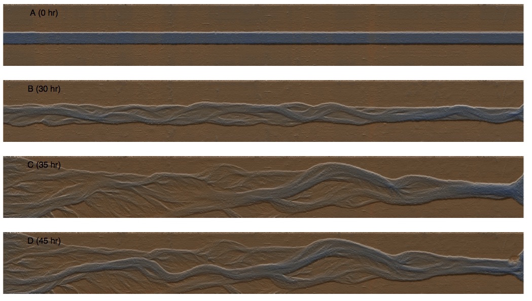
At UBC’s BioGeoMorphic eXperimental Laboratory (BGMX Lab), we are running experiments on how steep cobble-gravel channels like those found on alluvial fans in mountainous regions respond to extreme flood events. The Adjustable-Boundary Experimental System (A-BES) allows us to create scale models of long reaches of river, to image those systems using high-precision laser scanning, and to analyze sediment transport patterns in great detail.
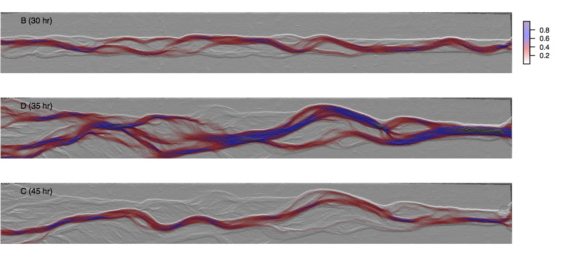
We have been able to use the Nays2DH flow model to estimate the flow conditions associated with each surveyed DEM, and have validated those results qualitatively against photos of the experiments by plotting maps of specific discharge on top of the hillshaded DEMs. These maps of specific discharge turn out to be tremendously helpful in detecting changes in the channel morphology…far more useful than the DEMs alone.
All of the data analysis and figure production for this work has been written in R, taking advantage of recently developed packages for spatial analysis.
We are using these data to investigate the potential for scour to expose infrastructure buried beneath the stream channel, and to investigate various morphodynamic thresholds governing the behavior of such streams.
In the new, big data era of geomorphology, we finally have more data than we know what to do with! Systems like A-BES and analysis tools like Nays2DH and R are changing the kinds of questions we can ask (and, once in awhile, answer!). We sure have come along way from the days of point gauges, tape measures, hand written notes, and transcription errors.
(Thanks to Lucy and Alex for working like demons to collect a whole treasure trove of data for me to work through on my sabbatical!)