The final map below shows the generated 125 bike-share stations on top of a bikeability surface map (see Methodology for how this was created):
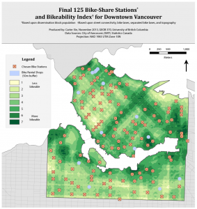

Keep in mind that these two maps were created separately and the stations are not located based upon bike infrastructure/topography. As noted in the map, the final 125 bike-share stations are based on a dissemination-block population measure while the bikeability surface is based on street connectivity, bike lanes, separated bike lanes, and topography. The objective was purely to combine and compare the two.
Discussion
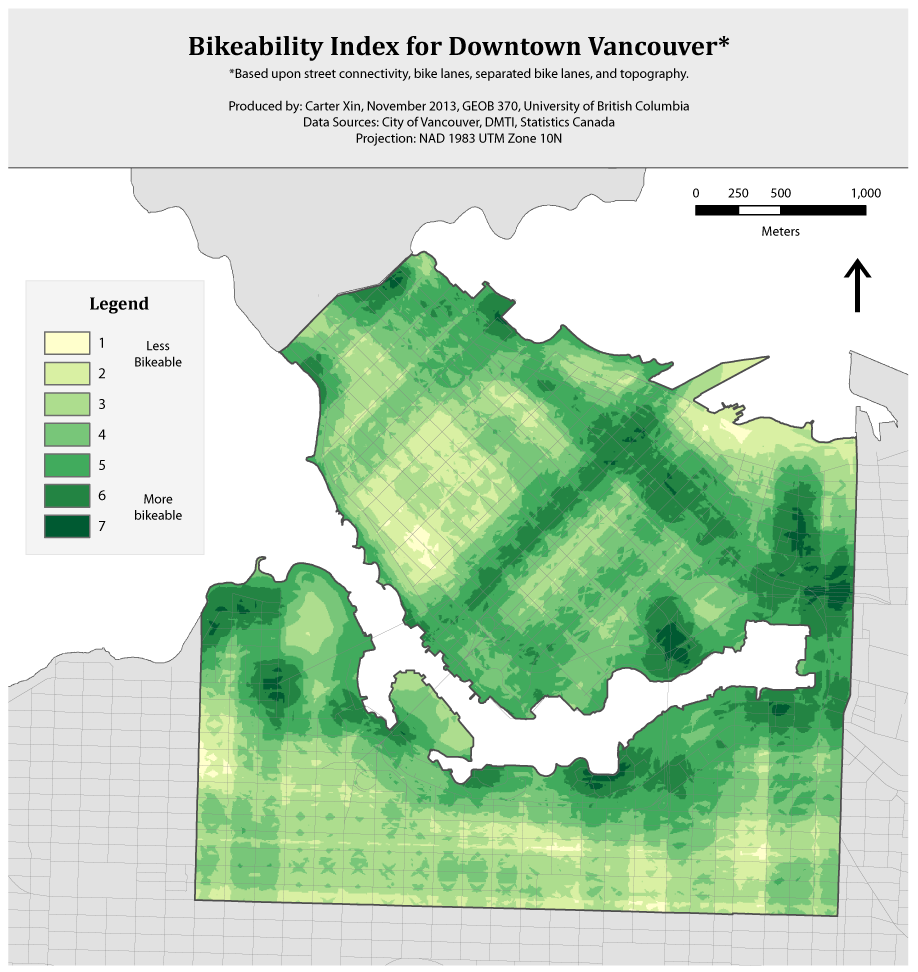
The bikeability surface illustrates an unevenness to the bikeability of the study area. In particular, there are noticeable ‘greener’ or highly bikeable areas including: around Carrall St. in Chinatown, off the Cambie Bridge around Expo Blvd., around Kitsilano Beach, and just before Stanley Park on W. Georgia. These areas emerge as a result of the high density of bike routes and intersections. Other highly bikeable areas on the map include the two stretches of green cutting through the middle of downtown which represent the Hornby St. (NE-SW) and Dunsmuir St. (NW-SE) separated bike lanes. The Seaside separated bike route which wraps itself around the downtown peninsula as well as south False Creek also contributes to the bikeable edge around the waterfront areas. Some of the spots coming off bridges (such as Burrard St. on the mainland, Granville St. on the Granville Island side, and to the east around the viaducts) appear bikeable but this may be flawed. They appear ‘green’ largely due to the high density of street intersections, many of which include ramps (largely car-oriented) to get onto the bridges (or viaducts).
There are also less bikeable areas, notably in the West End, due to an absence of separated bike lanes. A relatively steep slope towards the beach adds to this problem. Outside of downtown, the trend appears that areas become less bikeable as you move away from the water; again, this is due to a greater distance away from the separated Seaside bike route. All things considered, it is fair to say that the downtown and surrounding areas are quite bikeable in general compared to the rest of Vancouver and the Lower Mainland due to the density of intersections and overall number of bike lanes. This is evident in many bikeability maps of Greater Vancouver including Winter et al.’s (2013) study and bike score maps produced at Walkscore.com. Furthermore, the area contains the densest amount of destinations and attractions such as restaurants, hotels, and shops (which I did not consider in my study). However, enlarging the scale to focus just on the study area enabled a look into the nuances in bikeability within the Downtown area which I have presented above.
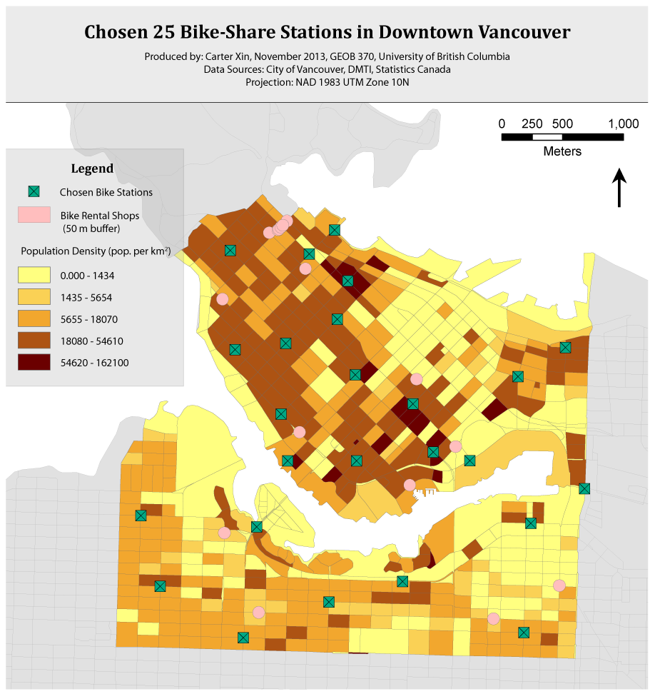
To speak a bit on the results of the location-allocation analysis, it is clear that bike-share stations were located in areas of high population, as suspected (see Methodology for the maps on population density). Areas with little population such as the core business area (around Granville and Dunsmuir streets), around Vanier Park next to the Burrard Bridge, and the light-industrial area just east of Cambie St. in Mount Pleasant contain few stations.
Examining the final map as a whole, I wanted to see if stations were located in areas of high bikeablity. For the most part, they are. Bike-share stations are dispersed throughout the area in a way which aligns quite well with bikeable terrain. However, there are key areas lacking stations: in particular before Stanley Park near Denman and W. Georgia streets, in the core business area around Granville & W. Georgia, around Chinatown, and near Kitsilano Beach.
Due to the existing bike rental shops, no bike stations can be located inside the 50 meter buffer zone specified on the map; this is why there is an absence of stations right before Stanley Park. The other three areas are bikeable areas with a high density of bike infrastructure. In particular, the business area around the Canada Line Vancouver City Centre station is dense with jobs, employees, and shops. Therefore, stations need to move to fill in this important gap. Furthermore, the area around Waterfront does not show up as bikeable; however, its importance as a transportation hub makes it vital for bike-share.
These gaps within the bike-share system are largely due to constraints in the data and methodology. The location-allocation analysis assumed demand based on measures of population and did not account for workers or tourists. This is further described in the Limitations section.