Approximately 15% of all of Vancouver’s land mass is at risk in the event of a tsunami. This percentage was determined by creating a layer for the City of Vancouver and using the attribute table to determine the area of the layer. Then a separate layer was created to illustrate the areas of Vancouver in danger in the event of a tsunami. These areas are either lower than 15m of elevation and within 1 kilometre of the shore. The total area for this layer was also determined and these two numbers were divided to determine the percentage of the city that is at risk to a tsunami.
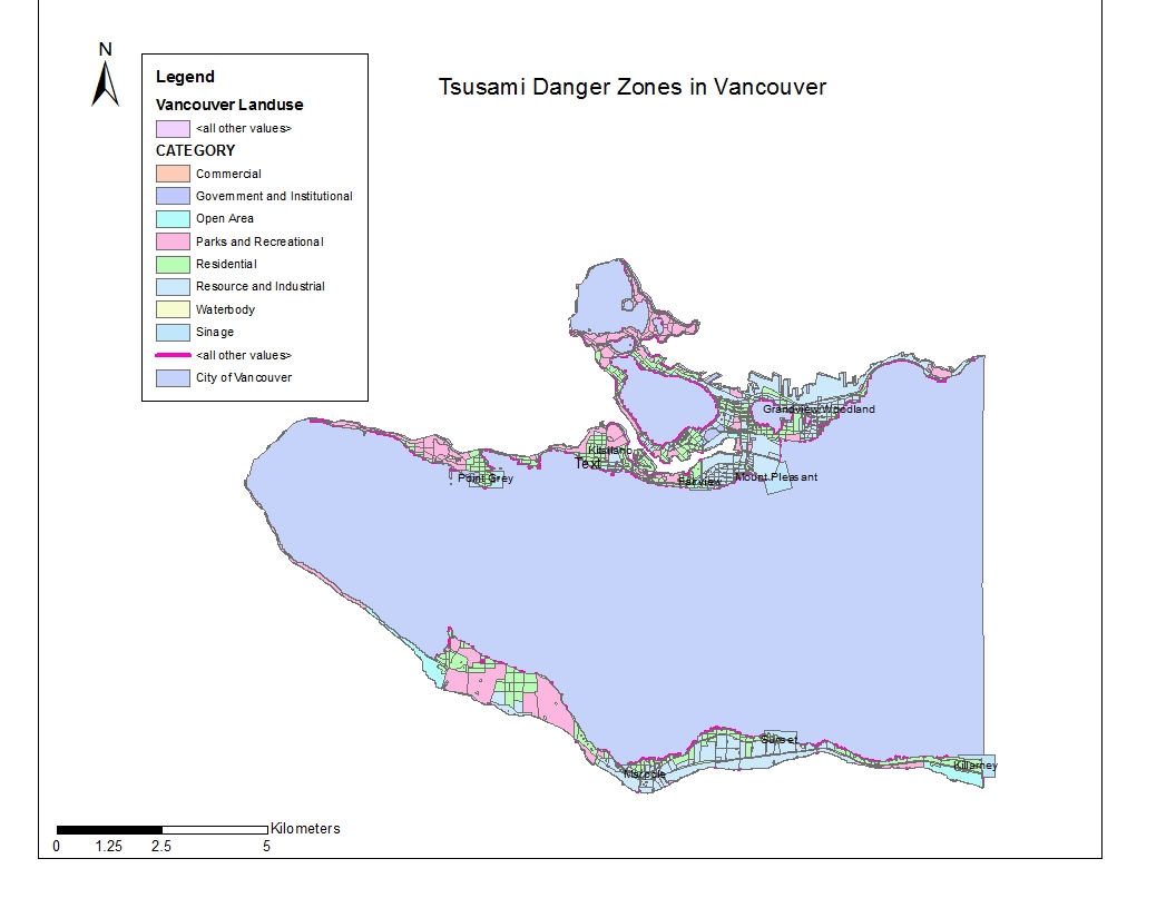
There are certain educational and healthcare facilities that are found within the tsunami risk zone in the City of Vancouver including, but not limited to Point Grey Private Hospital, False Creek Elementary School, and the Royal Canadian College. To determine this, vectors of all the educational and healthcare facilities in Vancouver was added to the map and then intersected with the danger layer to show which facilities are in danger.
ACCOMPLISHMENT STATEMENTS:
Learnt how to combine different layers to create one layer demonstrating a number of aspects.
Expanded knowledge of the social-economic potential of ArcGIS in relation to natural hazards.
Gained experience converting data sets from raster to vector and vice versa and deepened an understanding of the difference between the two.