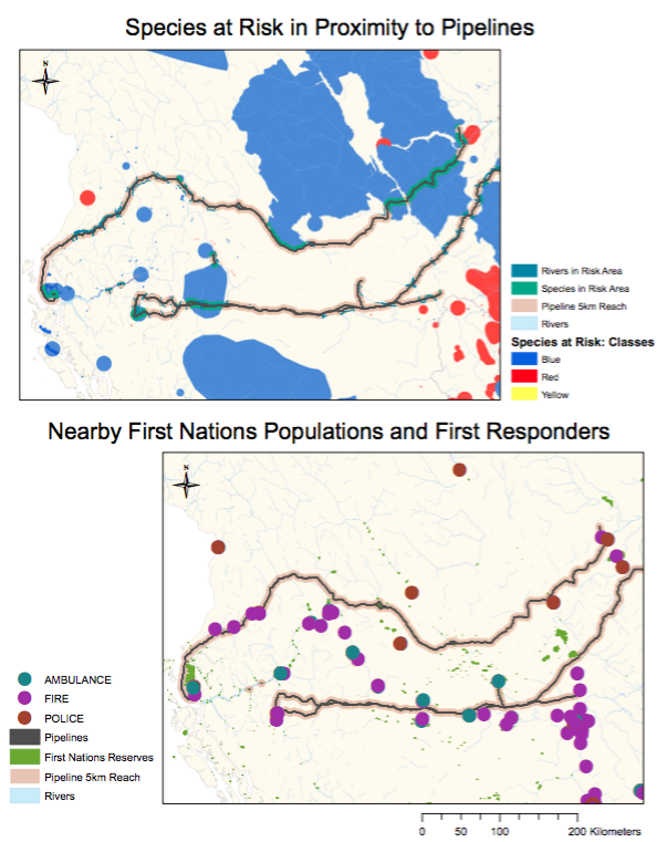
This study analyzes two pipelines transporting Liquid Natural Gas (LNG) across Northern BC to the coast. The location of these pipelines affects a number of species at risk and First Nations populations. 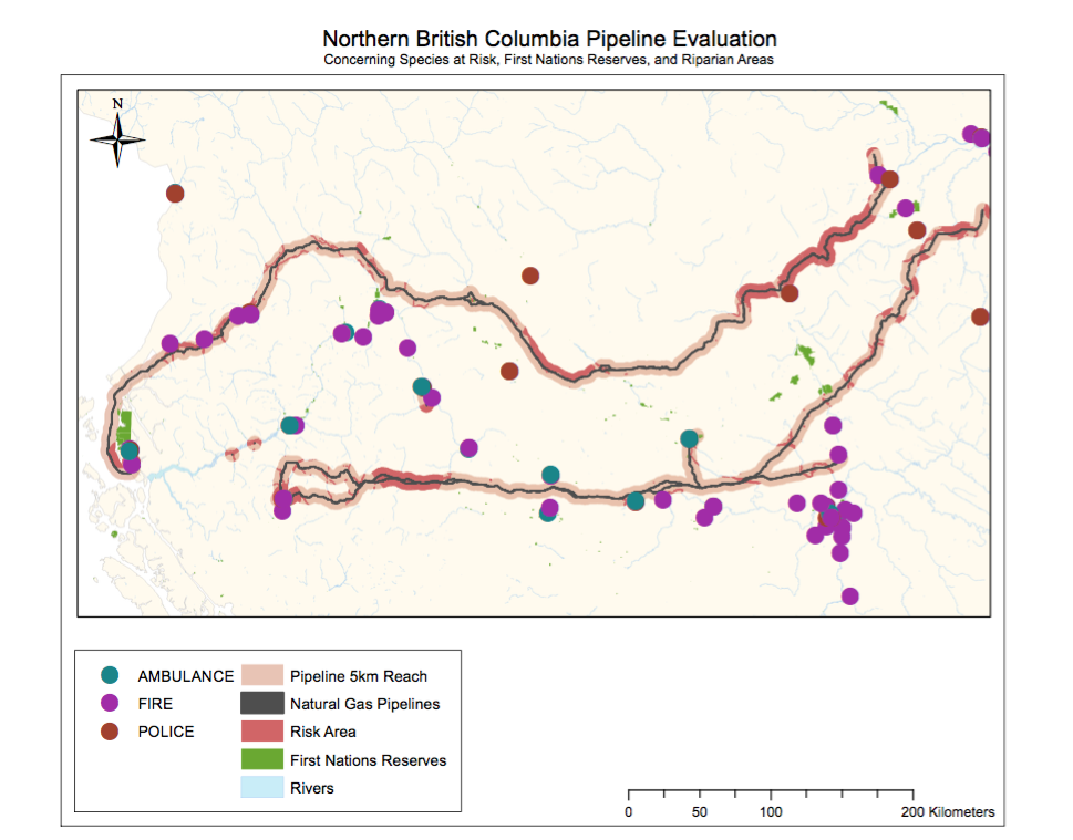 Additionally, we chose to include the location of all first responders in the area to determine the safety of these communities. We established a 5-kilometre buffer zone around the pipeline to account for the reach of any type of spill. The goal of this study was to determine who is most affected by the location of these pipelines and establish an understanding of the situation of these pipelines. This was accomplished through a series of analysis using ArcGIS to create 3 maps, each emphasizing a different aspect of the project. The first shows all the elements previously discussed like First Nations communities, First Responders, Species At-Risk, and the pipelines. The second and third maps are intended to highlight the biological and social implication respectively.
We conducted all of the analysis as a group of three sitting around one computer working on one map. I found this very useful because each of us was able to share at least one skill or trick with the group. It facilitated the process of creating a map completely from scratch. I learnt a lot about the value in working together because it allows you to examine things from an angle you might not otherwise consider.