Vancouver Tsunami Planning
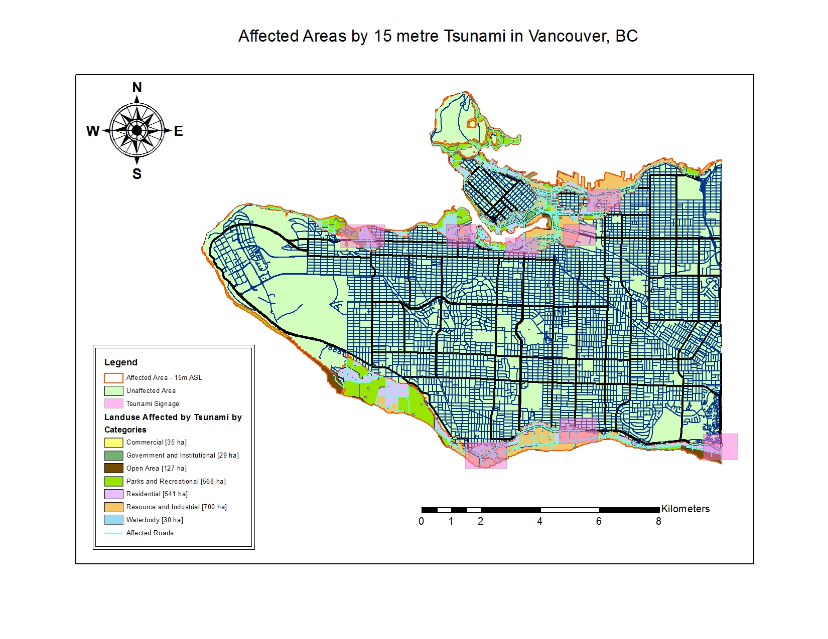
The map shown above delineates and are of Vancouver BC susceptible to damage should a 15m tsunami hit the west coast of Canada.
Using the sum area of the tsunami danger zone divided by the total Vancouver area, we find that 15.5% of Vancouver is susceptible to damage if water levels reach 15 meters.
Within the outlined danger zone, we find a list of healthcare and educational facilities at risk:
Healthcare:
- False Creek Residence
- Broadway Pentecostal Lodge
- Coast West Community Home
- Yaletown House Society
- Villa Cathay Care House
Education:
- St-Anthony of Padua
- Ecole Rose des Vents
- Heritage 3R’s School
- Vancouver Montessori School
- False Creek Elementary
- Emily Carr Institute of Art & Design
- Henry Hudson Elementary
- St-John’s International
- St-Francis Xavier
- Institute of Indigenous Government
(Note: This map was completed by a student as a learning exercise during a GIS course (GEOB 270) at the University of British-Columbia)