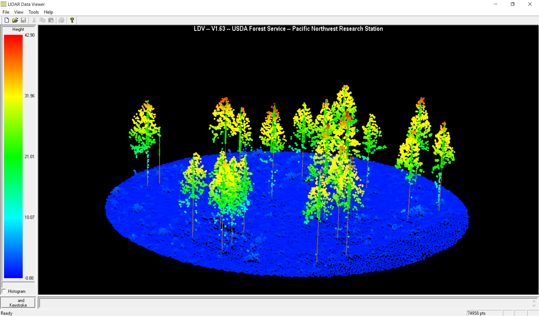
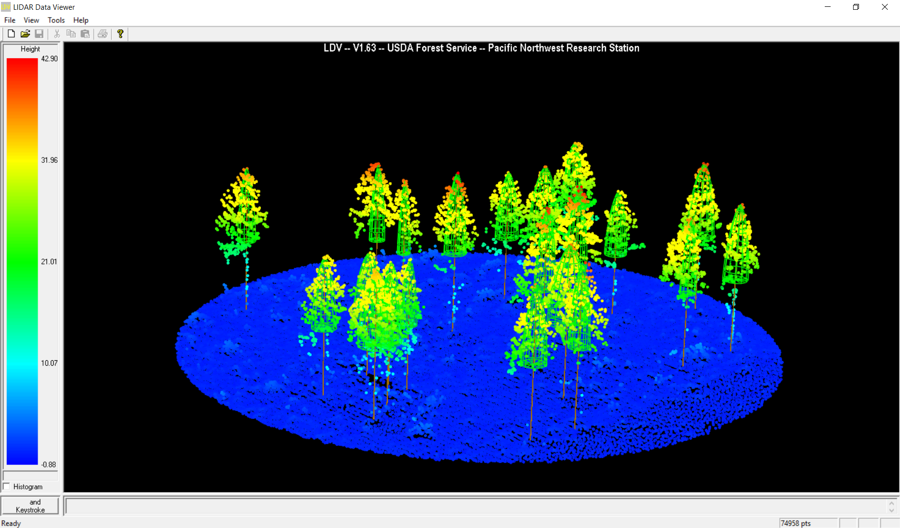
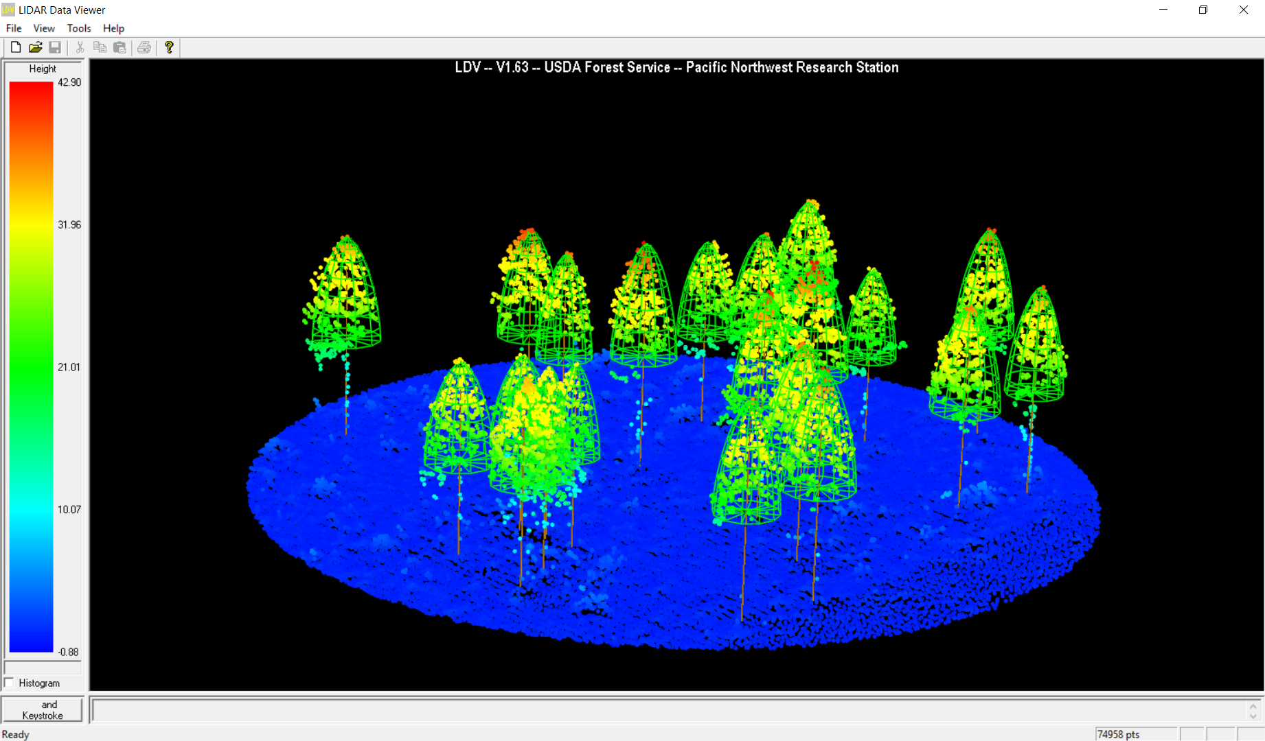
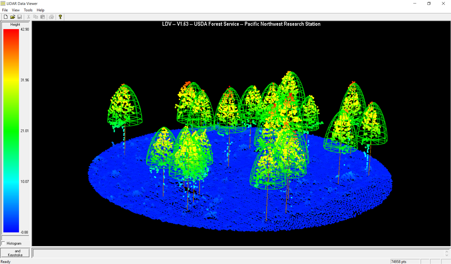
One of the applications of LiDAR data in forestry is modeling trees to support forest inventory management. The cloud points are normally obtained from an airborne LiDAR sensor due to its high efficiency in data collection. The raw LiDAR data can be processed in FUSION to derive digital elevation model (DEM), digital surface model (DSM), and canopy height model (CHM). Apart from the generation of models, FUSION can perform sophisticated data manipulations using command lines. One example is to calculate the forest metrics for statistical analysis and prediction from a plot stand to the whole forest area.
The LiDAR data I worked with covered Malcolm Knapp Research Forest, located in Maple Ridge, British Columbia, Canada. I used the command CanopyMaxima based on CHM to model trees under different LiDAR data resolutions (Fig. 1 – 4). The results show that with a smaller resolution, the canopy widths tend to be smaller and that the 2m resolution fits the best for the tree cloud points.