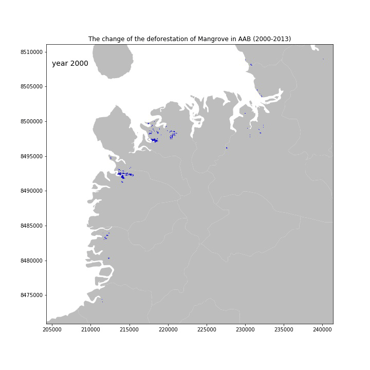
The mangrove in Madagascar contributes to 2% of the global volume. However, in the past two decades, the deforestation of mangrove became a major concern in the north-western Ambanja and Ambaro Bays (AAB), one of the largest mangrove ecosystems in Madagascar. The mangrove ecosystem was degraded or deforested due to anthropogenic reasons (Jones et al., 2016). To understand how the deforestation changed over time, I created an animation (Fig. 1) to show the expansion of the mangrove deforestation areas from 2000 to 2013.
The original data, mangrove deforestation shapefiles, were provided by Trevor Johns. I plotted the shapefiles using matplotlib python module and exported the images with JPEG format. The animation was created from these JPEG files using imageio module. The result shows that the areas of mangrove deforestation kept increasing over time from 2000 to 2013.
Reference:
Jones, T., Ratsimba, H., Carro, A., Ravaoarinorotsihoarana, L., Glass, L., & Teoh, M. et al. (2016). The Mangroves of Ambanja and Ambaro Bays, Northwest Madagascar: Historical Dynamics, Current Status and Deforestation Mitigation Strategy. Estuaries Of The World, 67-85. doi: 10.1007/978-3-319-25370-1_5