Coast Region
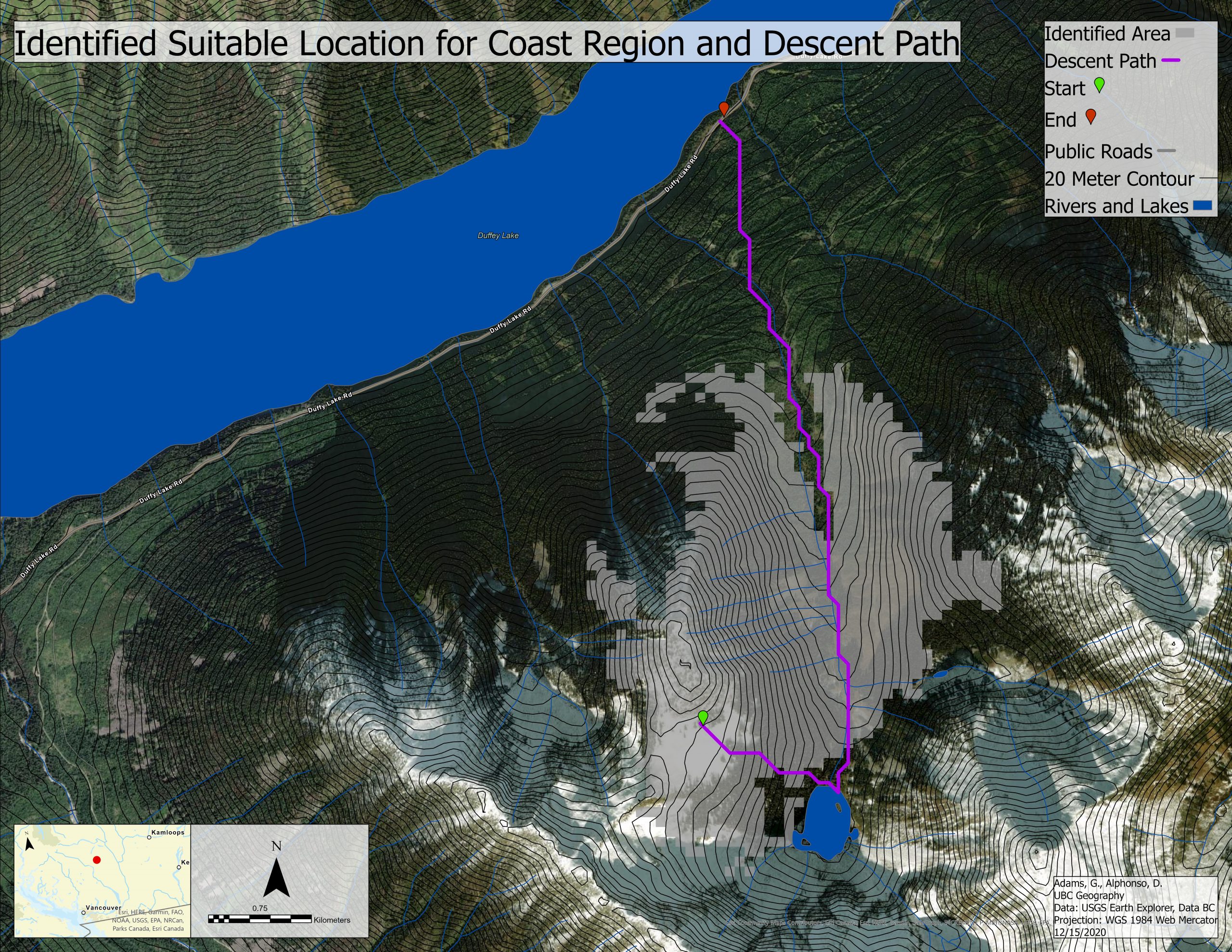
Above highlights the selected area by the MCE. In purple is the least hazardous descent path for the Cost Region. The identified descent path is situated to the south of Duffy Lake. The least hazardous descent path descent off the southeastern face. The path avoids steeper slopes off the eastern face of the peak. Upon reaching the lake, the descent path follows a relatively low angle valley down to the road. While the valley has norther exposure the low angle offsets the risk of an avalanche.
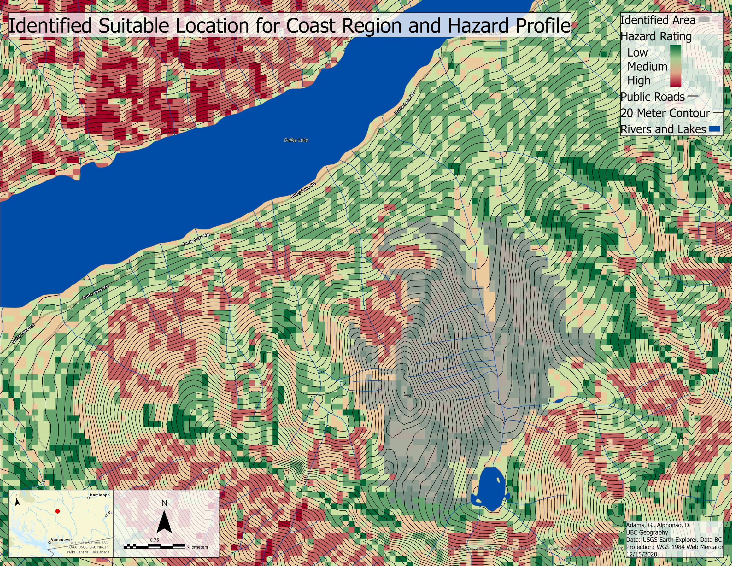
The above is the hazard profile and identified least hazardous ski area within the coast study region. The Identified suitable location for backcountry travel in the coast region is between two mountains. The 25 km^2 region has slopes on all aspects. While there are some regions of higher danger next to the identified location, there is little increase in risk immediately beyond the region. It appears that there could have been a more suitable location off to the east, but this may have been not selected due to it not meeting the size or shape requirements of the location selector.
Mixed Region
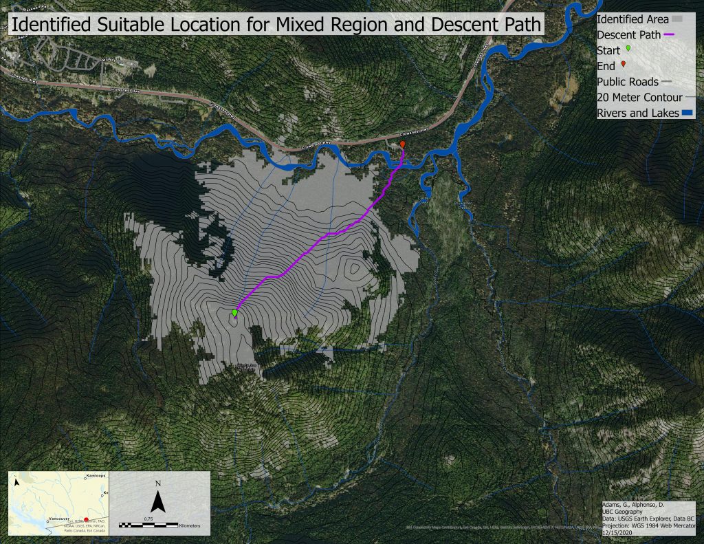
Above highlights the selected area by the MCE. In purple is the least hazardous descent path for the Mixed Region. The descent path flows from the peak to the northeast towards the road. The path crosses two streams and a major river before reaching the road. Furthermore, it appears as if the descent path moves around the steeper slopes by picking cells that are less risky to navigate through regions of higher risk.
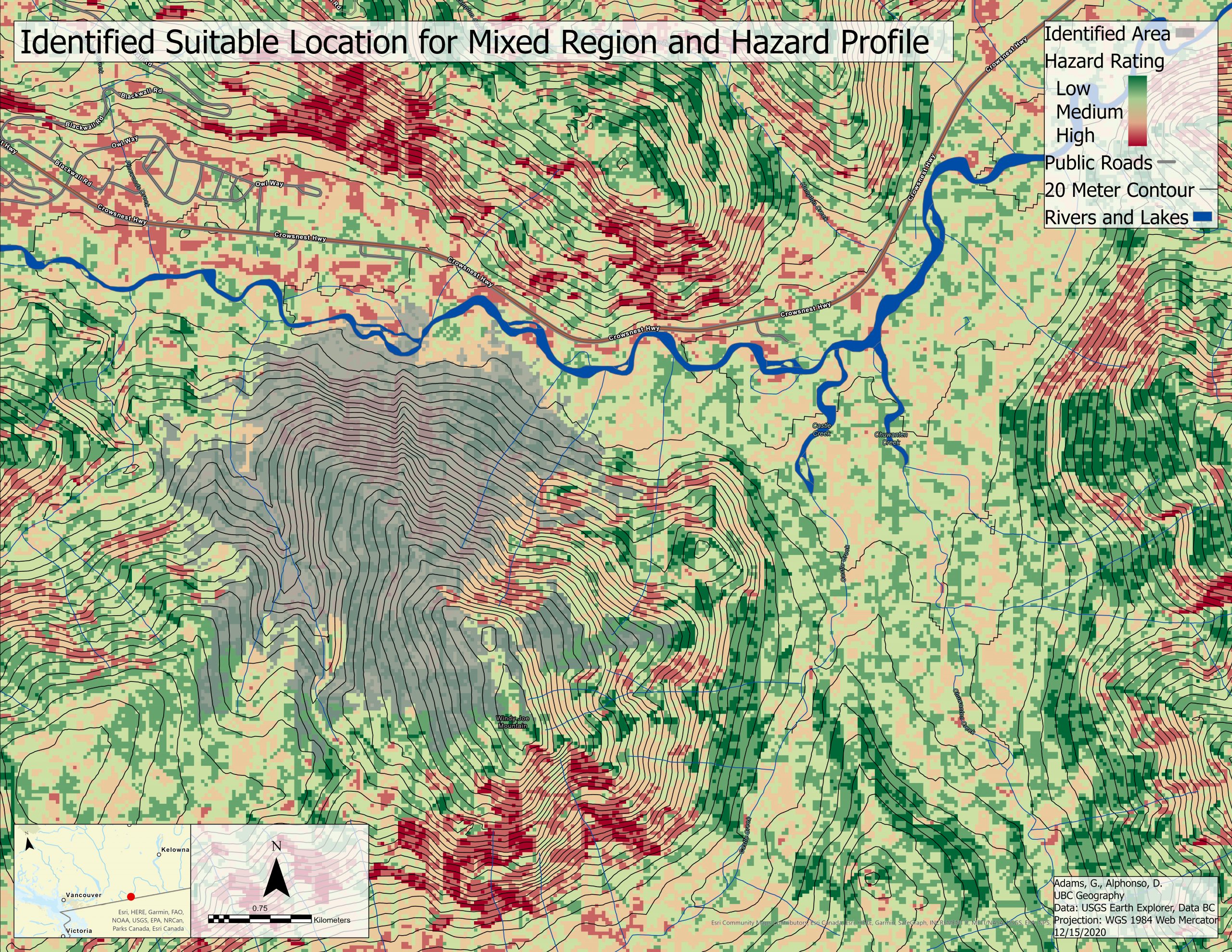
Above is the identified region from the MCE along with its the hazard rating of the study area for the Mixed RegionThe identified region of lower risk in the mixed study area is on the north face of Windy Joe Mountain. The selected area overlies a slightly hazardous section of the mountain. While the section of the identified on the western edge is lower risk, it appears that the model has selected an area of higher risk to have in the middle of what is supposed to be the least hazardous zone. There are a couple reasons for this that will be talked about in the discussion.
Rockies Region
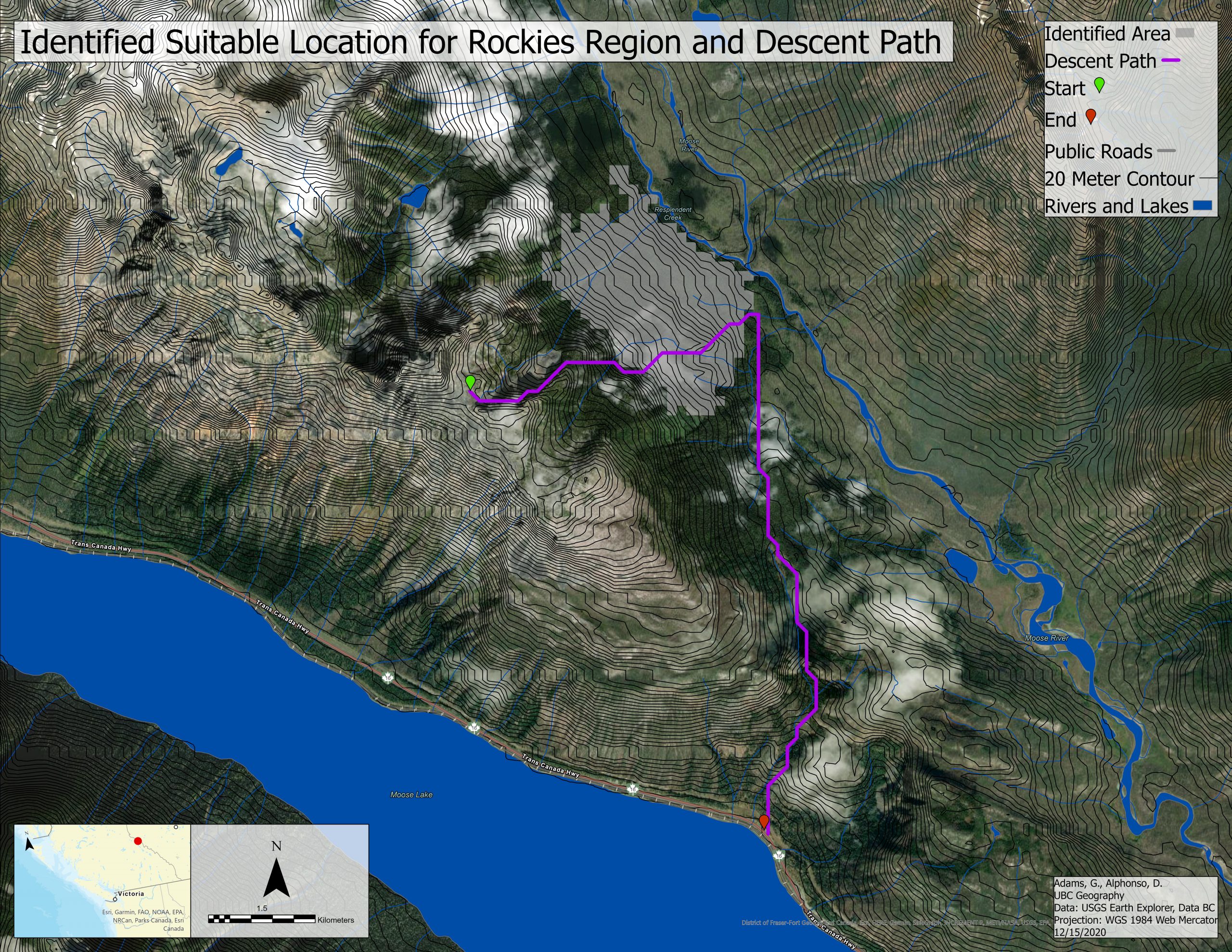
Above is the safest descent path identified by the model along with the suitable location as identified by the MCE. The path avoids the steep terrain off to the southwest of the face and opts to descend off the east face of this peak within the rainbow mountain range. The descent path then handrails along a flat to work its way around the mountain towards the road. This is the safer paly as it avoids heading back up hill into more hazardous terrain even though it would be a shorter path. Finally, the safest descent route works is way down between two mountains as it moves towards the road. In this movement it also avoids the steeper more avalanche prone sloes to the west of its location.
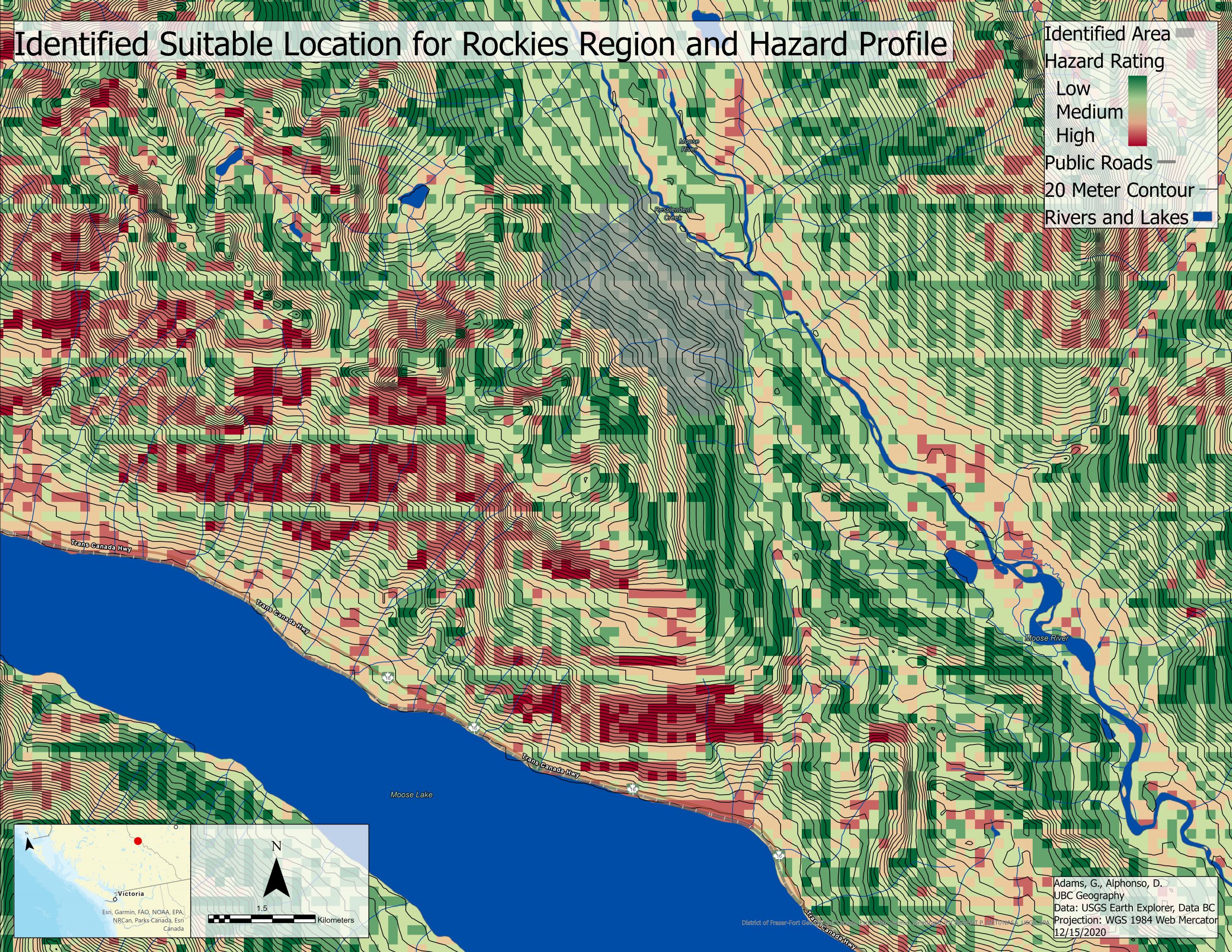
This is the final map of the MCE that looked at avalanche terrain across three different study areas. This Map is of the hazard profile along with the identified least hazardous area within the study area. The suitable region that the MCE located is between two lower risk regions of about equal size. This may be an example of the MCE Locate feature selecting criteria based on trying to maintain a shape rather than selecting the lowest risk area.