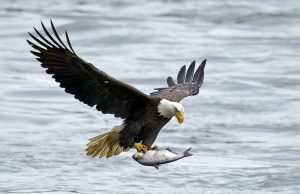
We have made several sequences of maps based on different mapping methods to find the changes in Bald Eagle’s habitat in response to climate future. We first determined the temperature, humidity and precipitation of the bald eagle’s preferred habitat, as well as their predatory habits and nesting locations. Bald eagles tend to live beside water bodies like wetlands, lakes, rivers with lots of fish, and surrounding forests would be a plus. They can also be found near unfrozen water bodies and forests. Bald eagles make their nests in forested areas near large bodies of water. Eagles also prefer areas that are isolated from human activities.
In order to get more comprehensive results, we have used two mapping methods: sieve mapping and multi-criteria evaluation. We also chose two Representative Concentration Pathway (RCP), 4.5 and 8.5. RCP 4.5 means that the emissions of carbon dioxide (CO2) will peak around 2040 then decrease, which is a slightly better condition compared to RCP 8.5. For climate model RCP 8.5, the emissions of CO2 continue to rise and lead to worse situations. We have observed that for normal situations, bald eagles tend to have their habitat closer to the coastal regions of Vancouver Island, mainly in the north-west region. The potential habitat in 2025 by using climate model RCP 4.5 shows a similar area with the normal situation. However, for 2055 and 2085 by using climate model RCP 4.5, we have observed decline in habitat areas and the worst habitat-shrinking situation is near the Campbell river. By using climate model RCP 8.5 which indicates the worst condition, we have observed a dramatic decline in habitat on the east of Vancouver Island in 2085 compared to climate model RCP 4.5.
The analysis of MCE suggests similar results with sieve mapping. MCE stands for the most suitable areas for bald eagles. For climate model RCP 4.5 and RCP 8.5, the potential habitat area for bald eagles are quite similar to the normal situation. Both climate models show that the most suitable area will shift along the west coastline of Vancouver Island since RCP 8.5 suggests the CO2 emission will significantly arise throughout the 21st century.
Through our analysis based on the two different mapping methods, we conclude that bald eagle habitats would be significantly affected by changes in climate. The sieve mapping examined the changes in habitat areas while MCE suggests the changes in distribution of bald eagle’s habitat. The two climate models RCP 4.5 and RCP 8.5 all suggest that the habitats for bald eagles will shrink in 2055 and 2085. We also observe that for 2055, climate model RCP 4.5 suggests a slightly higher habitat area than climate model RCP 8.5, this is due to the influences of precipitation is larger than the influences of temperature. Overall, climate model RCP 8.5 indicates more shrinks in habitat than RCP 4.5. For future analysis, we suggest to include more climate models and form a more comprehensive analysis. We also observe that the shrinking areas are mainly near human activities, thus future analysis could also include the changes in human activities to get a more comprehensive analysis.