Capability
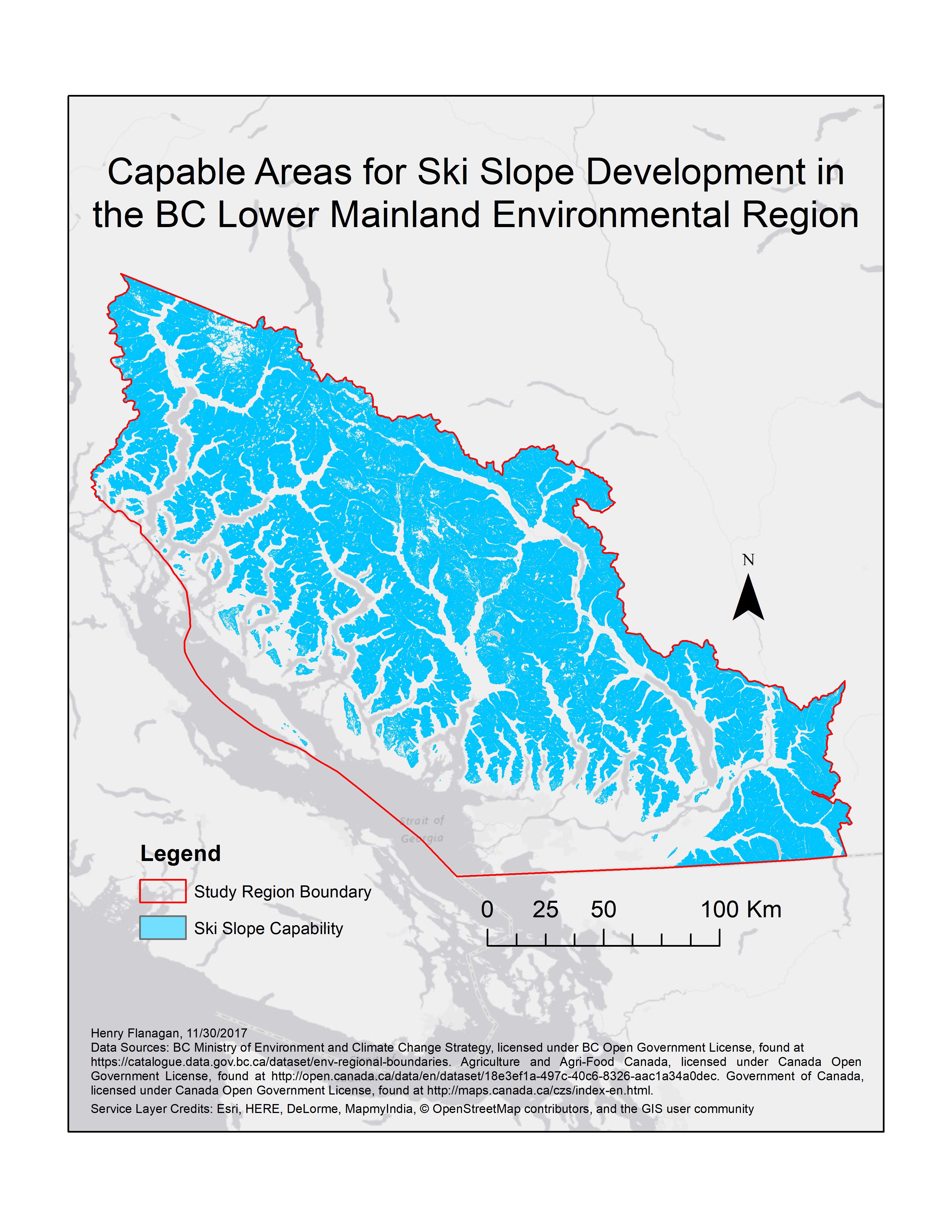
This map shows the area of the province that I determined through my analysis to be capable for supporting skiing and snowboarding activities in a resort capacity. The capability raster that I produced had a 30 meter resolution that and contained 20,825,407 ‘capable’ cells, out of 48,382,263 total. This means that 43.04% of the total study area could potentially support ski slope development. Since each cell in the output capability raster was 30 x 30 meters, the total area of the capable region is 18,742,866,300 square meters, or 18,742.87 square kilometers.
I considered capability in this project to refer to approximate capability for supporting ski resort operations, which is why I decided that the baseline elevation for capability (653 meters) should be equal to the absolute lowest elevation of any of the ski resorts that currently operate many in the region. There are many elevations in the study area below this threshold that do receive large amounts of snow in the winter and could support short-term skiing and snowboarding, but they are unlikely to be usable throughout the entire winter season. As such, this classification of capable regions should be considered approximate rather than exact.
Suitability
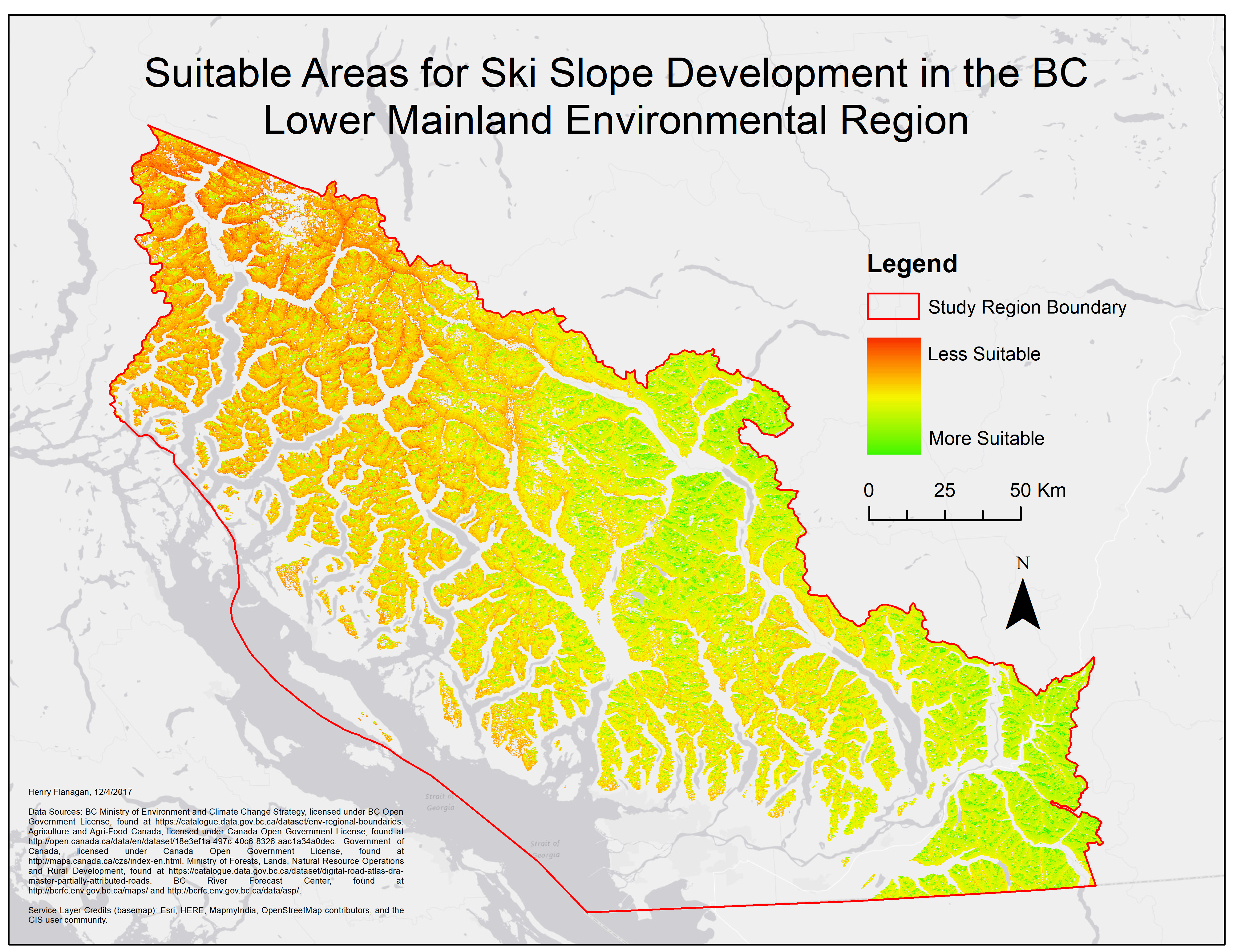
This map shows the final results of the suitability analysis that I performed using a multi-criteria analysis (MCE) approach. Suitability was assessed using five criteria for each pixel: slope suitability in terms of closeness to an intermediate skiing grade of 35 degrees, aspect in terms of more northerly slope angles, elevation, snow depth (interpolated using a trend surface), and road access in terms of euclidean distance from the nearest highway/freeway/arterial. Each of these criteria was given an equal weight in the analysis. The output raster, pictured above, shows each pixel in the capable region assigned a value from 0-1 where a higher value indicates greater suitability. Like the capability analysis, this suitability map should not be considered as being empirical since there is no definitive method for assessing ski slope suitability. The suitability map shows that the most suitable regions for ski slopes are primarily clustered in the southeastern and north-central areas of the study region.
Identifying Best Sites
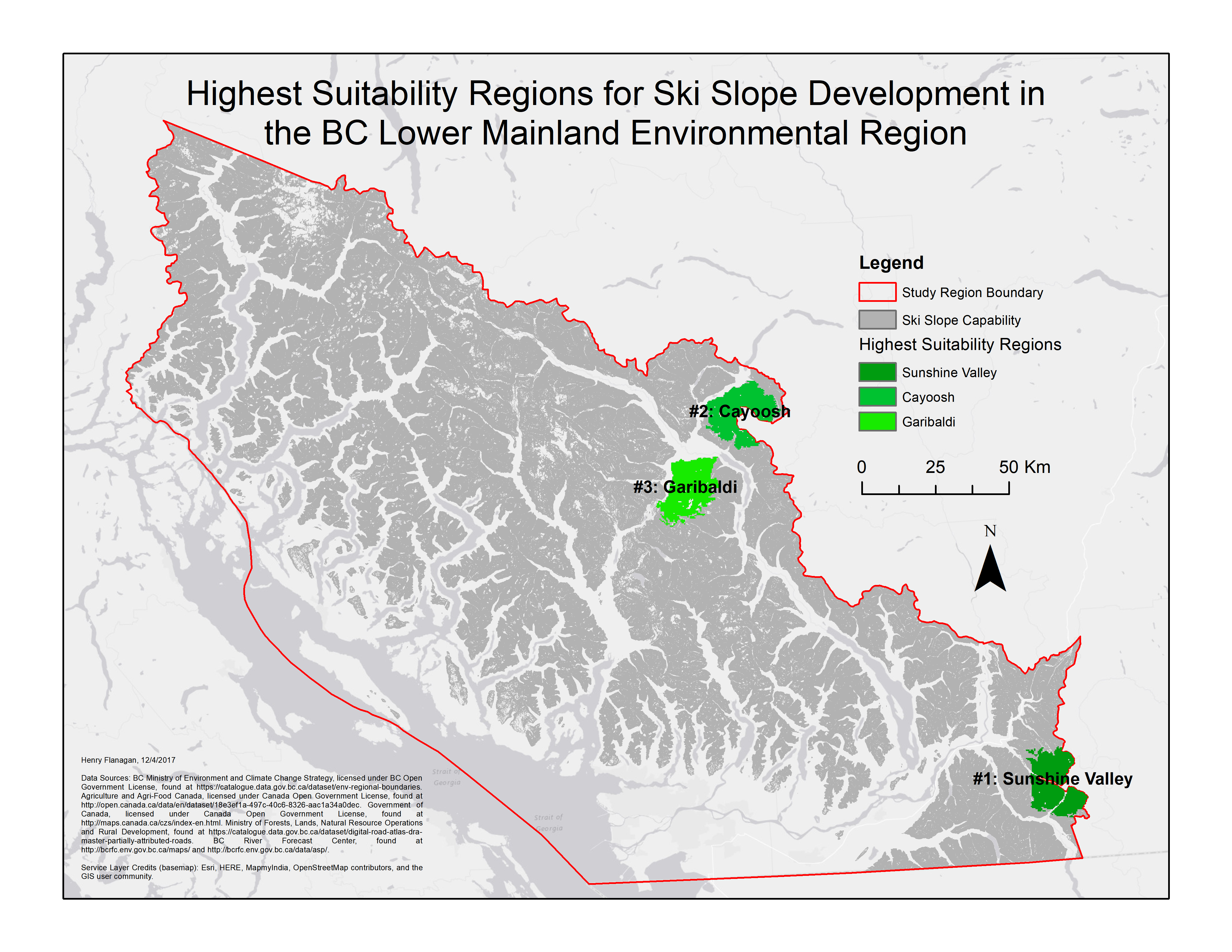
This map shows the three regions within capable area that were identified as being the most suitable for ski slope development. These regions were generated by using the Locate Regions tool in ArcMap on the suitability raster. The regions were generated through an automated process that uses an input shape, in this case circular, to loosely contain pixels with the highest average values. The regions were set to have an area between 0.5 and 300 square kilometers, be at least 5 kilometers apart from each other, and given an aerial unit equivalent in size to the input raster aerial unit squared which in this instance was 400 meters.
I named the three regions based on nearby features or towns. The Sunshine Valley region was the identified area with the highest suitability. Located in the southeastern corner of the study region, this area is located east of Hope along Highway 3. There is little apparent development in any of the mountains in this region. The second best region identified was in the area around the Cayoosh mountains, in the north central area of the study region. The Cayoosh region is found just north of Lillooet Lake along Highway 99, near the town of Pemberton. Like the Sunshine Valley Region, the mountains in the Cayoosh region have also not been developed for skiing purposes. The third identified region lies largely in the northern area of Garibaldi Provincial park, slightly to the south and east of the Cayoosh region. This region has already experienced significant ski resort development: it is the home to Whistler-Blackcomb ski resort, the largest in the entire province. While there are many other conditions beyond the scope of this study that would need to be explored to locate a ski resort, these 3 regions would serve as optimal places to consider ski slope development by meeting key physical criteria and access considerations.