For our cities, reductions in the amount of vehicle miles travelled by improving alternative transportation networks is key in mitigating climate change. Biking is regarded as a key prong of this framework, providing many ancillary but important benefits such as improving travel safety, reducing congestion, improving health outcomes, improving local economies, and increasing transportation equity (National Association of City Transportation Officials [NACTO], 2017).
Despite the City of Vancouver’s efforts to increase ridership, the percentage of commuters that utilize cycling as a mode of transportation currently sits at around 6.1%, based on 2016 Census data (HUB Cycling, 2019). Cycling and transportation engineering literature cites three key factors for increasing bicycle ridership within our cities: Safety, Comfort, and Equity (NACTO, 2017). This project focuses on improvements that can be made to Vancouver’s Bikeway network that address these three factors.
The project can also be subdivided into its two infrastructural foci: Intersections and Routes.
Intersections
1) To improve cycling safety, intersections are analyzed. Research suggests that intersections are where there is the largest potential for bike-vehicle conflicts to occur (HUB Cycling, 2019). Thus, the locations of bike incidents, which include official bike-related collisions reported by the Insurance Corporation of British Columbia (the province’s official automotive agency) and crowdsourced data (collisions, near-misses, and hazards) from BikeMaps.org are plotted and used to derive hotspot and outlier intersections for further investigation. This combination of data points has been suggested to be complementary; introducing near-miss incidents can be of utility as these events occur at a higher frequency than collisions (Branion-Calles et al., 2017). As a result, the combination of these data points from official and crowdsourced sources can potentially provide more explanatory power to a spatial analysis of dangerous intersections.
Routes
2) To improve cycling equity, gaps in accessibility/coverage for Vancouver’s AAA Bikeway network are located through a multiple criteria evaluation (MCE) for commuters. The AAA standard (All Ages and Abilities) is a broad framework for improvement of bicycle infrastructure to increase ridership (NACTO, 2017), and has been cited by the city of Vancouver as aspirational (City of Vancouver, 2017) in making bikeways as comfortable as possible to the widest population. Based on this mandate, five factors are weighted and filtered to propose expansions to increase coverage of the AAA Bikeway network for commuters.
3) To improve connectivity, gaps in connectivity for Vancouver’s AAA Bikeway network are located through a MCE for commuters. The City of Vancouver considers only about 25% of its network to meet the AAA standard (Hub Cycling, 2019). Factors are weighted and filtered to propose expansions to increase the connectivity of the AAA Bikeway network for commuters.

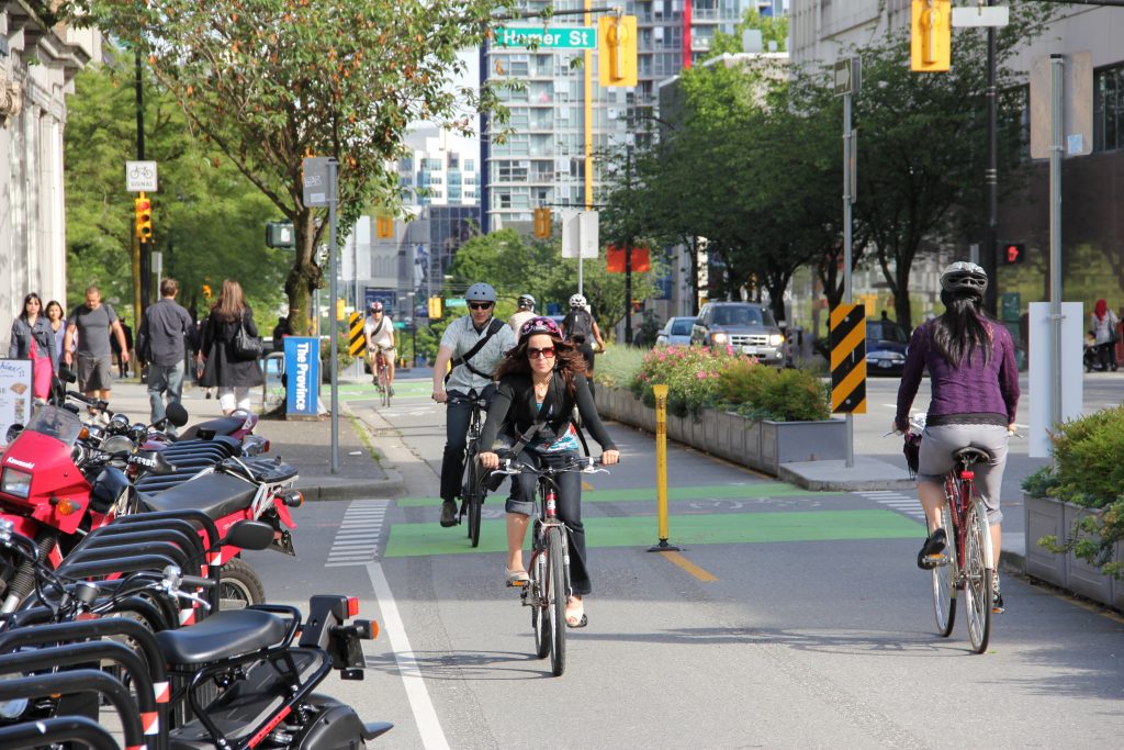
Photo by Paul Kruger CC by 2.0 via Flickr Commons
Research Questions
Part 1. Intersection Analysis: Bike Incidents Hotspots and Outliers
Question 1: Which intersections are hotspots for bike incidents?
Question 2: Which intersections along bikeways are outliers for bike incidents? Can we improve on these dangerous sites, particularly if they involve intersections with major roads?
Part 2. Route Analysis: Improving the Accessibility and Connectivity of the AAA Bikeway Network
Question 1: Where can we improve the accessibility of our bike networks, particularly where there is a lack of AAA Bikeways?
Question 2: Where can we improve the connectivity of our current bike networks, particularly in connecting with our current AAA Bikeways?
