In this project, myself, Anna Kaveney, Hriday Keshav, and Alex Newall decided to analyze an issue of which has risen to be very controversial, yet simultaneously does not commonly reach the masses through media streams. This issue is related to the proximity of hydraulic fracturing practices in northeastern British Columbia to Indigenous lands and freshwater sources. Recognizing the importance of doing this work, we set out to produce a set of maps that illustrate this particular case of environmental racism, as we believed a visual component detailing the problem could be helpful in allowing the greater public to fully grasp the issue at hand.
We split the tasks up among our teammates, though all worked together on each part as a collective. I was largely in charge of the map production and I worked on the report. Anna was largely in charge of the flowchart. Hriday made the visuals for the maps, and did a large portion of the report writing. Alex worked on the maps as well, found data sources, and also worked on the report. This setup worked well for us, and we were able to make the maps and report in an efficient and timely manner, though we definitely could have improved upon our communication to streamline the process.
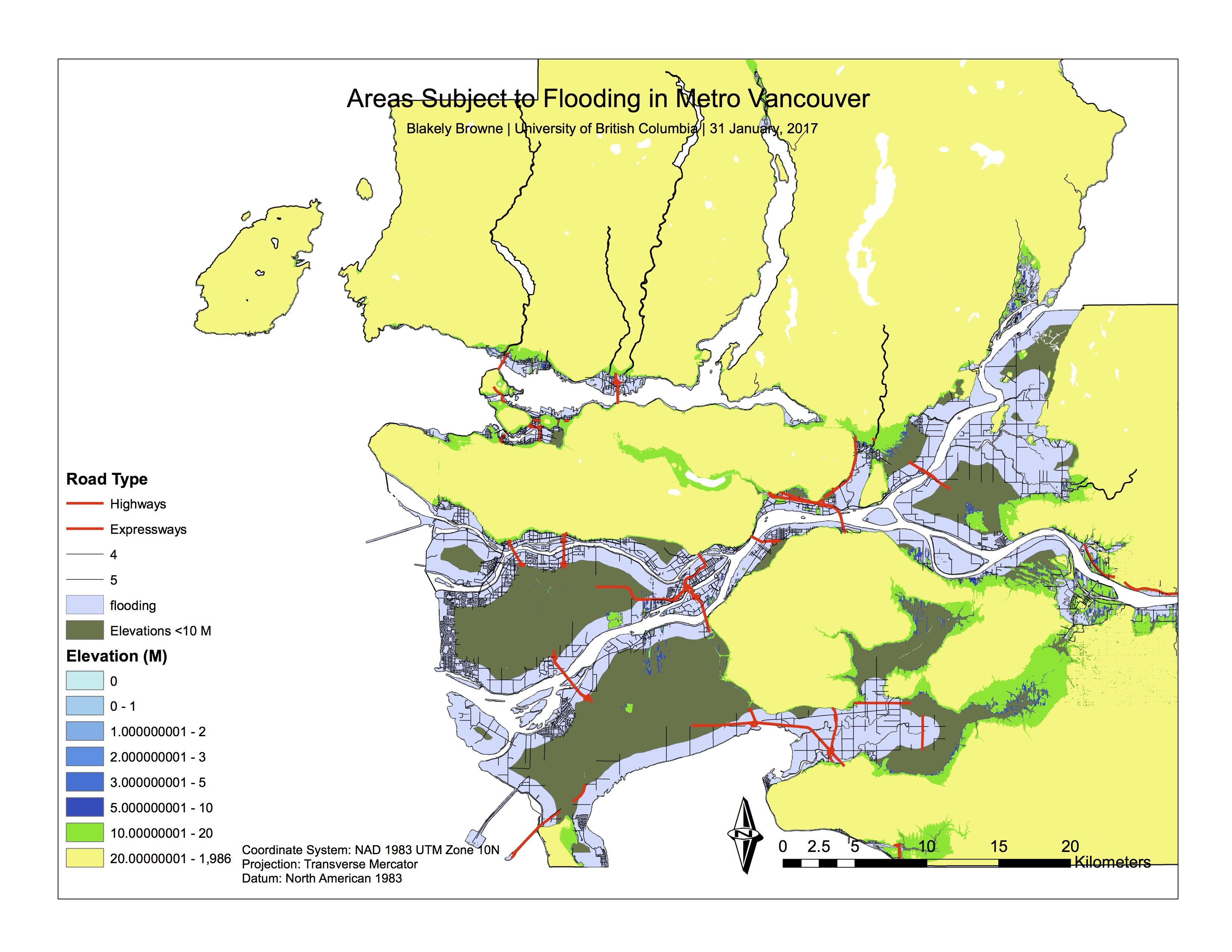
The findings of this project were shocking. The proximity of wells and waste sites, as well as water access points were largely within 15 kilometres of Indigenous lands in northeast BC, and within 2 kilometres of freshwater sources. We studied the Montney Formation in particular, and found that there were massive amounts of freshwater access points threatened by the growth of hydraulic fracturing. Below I have attached a link to our project, where the results are more detailed.
This project taught me a huge amount about team work and how to function efficiently in a group work setting. Moving forward, I now feel much more comfortable working on GIS, as well as with a group, as this project required a lot of communication and participation from all members to make it come together.
I hope you enjoy!