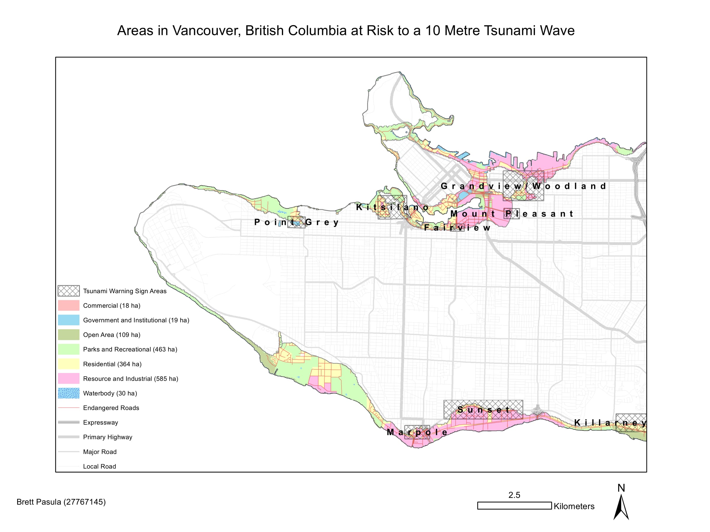
- Performed buffer analysis, reclassified and converted raster layers to vector, and intersected layers of interest by combining a 1 kilometer zone around the shoreline along with areas lower than 10 meters elevation in Vancouver which may be susceptible to a tsunami or storm surge.
- Performed proximity analysis by delineating points and areas of interest (education, healthcare, roads and general landuse) that were within the danger zone, and created summary tables to provide users a simple view of the extent of affected points and areas of interest.
- Created a new feature class to highlight areas that require signage to indicate tsunami risk.

Figure 1. Areas in Vancouver, BC at risk to a 10m tsunami wave.

Figure 2. Effect of a 10m sea level rise at the False Creek Tidal Flats.
The following list contains the education and healthcare facilities within the Vancouver danger zone:
- Anthony of Padua
- Ecole Rose des Vents
- False Creek Elementary
- Emily Carr Institute of Art and Design
- Henry Hudson Elementary
- False Creek Residence
- Broadway Pentecostal Lodge
- Yaletown House Society
- Villa Cathay Care Home
As highlighted by Figure 2, the new site of St. Paul’s Hospital is directly in the way of a tsunami (10m) should it strike Vancouver. In addition to that, the False Creek Tidal Flats are subject to severe liquification due to the soft, fine-grained nature of the sediment which underlies the area. Both are cause for concern should an earthquake strike off the Pacific coast.
