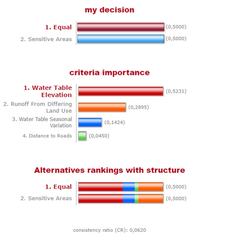
With all the layers created, we were then able to determine the locations on Burns Bog which were most vulnerable by identifying the areas which best met the 4 criteria. To do this we used the ‘Weighted Sum’ tool in ArcMap which sums the raster layers by applying different weights. We decided on the weights using a weighting calculator at www.123ahp.com as can be seen in figure 6. We determined water table elevation to be the most important criterion as bogs require high water tables to support sphagnum mosses and to prevent growth of forest vegetation. Contamination potential from runoff was determined to be of secondary importance as bogs are ombrotrophic regions (fed by rainwater) and thus have low nutrient concentrations. However runoff from external areas is often higher in nutrients and pH which kills bog vegetation while encouraging growth of forest vegetation. Seasonal variation in water table elevation is next as high variability indicate areas that are susceptible to more intense drought or more intense flooding which puts the bog under stress. Distance to roads was given the lowest weight as we determined that impacts associated with roads tend to effect the area in the immediate vicinity of the road, and the bog as a whole to a much lesser extent.
With the weights determined, we ran the ‘Weighted Sum’ tool which identified the areas of the bog that best met these criteria. We also ran the tool with the criteria having equal weights as a sensitivity test.