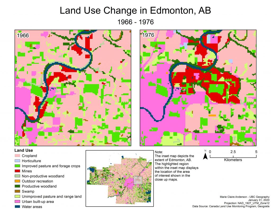
This lab explored land use change in Edmonton, AB from 1966 to 1976. Data was obtained from the Canada Land Use Monitoring Program (CLUMP) for both years. These files were obtained in vector format, and for the purpose of this lab, they were converted into rasters at a 100 meter spatial resolution.
To assess land use change over these 10 years, a transition matrix was created and FRAGSTATS was used to develop relevant spatial statistics.
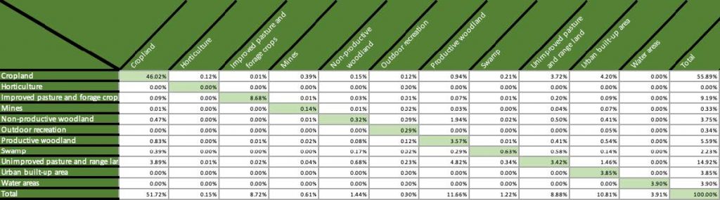
Transition Matrix

Landscape Metrics
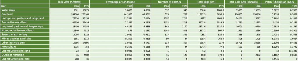
Class Metrics
The dataset proved to show a series change in many class and landscape based aspects of the study area. Results included significant change in cropland, mines/quarries/sandpits, and urban/built up land cover types.
Full report here: Anderson_479_Lab01