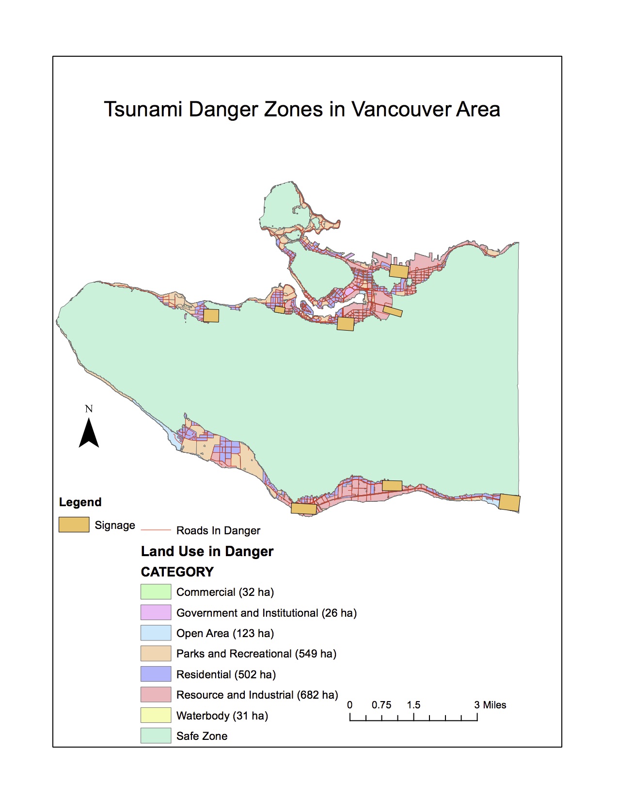
This lab found that 14% of the Vancouver area is in danger of tsunamis. This was determined by selecting all areas that were both within 1 kilometer of the shoreline and which had an elevation of 15 meters or below.
‘Buffer proximity analysis’ was used to create a 1 kilometer buffer around the Vancouver shoreline and a ‘selection by attribute’ of a digital elevation model was used to select all areas 15 meters or below. An intersection of these two layers showed the areas vulnerable to a tsunami.
It was found that the following health care and educational facilities were found within a tsunami danger zone:
- Health Care:
- False Creek Residence
- Villa Cathay Care Home
- Broadway Pentecostal Lodge
- Yaletown House Society
- Educational:
- Emily Carr Institute of Art & Design
- Institute of Indigenous Government
- Henry Hudson Elementary
- False Creek Elementary
- Vancouver Montessori School
- Heritage 3R’s school
- St Anthony of Padua
- Ecole Rose des Vents
This was done by using the ‘Selection by Location’ tool, and then inputing layers of Vancouver healthcare and Vancouver education, with the ‘danger zone’ layer as the source layer.
Accomplishment Statement:
Performing buffer proximity analysis, reclassification and conversion of raster layers and a variety of overlay tools in order to calculate statistics describing land and facilities vulnerable to tsunamis within Vancouver.