Health care facilities in danger zone:
- False Creek Residence
- Broadway Pentecostal Lodge
- Yaletown House Society
- Villa Cathay Care Home
Education facilities in danger zone:
- Anthony of Padua
- Ecole Rose Des Vents
- False Creek Elementary School
- Emily Carr Institute of Art and Design
- Henry Hudson Elementary
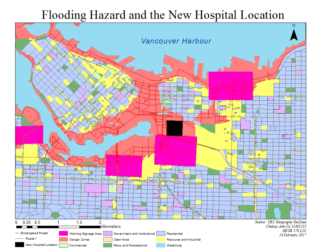
I got these results by first intersecting the land use layer data with the danger zone layer data. Then I intersected the new resulting layer with the healthcare facilities location data and the educational facilities location data respectively. This gave me the remaining points of which healthcare and educational facilities are currently located in the danger zone and are at risk of flooding should a tsunami hit Vancouver.

The new site for St. Paul’s Hospital is located in the danger zone. This means that if there were to be a tsunami and subsequent flooding, the hospital would have to be evacuated or it would not be accessible if the surrounding roads were flooded. Since it will be a major healthcare facility for the east end, this might lead to problems in the event of an emergency.
Recap of learning: Working with both spatial and tabular data, I was able to identify and create a map of areas that are prone to flooding in the event of a tsunami. I was then able to locate the areas that will require warning signage as well as determine whether the proposed location of the new hospital will be affected.