Following the processes outlined, the final locations and Least cost path are seen in Figure 2. The two selected sites were of the top 5 largest sites (Fig 1.) that were deemed to be acceptable by the MCE and outlined assumptions. These areas may have varied with the inclusion of Martian dust data when considering the MCE.
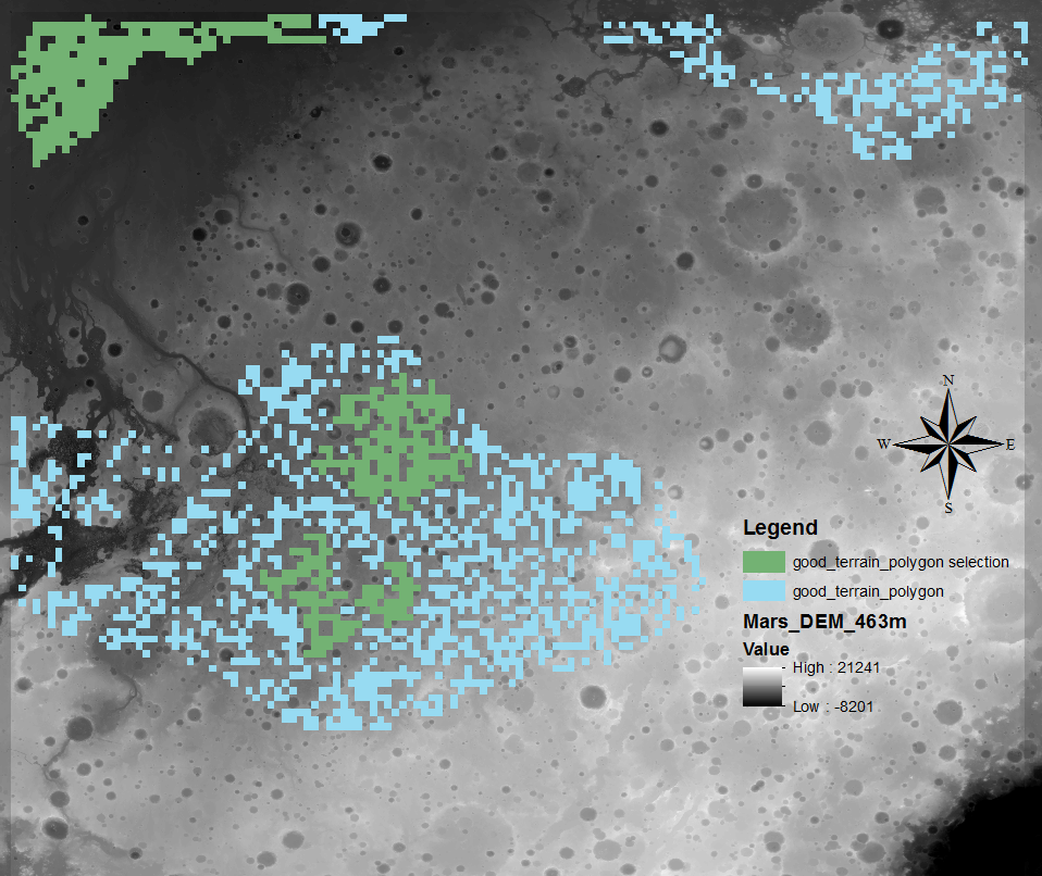
Figure 1.
The area on Mars for the MCE was chosen for its variability of terrain there is the presence of canyons, craters, flat lands which cover a large range of the structural variability in Mars’ topography. The sample area was also specifically chosen to reduce distortion in area size due to operations being completed on a geographic projection as there is no projection systems for Mars yet. This is why it is difficult to conduct a more automated way of calculating areas on Mars.
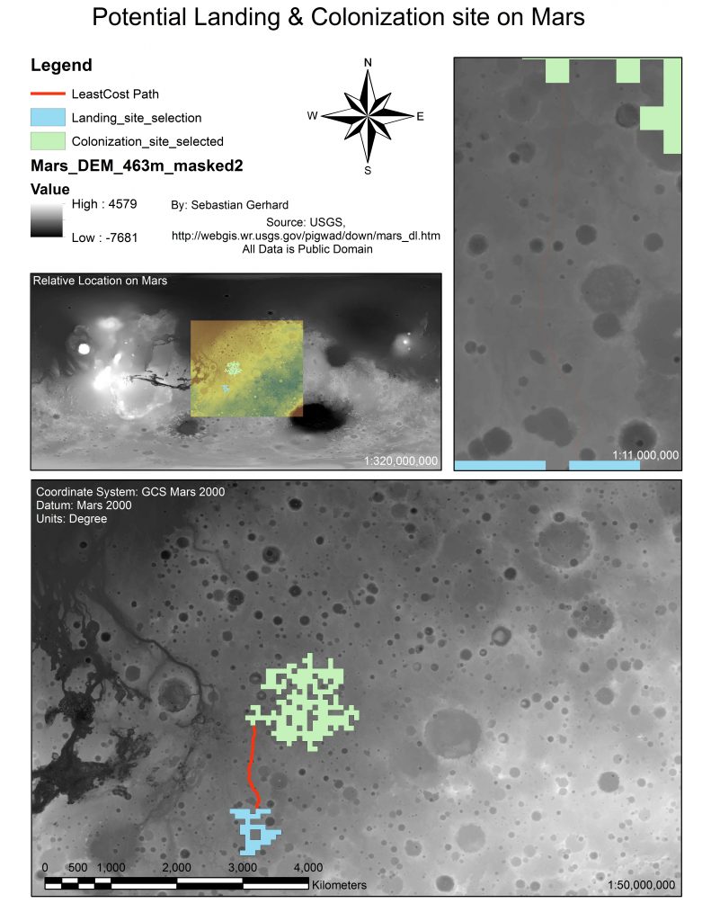
Figure 2.
These landing sites were chosen of the top 5 (Fig 1.) to show the Least Cost Path step of the analysis (Fig 3) while being still within reasonable proximity. The area had to parsed down for calculations and can be seen in the top left of Figure 3. all least cost path calculations were run on this area. Total travel distance between the calculated sites was 684 km, which would be considered on the larger side of preferred travel distances on Mars. Depending on advancements in technology for transportation on Mars this trip could take many weeks with current technology.
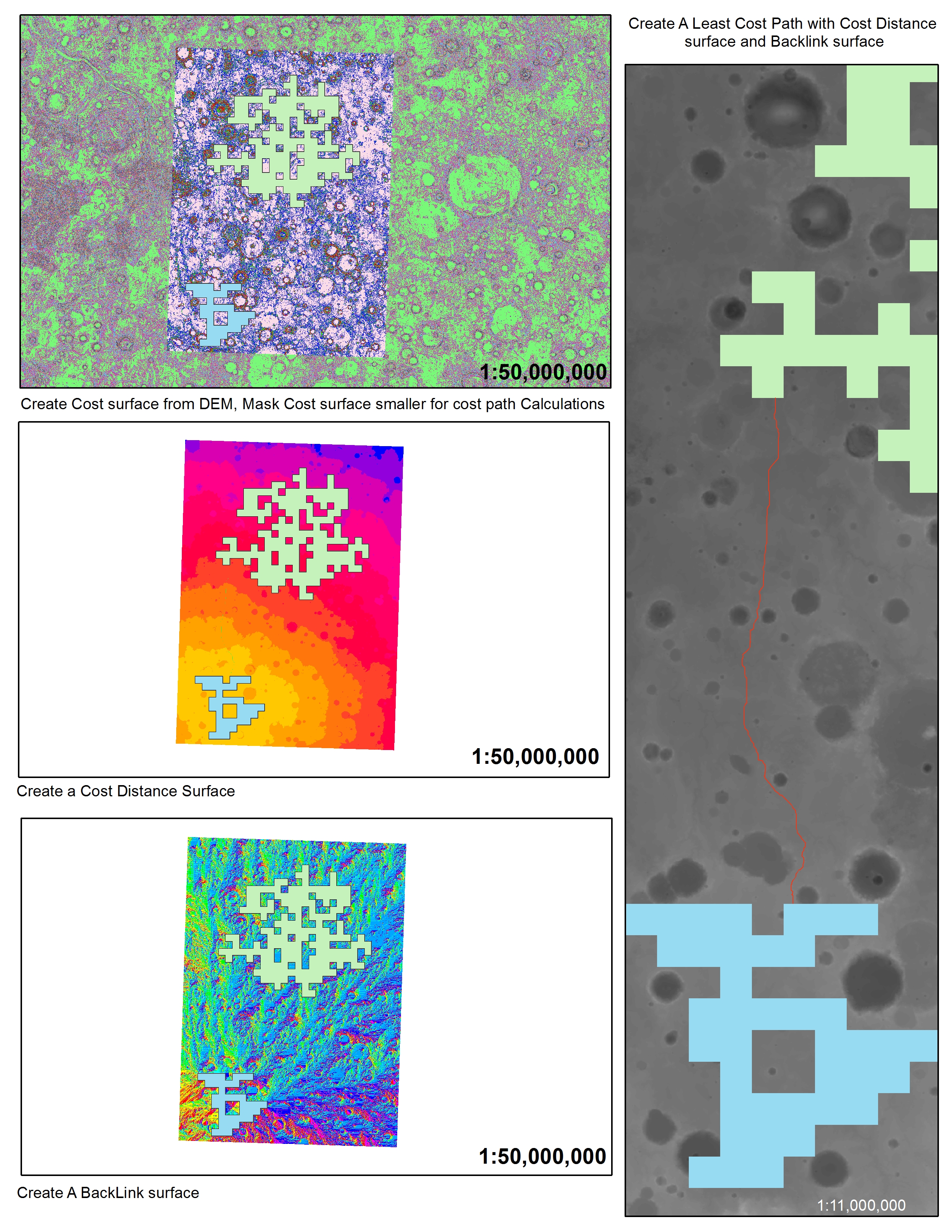
Figure 3.