Given Fig. 4 below, most of the province of BC has insufficient eBird sighting data (red areas) to form a reasonable interpolation of bird ranges. The areas in Fig. 4 that were potentially suitable for inferring actual ranges (green areas) included land near the largest cities in the province — Vancouver, Victoria, and Kelowna. Some areas were of intermediate accuracy, which included much of land between Vancouver and Kelowna (yellow areas), where the population density is relatively high.
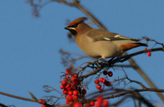
Elegant cedar waxwing (PD).
It has also been found that many of the eBird sighting points in the northern part of British Columbia — especially in the case of the cedar waxwing — were in very close proximity to major roads and highways (Fig. 2). This, along with the increase in sightings near high-density human populations, enforces that that there are more sightings in areas with higher human populations. One of our hypotheses stated that areas that are easily accessible and/or near high human populations will have more recorded data, and therefore more statistical certainty. This appears to be somewhat true, however, more bird sightings does not necessarily mean higher accuracy in sightings. Figure 2 shows that some of the eBird sightings were outside of the established ranges of the cedar waxwing. It appears that human error — misidentifying bird species, in this case — may become an issue with inferring data from citizen science initiatives like eBird.
There is, however, another possibility — that climate change, and/or other anthropogenic environmental changes have altered bird habitats. These changes may be pushing the birds northward to such an extent that these cedar waxwing sightings were not mistakes, but the result of human interference in the natural environment (Fig. 2). Future studies on the accuracy of the eBird program should take climate change and human intervention into consideration when developing their plans.

Figure 4. The overall spatial accuracy of the bird ranges determined from the eBird program compared to determined ranges of the three different species of birds.
- Green areas: high accuracy
- Yellow areas: medium accuracy
- Red areas: low accuracy