Hey there,
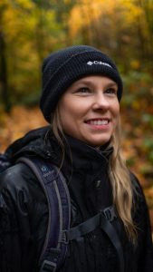
My name is Emma Cunningham and I am currently a Geospatial Data Analyst working in Vancouver, BC. I graduated from the Master of Geomatics (MGEM) Program at the University of British Columbia in May 2019 and have been building my career in GIS and Remote Sensing ever since. Prior to completing the MGEM program, I received my bachelors degree in Natural Resources Conservation from the UBC Faculty of Forestry. I majored in Science and Management and graduated with both Honours and Co-op designations. Throughout my undergrad I was introduced to geospatial applications through both coursework and co-op positions, and thus my passion for geomatics was born.
Since graduating from UBC, I started my professional career with TRE-Altamira where I worked as a GIS analyst and specialized in InSAR data analysis. InSAR – which stands for interferometric synthetic aperture radar – can be used to measure ground movement from space with millimetric precision, and has significant applications within Oil & Gas, Mining, Natural Hazards and Civil Engineering sectors.
After 3.5 years with TRE-Altamira, I decided to tailor my career to a more environmentally oriented position. In the fall of 2023, I began working in my current position with Fisheries and Ocean’s Canada (DFO) as a GIS Analyst and Database Technician. In this role, I am part of a small team responsible for designing a relational database to store data related to Pacific salmon habitat restoration efforts throughout British Columbia and the Yukon. I have developed SOP’s, ERD’s, coordinated between different teams/ departments to meet objectives and deadlines, and led a pilot project where I developed an AI-driven prompt system for extracting information from reports and populating a database.
In my free time, I’m an avid skier, mountain biker, hiker and camper. I enjoy spending as much time outdoors as possible, and my hope is to one day incorporate my passion for the outdoors into my career as a geospatial data analyst. I am also very passionate about animals and I’m quite involved in the dog rescue scene. Ever since adopting my rescue Husky from a kill-shelter in California, I have started to network to help get dogs seen and find them forever homes in Canada.
The main purpose of this site is to showcase some of my recent work related to geomatics and to highlight my experience with GIS, remote sensing and spatial data analyses (note that any work showcased on this site is either owned by myself or is publicly available).