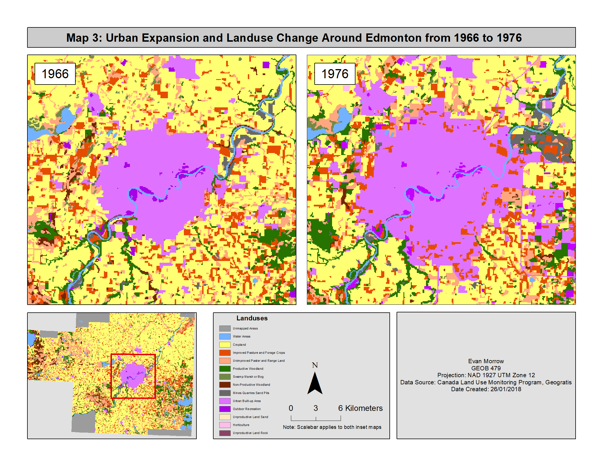
In lab 2: Exploring Fragstats, we performed spatial analysis using the software program Fragstats to visualize and quantify different changes to the landscape around Edmonton Alberta. Fragstats is a software program that helps understand a landscape in a descriptive manner. It does this by calculating metrics for variables such as land use distribution, size, patchiness, edge lengths, patch diversity etc. It can also be used for temporal analysis. In the case of this lab Fragstats was used to look at changes in land use between 1966 and 1976. Using data collected from the Canada Land Use Monitoring Program (CLUMP) figure 1 highlights the changing land uses around the perimeter of Edmonton, AB. As evident in the map, the area became extensively urbanized over the 10-year period. This change primarily occurred due to the conversion of farm land to urban land. This pattern was observed throughout the entire study area as urban areas around smaller settlements and Edmonton sprawled quite drastically. By performing analyses like this it is possible to view patterns of change in the past in order to plan for future urban growth. For instance, perhaps the loss of agricultural land is cause to implement agricultural reserve programs to protect agricultural land from urban encroachment going into the future.