The geography themes include: place, location, human interaction, region, and movement. There are many ways to incorporate geoliteracy themes into the social studies curriculum.
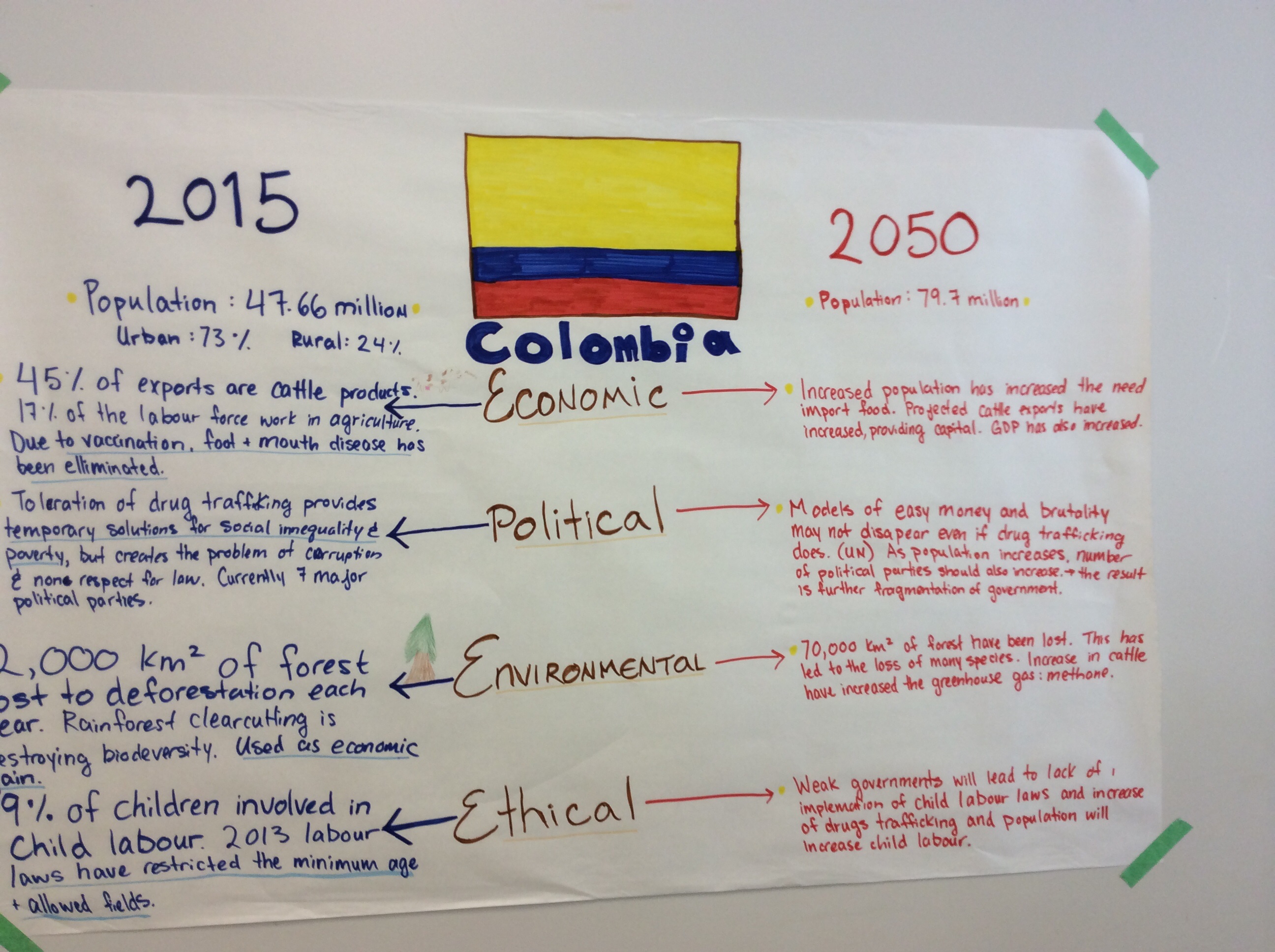
Colombia 2015 to 2050
For this assignment we were looking at four major sections of social studies: economic, political, environmental, and ethical. Population increase is an increasing concern in today’s society. We examined Colombia’s population growth which is growing exponentially and by 2050 will double. This activity assessed geoliteracy skills of place, location, region and human interaction. This represents change of a place over time which is crucial to geography and fits suitably in the social studies curricula. The interconnectedness is key to understanding the global climate of the time in terms of environmental, political and social constructs. The three I’s of geoliteracy are essential here. Firstly, interactions between human to human as well as human to animal and human to land show us the effects that will have on the country of Colombia, in this case. In an increasingly globalized world, these concepts become critical to understanding our overall social studies curricula as well as our place in context of the world, both physically and metaphorically. This represents the interconnections. For Colombia, interconnections are seen through trade of cattle, coffee and other items. Interconnections were displayed within the group dynamic itself, in which we all created a poster displaying the information. Finally, with our predictions of what Colombia will look like in 2050, we are able to access implications – what will the outcome be of Colombia’s population growth over the next 25 years? What impact will this have on the environment? The political climate? The social structures? Geoliteracy brings us closer to understanding these questions and generating solutions.
How exactly does this fit in the new curricula?
Under “Creative Thinking” , the new curricula states that “competency involves the generation of new ideas and concepts that have value to the individual and others”. This assignment relates directly to this new aspect of the curricula because this was a creative thinking assignment in which we generated new ideas (I.e. New projections based on imperial data) to assess Colombia’s population and related aspects in 2050. This also involves critical thinking concepts which is key to geography and historical concepts in social studies.
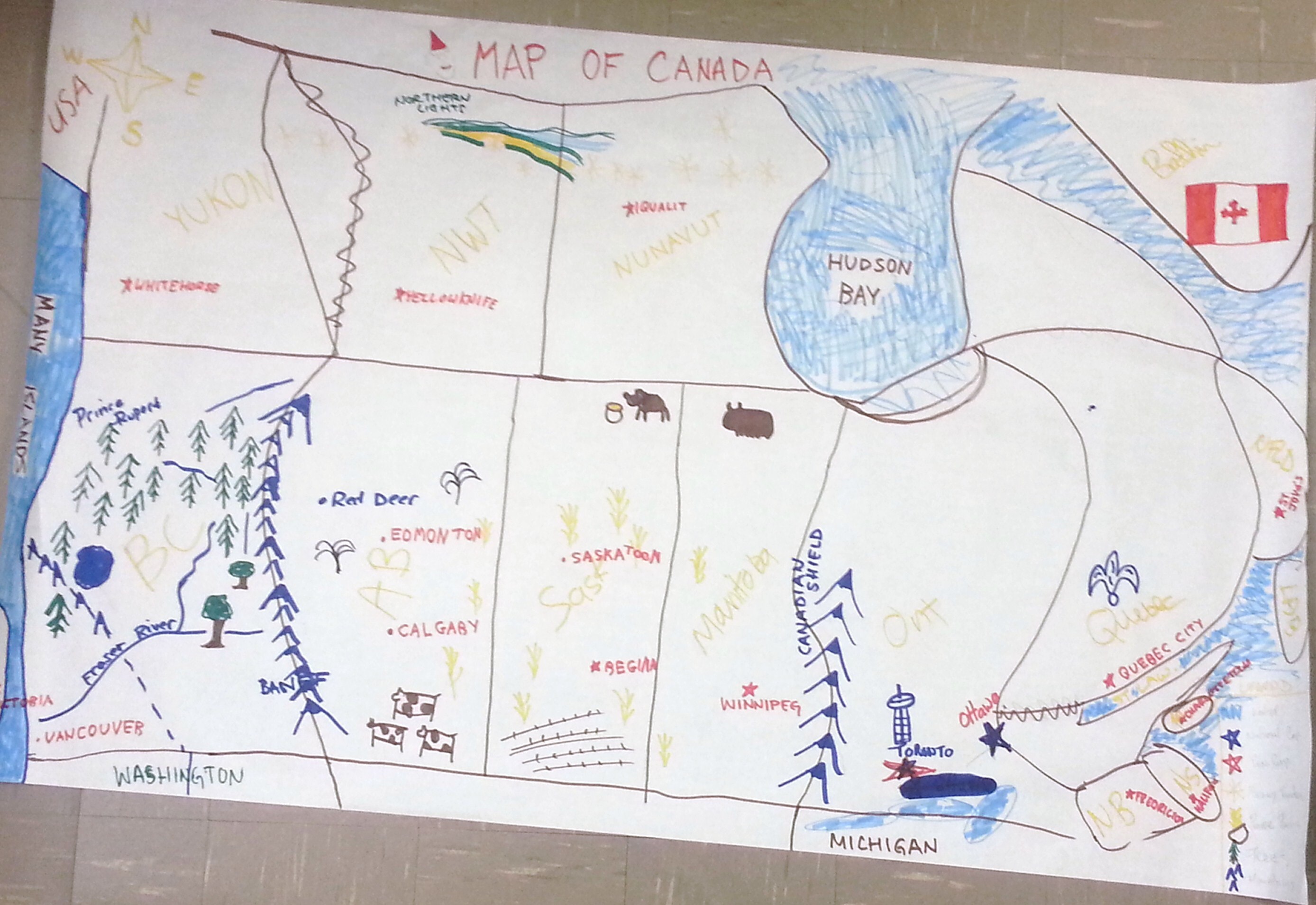
Map of Canada
Assignment – this activity was quite interesting in that it required us for the first mapping part to not communicate verbally. This created a difficult task, but opened new areas of communication and allowed for a very different approach. This would be beneficial for students in social studies from k-12 with certain adaptations if necessary. It was interesting to see how various groups created different looking maps depending on where they started (geoliteracy – location and region). It was also interesting to see the various groups and the ways the geoliteracy movement was shown. For some groups they started the map at the 49th parallel, from others east to west or west to east. It is interesting to note how perception of these geoliteracies also reflected the final product.
How exactly does this fit in the new curricula?
This fits under the creative thinking in the new curricula which explains that creative thinking competency involves the generation of new ideas and concepts that have value to the individual. In this activity we connected with what we thought was important to cover on a map of Canada. This also relates to the personal and social new aspects of the curricula.
Strings
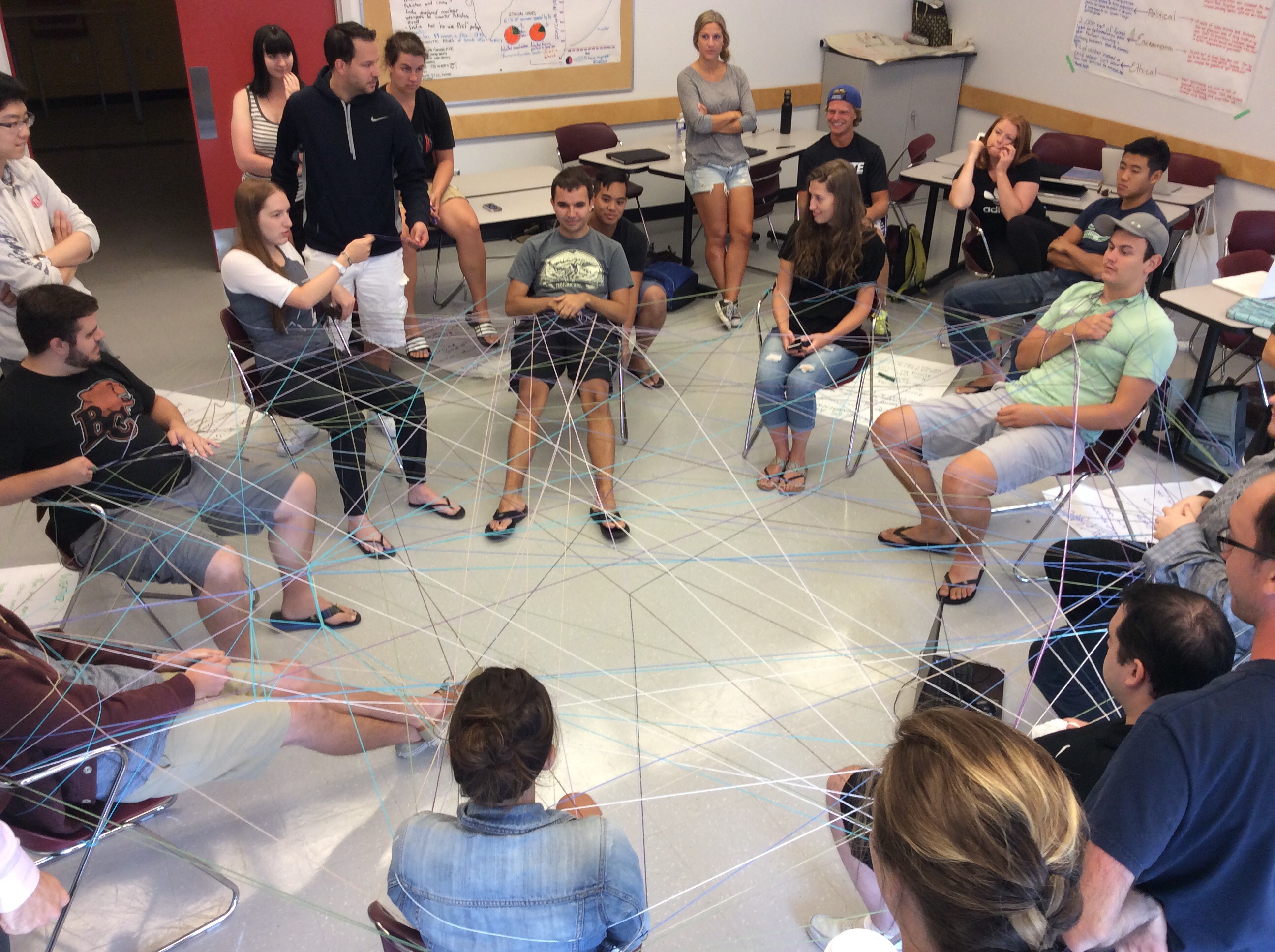
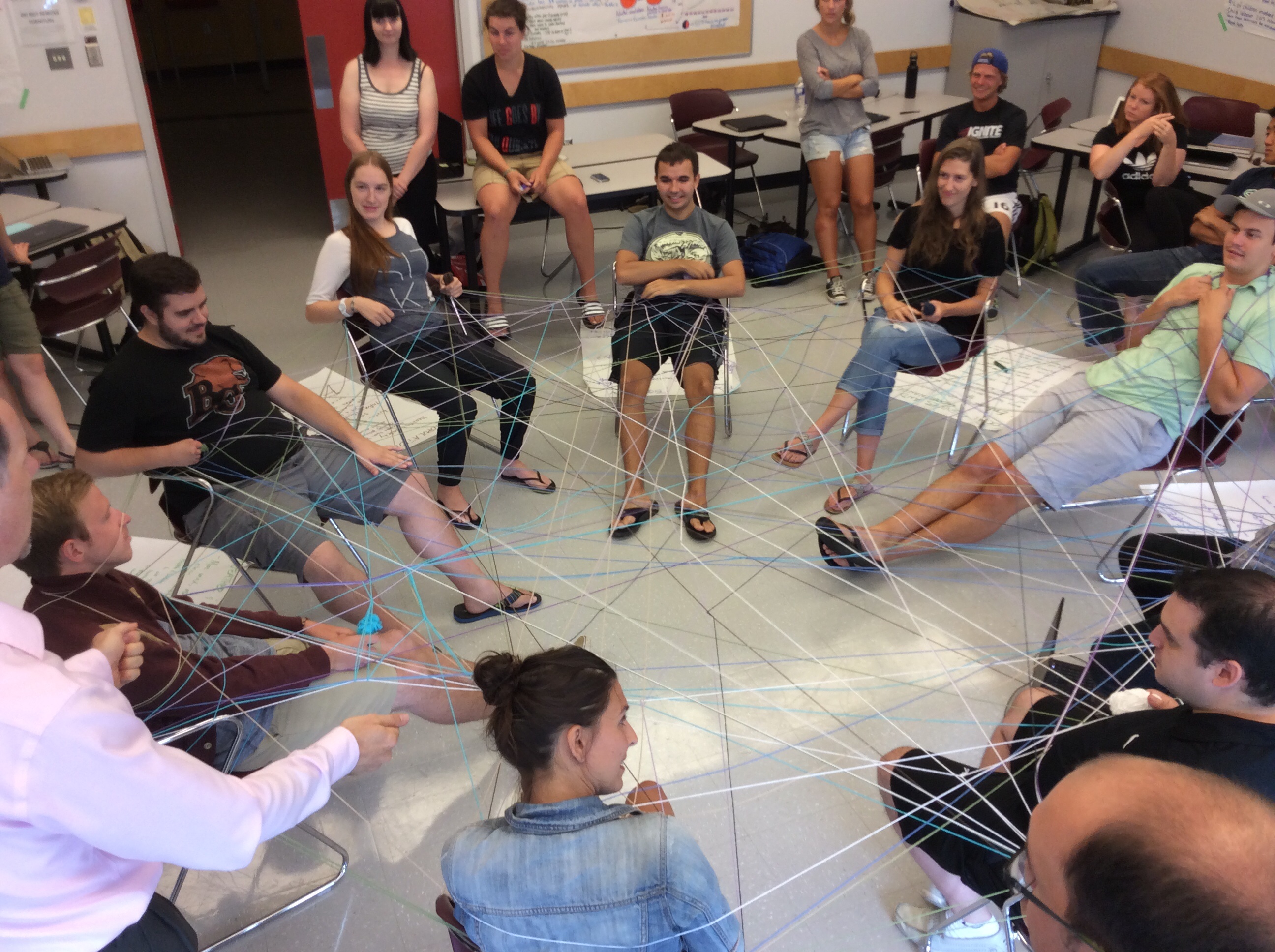
Climate change and global warming have often been referred to as “wicked problems”, that is to say they are problems that there are no immediate or long term solutions. There are so many factors that play a role in the “wicked problem” that is climate change including: economic factors, political factors, social and ethical factors. It is clear what is happening when it comes to climate change but it is unclear the solution to the problem. For example, various parts of the world look at this situation differently and have different solutions in mind. Others will not have this as a priority whatsoever. One thing is for sure, climate change is a scientific truth and the geoliteracies of interconnections, interactions and implications are exemplified through this. We did an excellent activity to show just how wicked this problem can be. All three geoliteracies were exemplified through this activity. Climate change is completely interconnected, and every aspect is interconnected such as: energy consumption and production is interconnected with food shortages and air quality and water scarcity etc.
How exactly does this fit in the new curricula?
This activity definitely involved all aspects of the new curricula. It involved critical thinking aspects, such as making judgements and drawing conclusions towards the interconnections of various topics on climate change. It also involved making many judgements to assess whether or not strings did connect together or not, and how they did. The new curricula states that “critical thinking involves making judgments based on reasoning: students consider options; analyze these using specific criteria; and draw conclusions and make judgments. Critical thinking competency encompasses a set of abilities that students use to examine their own thinking, and that of others, about information that they receive through observation, experience, and various forms of communication.” This activity allowed us to experience negotiation and discussing in a critical matter.
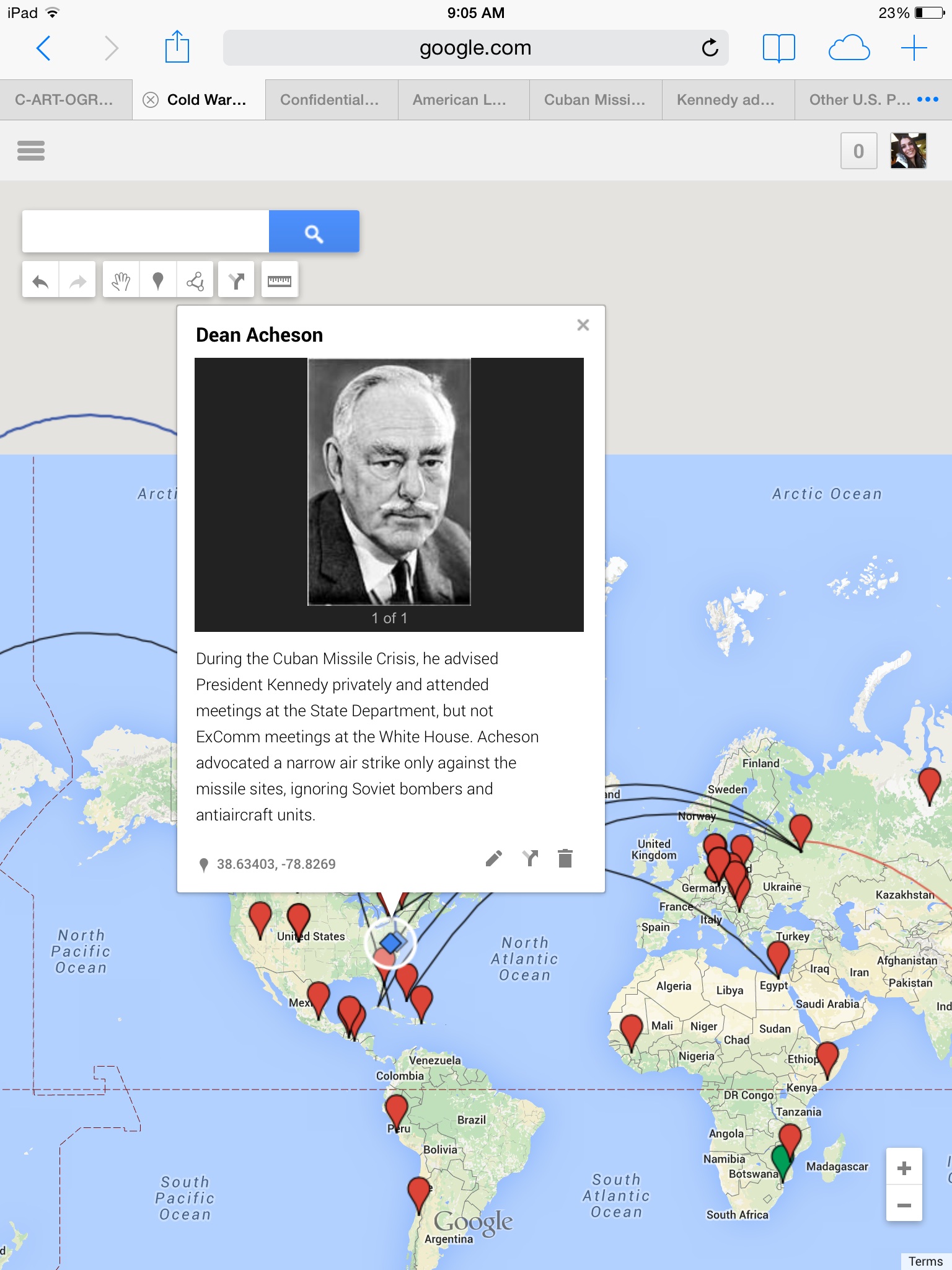
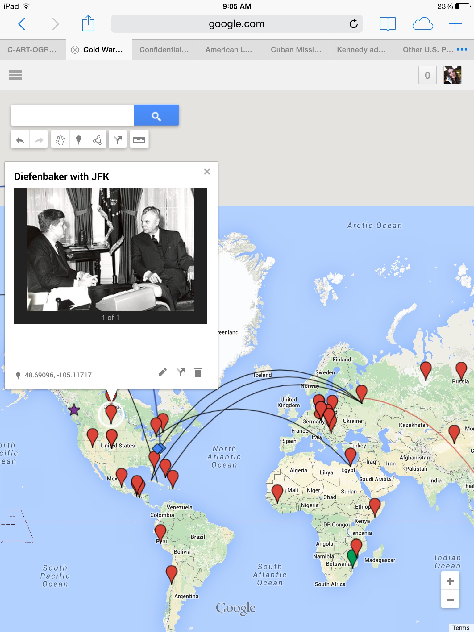
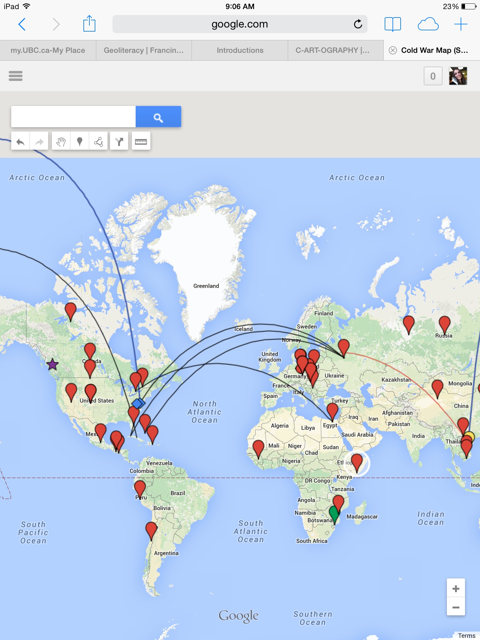
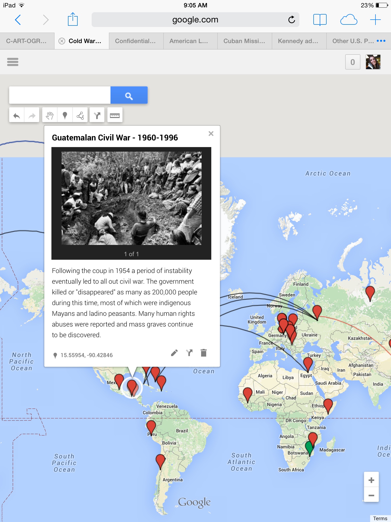
Google Maps
Population Pyramids