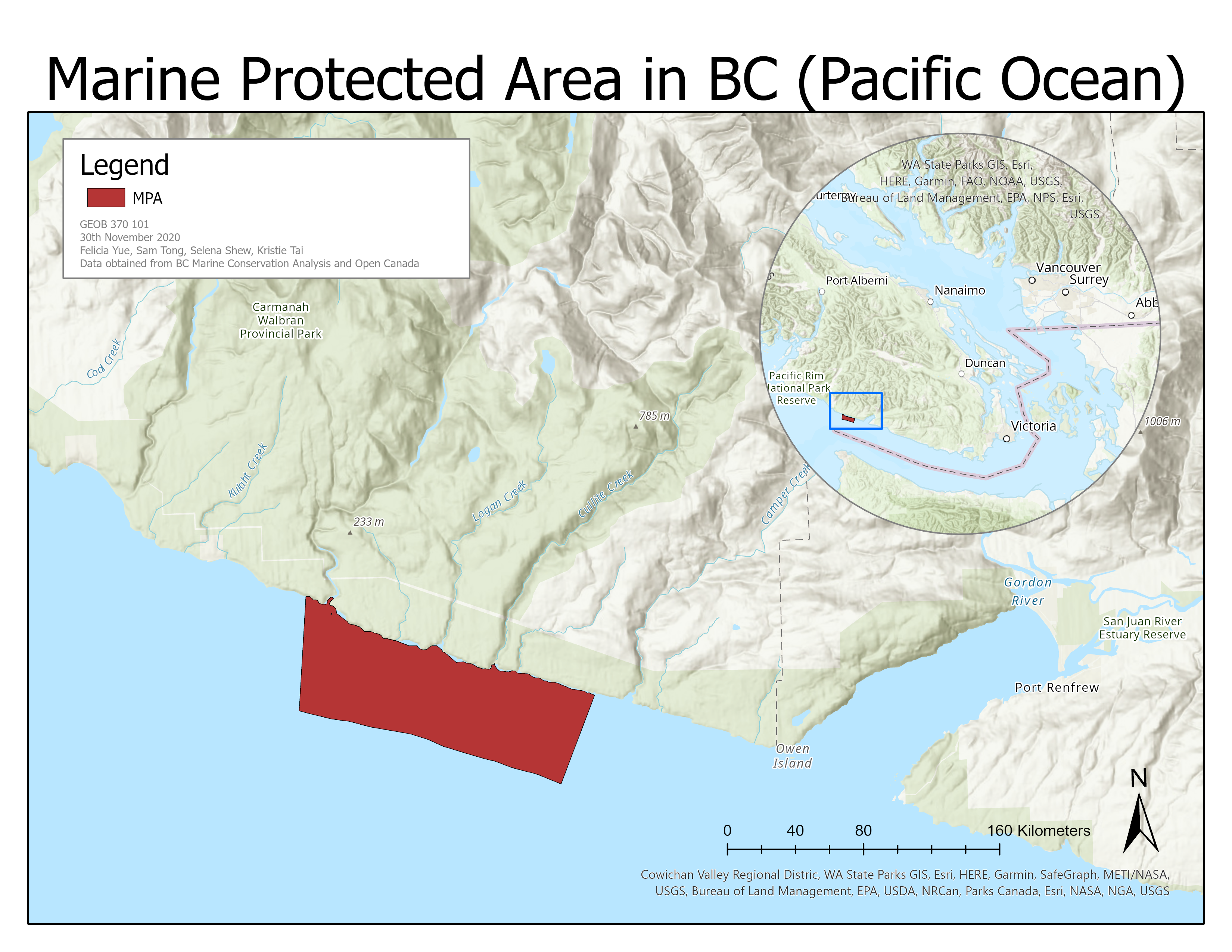
Figure 3. Final proposed Marine Protected Area
[click here or the image to enlarge]
Our MPA is composed of marine mammal distributions, vegetation distribution and biologically important areas. We decided to choose the biggest overlapping area and that area is on the Southern side of Vancouver Island between Carmanah Walbran Provincial Park and Port Renfrew.
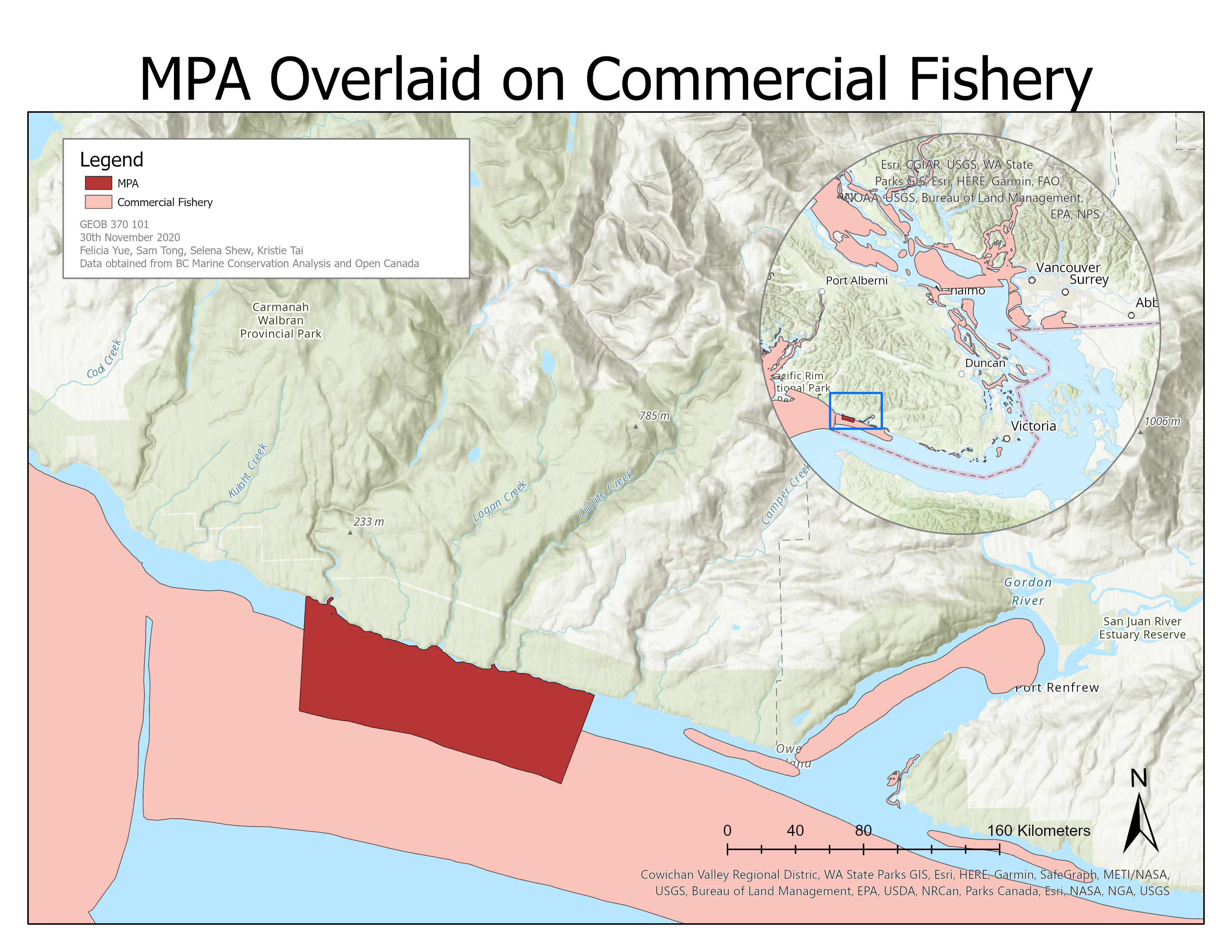
Figure 4. MPA falls within salmon trawling grounds
[click here or the image to enlarge]
From this layout, we decided to overlay the MPA on top of the commercial fishery layer. We found out that our MPA is located on top of the salmon trawling grounds.
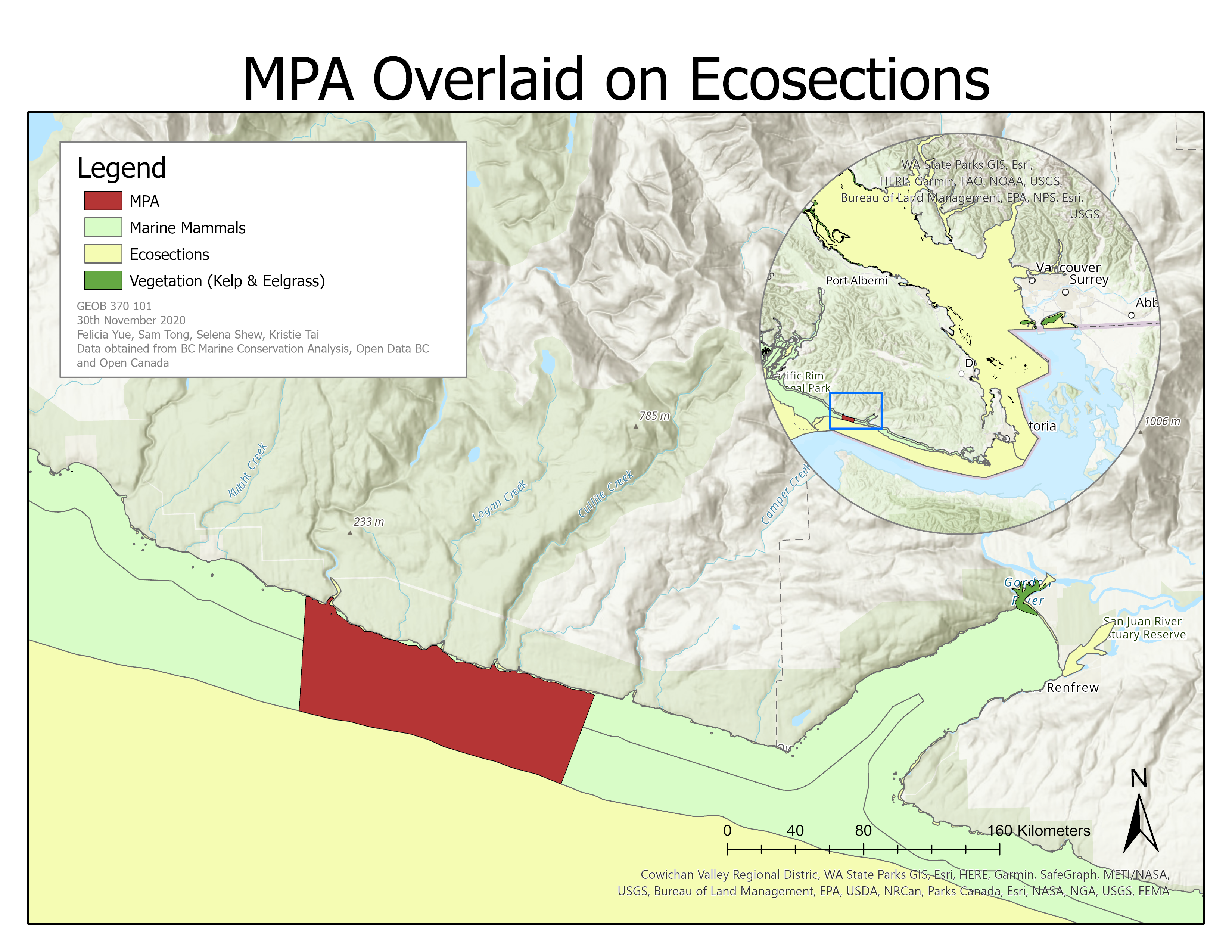
Figure 5. MPA falls within the Juan de Fuca Strait Eco-section
[click here or the image to enlarge]
From this layout, we decided to overlay the MPA on top of the ecosection layer.
The MPA falls with the Juan de Fuca Strait Eco-section and the Scotian Shelf Bioregion.
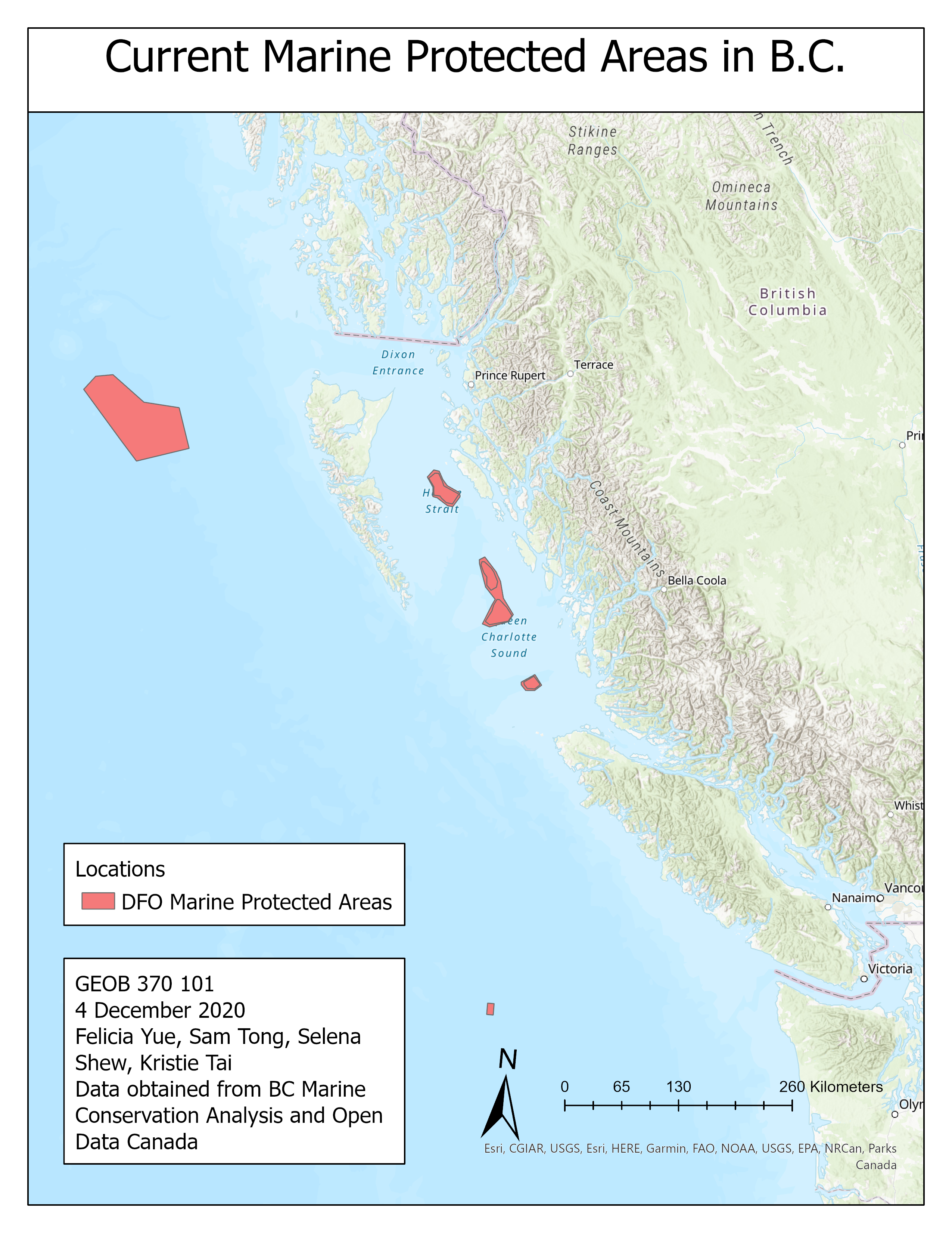
Figure 6. Current Marine Protected Areas in BC
[click here or the image to enlarge]
From this layout, we can see that most of the current marine protected areas in BC are located on the Northern side of Vancouver Island. Since there are no marine protected areas in the Southern side of Vancouver Island, it would be ideal to build one there based on our findings.
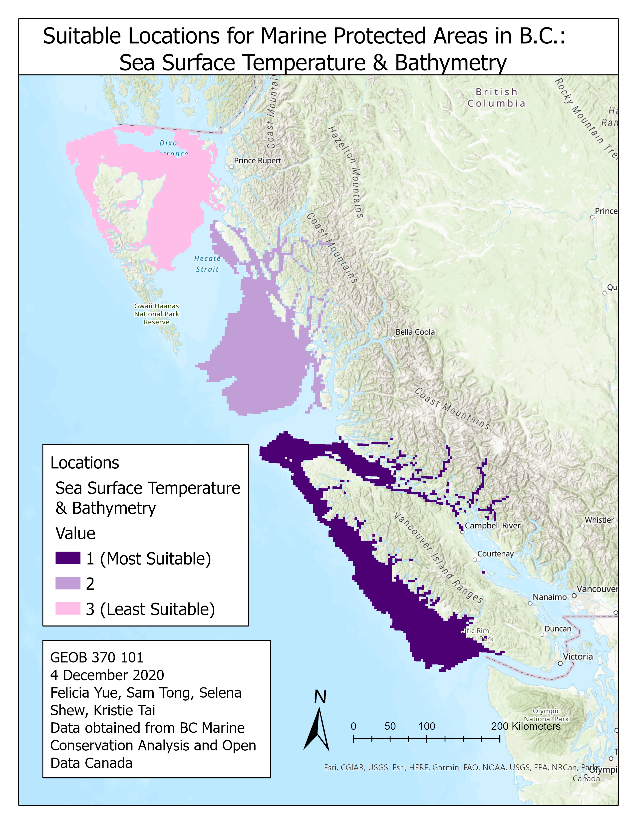
Figure 7. Suitable locations from MCE analysis
[click here or the image to enlarge]
From this layout, we’ve used the suitability modeler to locate the suitable locations for marine protected areas in BC. In the suitability modeler we used the sea surface temp data pulled from Giovanni NASA website and the bathymetry data from BCMCA. As a result, we were able to create this layout of the suitable locations for marine protected areas in BC and labelled them from least suitable to most suitable.
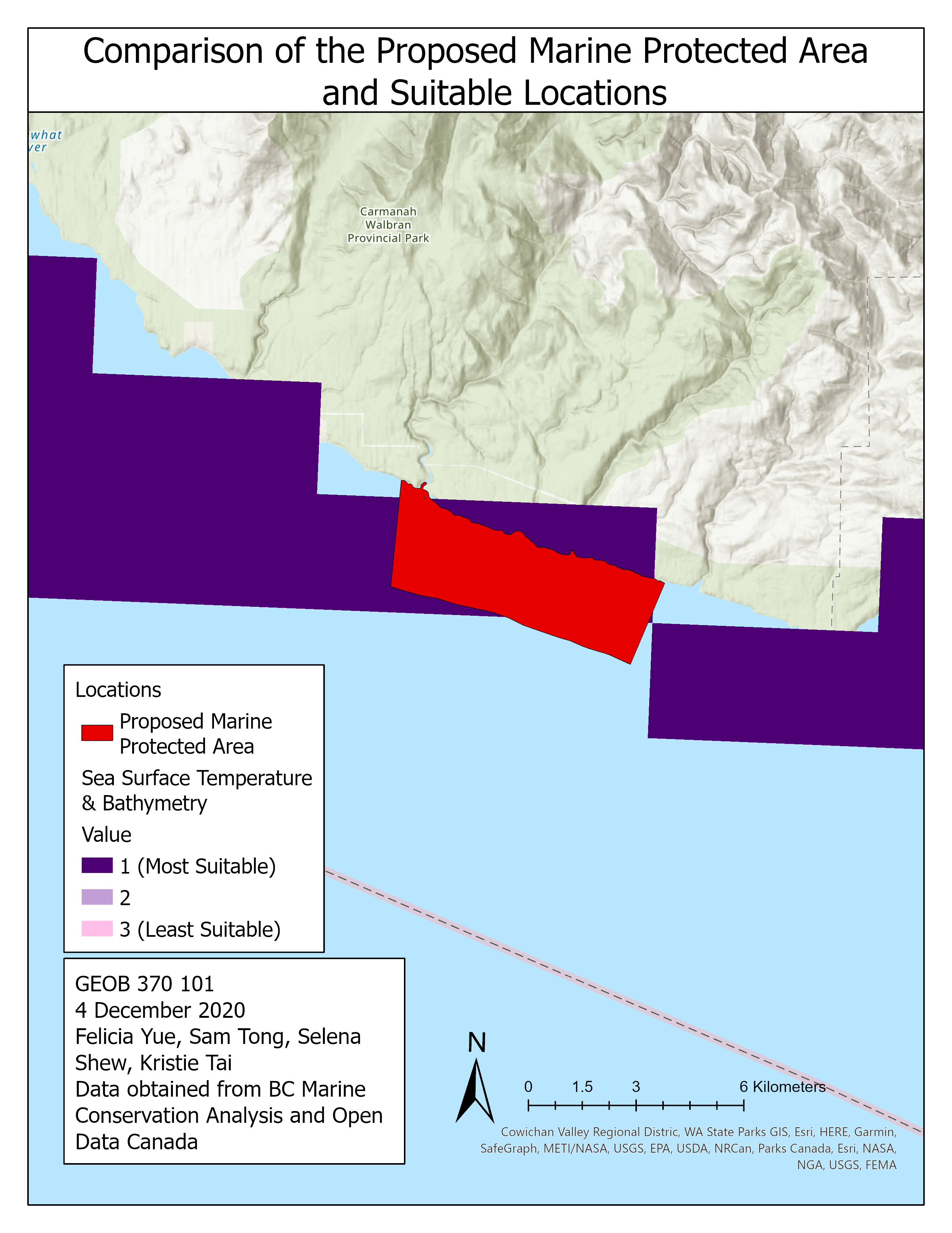
Figure 8. Comparison between proposed MPA and suitable locations
[click here or the image to enlarge]
From this layout, we decided to overlay our MPA on top of our suitable locations for marine protected areas in BC. From this comparison, we can see that our final location is overlaid on top of the most suitable area.
Dimensions of the layout
Our layout is based on the Projected Coordinate System, NAD 1983 BC Environment Albers. The perimeter is 21,668.88 meters and the area covered is 17,816,952.45 meters squared.
Continue to our discussion.