Learning objectives
This post is about topics explored in the final GIS laboratory session, which had the following learning objectives:
- Identify, manage, and manipulate data sets appropriate for GIS analysis;
- Conduct GIS analyses that demonstrate mastery of GIS concepts and software;
- Design and implement a project approach;
- Build teamwork skills;
- Produce maps, flowcharts and work logs, and a detailed report describing your analysis.
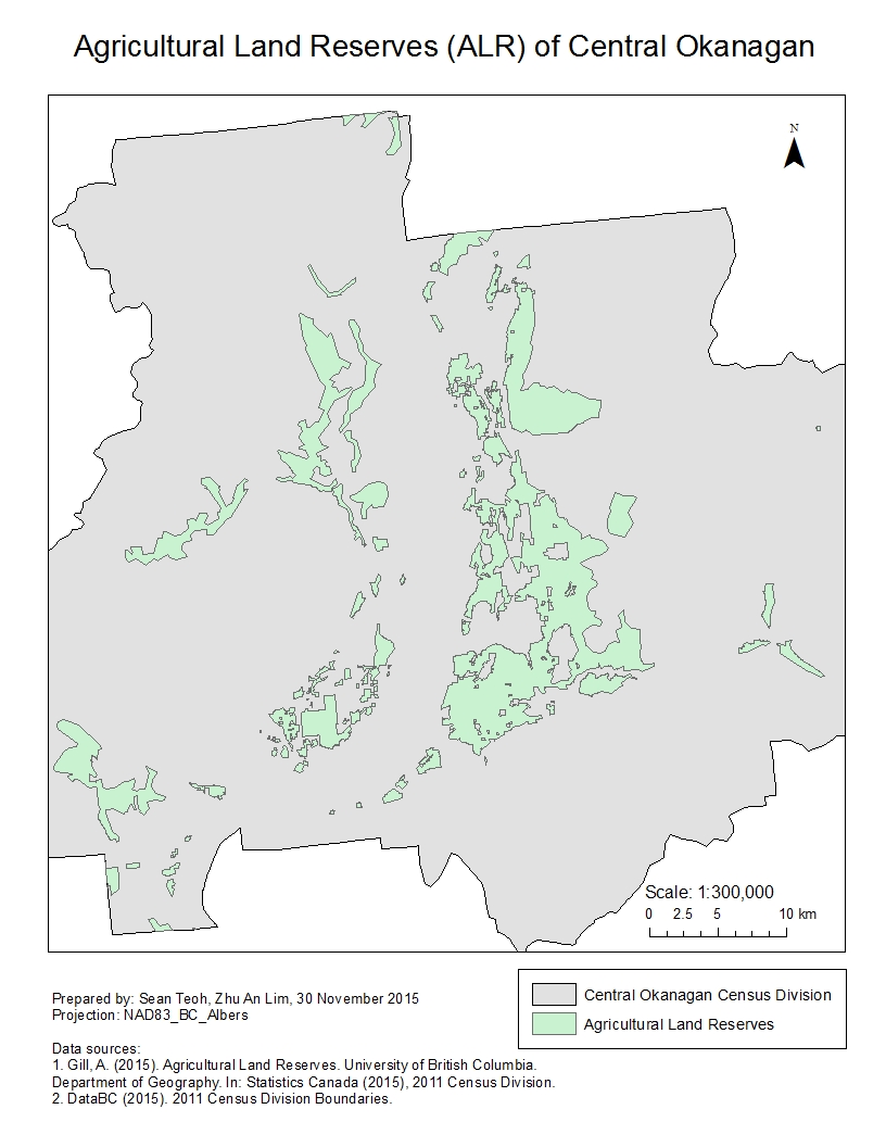
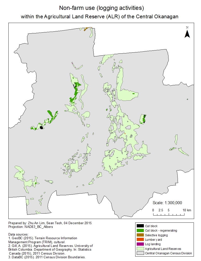
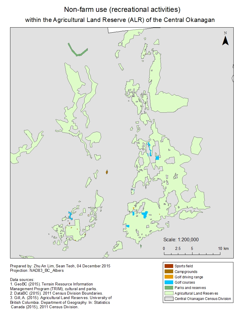
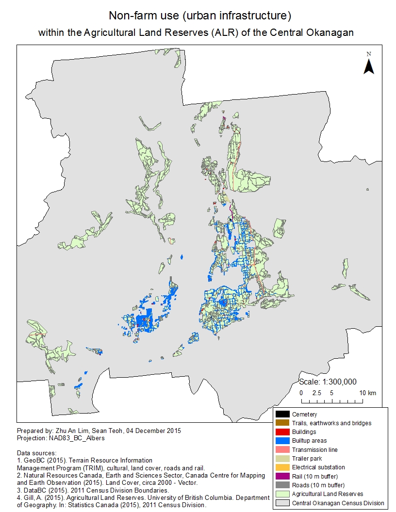
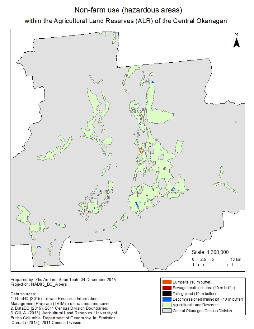
Agricultural Land Reserves of the Central Okanagan, British Columbia
Project goal and report
In the final lab of my GIS module, GEOB 270, I was tasked to analyze the Agricultural Land Reserves (ALR) in Central Okanagan, British Columbia (B.C.). This project was to be completed together with my team, which consisted of Zhu An Lim, MacKenzie Baxter, Ron Blutrich and I.
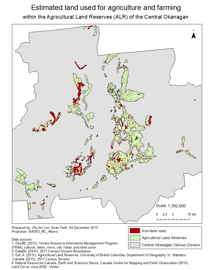
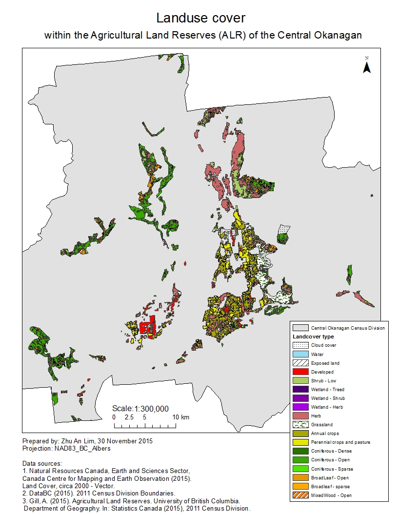
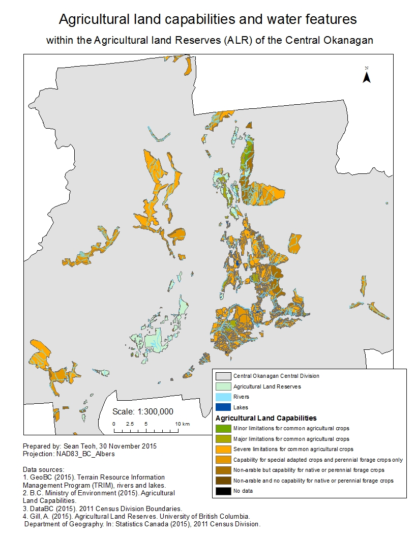
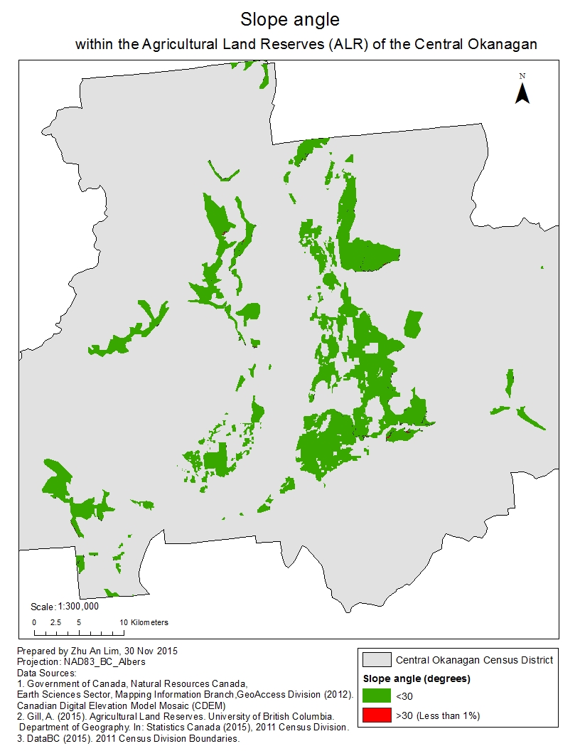
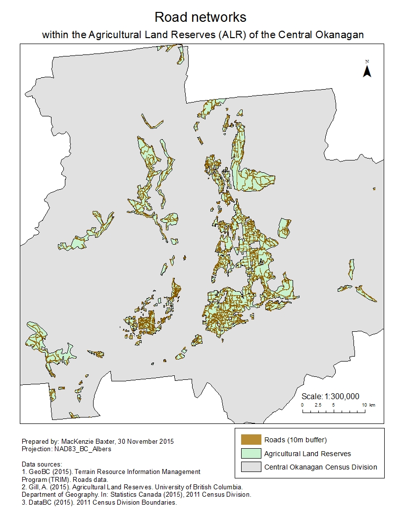
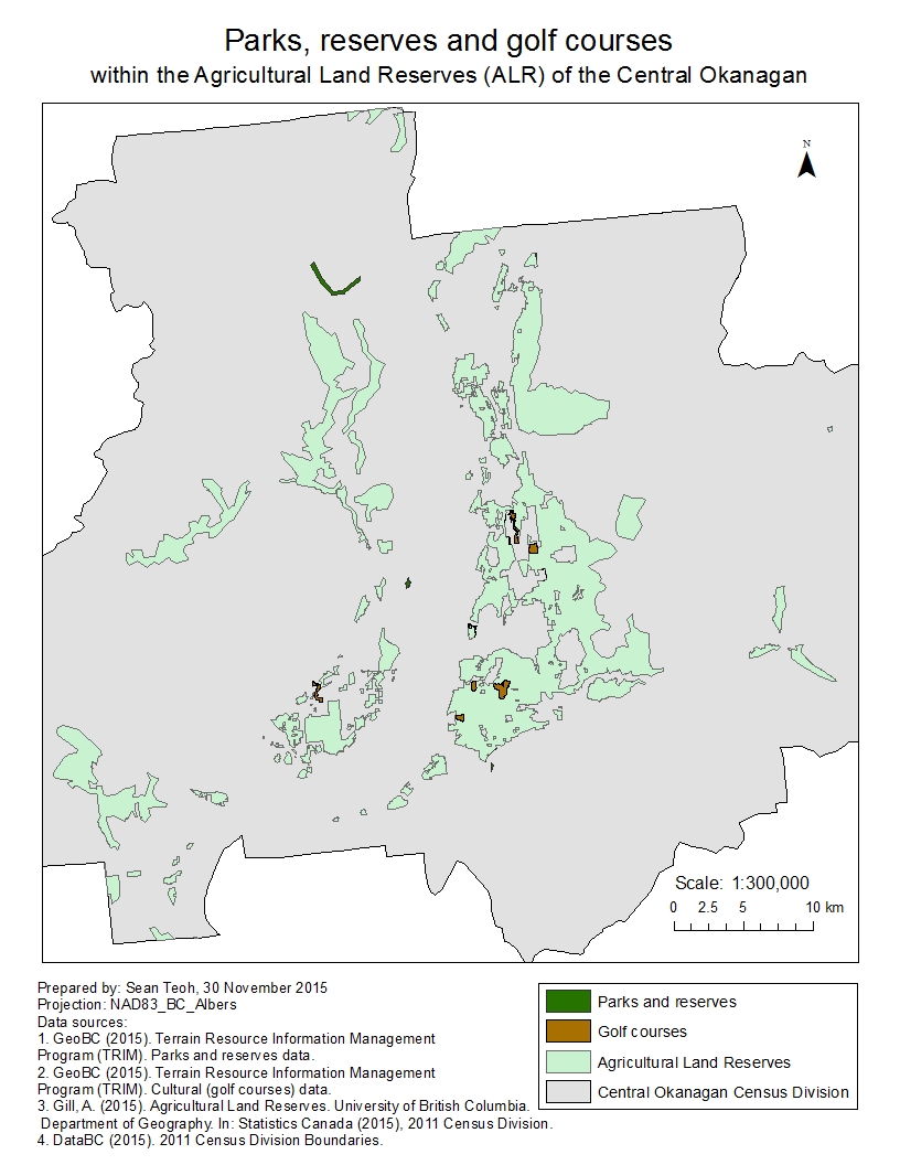
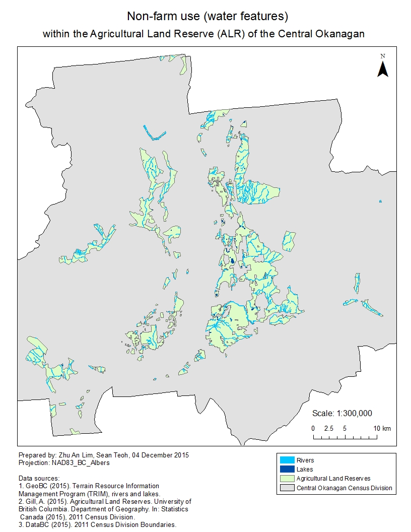
Agriculture contributes significantly to the regional economy of British Columbia. As the ALR consists of land reserved for agricultural production under B.C. law, it is thus vital for maintaining or improving the state of agriculture in B.C. Although estimates of the total area of ALR have previously been made, these numbers may contain errors due to the lack of consideration for various non-agricultural use of land within the ALR. This results in inaccuracies in terms of the actual usable areas for agricultural production within the ALR. My team was tasked to improve estimates of ALR land through GIS analysis, through the exclusion of non-agricultural use of ALR land. To do this, datasets were obtained from various government and academic databases.
The final project report and maps can be downloaded here:
Project management
As the coordinator of my team, I split the project into three phases: data collection, analysis, and report-writing. Each of my team members (including myself) would have to search for datasets from specific databases that we thought would contain the data that we needed. For example, Zhu An would search Statistics Canada, Ron would search for TRIM data, MacKenzie would search DataBC, and I would search for other sources of data. Our project required the production of 8 different maps, thus I assigned maps to each person to work on for the analysis. Once all maps were produced, those who did a lesser number of maps during analysis would work on a greater number of sections on the report. Finally, I would edit the whole report to ensure that formatting is properly done and all sections flow and corroborate with one another.
Contributions and acknowledgements
Some my most valuable contributions for the project were to:
- Work on a large proportion of the analysis;
- Standardize the maps that were created;
- Manage the data and analyzed files on Google Drive;
- Edit the entire report.
I did about half of the analysis required for Biogeographical and Social, some in collaboration with Zhu An and MacKenzie, and worked with Zhu An to complete the analysis for Overview and Summary. I also standardized the maps that were created. Ron and MacKenzie wrote most of the report, and as the coordinator of the project I eventually edited the entire report and worked on filling in missing information in the different sections. Finally, Zhu An created most of the flowchart of the analyses for the report, which I also chipped in for some areas.
I wish to express my sincere thanks to Zhu An for working side-by-side with me for most of the analysis and flowchart, and Ron and MacKenzie for writing most of the report.
Learning points
Some of the interesting things that I’ve learnt through this project are:
- In terms of the ALR. although legally protected by B.C. law for agricultural use of land, it is actually possible to do land swaps (i.e. trading non-ALR land for ALR land) as long as approval is sought from the Government of B.C. Inevitably, this would affect the soil quality of the ALR as it is likely that ALR land that is highly suitable for agricultural production would be swapped for low quality non-ALR land.
- In terms of GIS techniques, an interesting GIS analysis technique that I encountered in this project is the “Erase” tool, which allows the GIS analyst to erase parts of a layer that intersects with the spatial features of another layer. It was certainly handy when I had to remove non-agricultural use of ALR land from the original shapefile.
- In terms of project management, the stark reality that hit me is that team members often have other commitments, be it in school or in the workplace. Not everyone would be available to work on the project at the same time that I am, therefore communication and forward planning is most important to ensure that there is progression for the project. Without a team leader, nothing would get done because everyone will place their other priorities ahead of the project until the project is close to the deadline.
- In terms of data management, I learnt first-hand the importance of having a naming convention for the different shapefiles that were produced during the analysis. Some of the shapefiles produced by my team members were not named properly and I did not know what tools were used to arrive at that shapefile. This increased the amount of work as I had to go back to my team members and check with them the steps they took.
- In terms of publicly available data, I learnt that their quality is usually not as fantastic as data that needs to be purchased. We downloaded data from a variety of online sources that were free. However, when compared to data from the Terrain Resource Information Management (TRIM) Program, these publicly available data could not match the quality of the data from the TRIM Program. In the end, most of the data that we used for the analysis was TRIM data, which we would need to pay for if we were not UBC students or staff.