
The Hotspot analysis identifies the propensity for Northern Goshawk habitat to be located away from high population centres and concentrated to low population centres. The generalized linear regression combines the variables of Population, road infrastructure, and forestry cut-block locations, to determine spatial correlation.
GLR Map Analysis
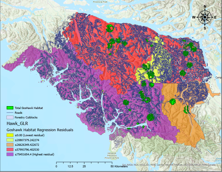 This GLR map is concentrated in the Courtenay / Campbell River area where the highest concentration of Goshawk habitat is located in the lower mainland and Island.
The GLR models the distribution of Goshawk habitats and the resulting residuals display areas that contain a higher or lower concentration of habitat than what was predicted by the regression model. The area of study had to be minimized because the number of data points exceeded the limit of the modelling tool in ArcPro. the boundaries of the study area were chosen to make use of the high concentration of Goshawk habitat in the area. Because of the high concentration, the model calculated high residuals in the area, exceeding the expected number of habitats as modelled by the GLR.
This study also conducted a spacial auto correlation analysis that reported a z-score of 0.683785, which implies a low clustering or correlation between the chosen variables and the Goshawk habitat; this is a result of the small study area. Although the spatial auto correlation analysis didn’t provide definitive results, the GLR and it’s residuals still offer information that can be comparatively analyzed to derive some sense of the spatial correlation of the Goshawk habitats:
Human Population Reference
 This map to the same extent of the GLR map shows the population distribution in the area