Increasing timber harvest output while enhancing other ecosystem services is one of the greatest challenges in forest management. Another question for this project is to truly define what is sustainable timber harvesting. We have discovered a number of concerns related to this project. The major factors of concern were the Recreational Areas (parks and hiking trails), Wildlife Habitat, Watershed Protection and Old Growth Trees.
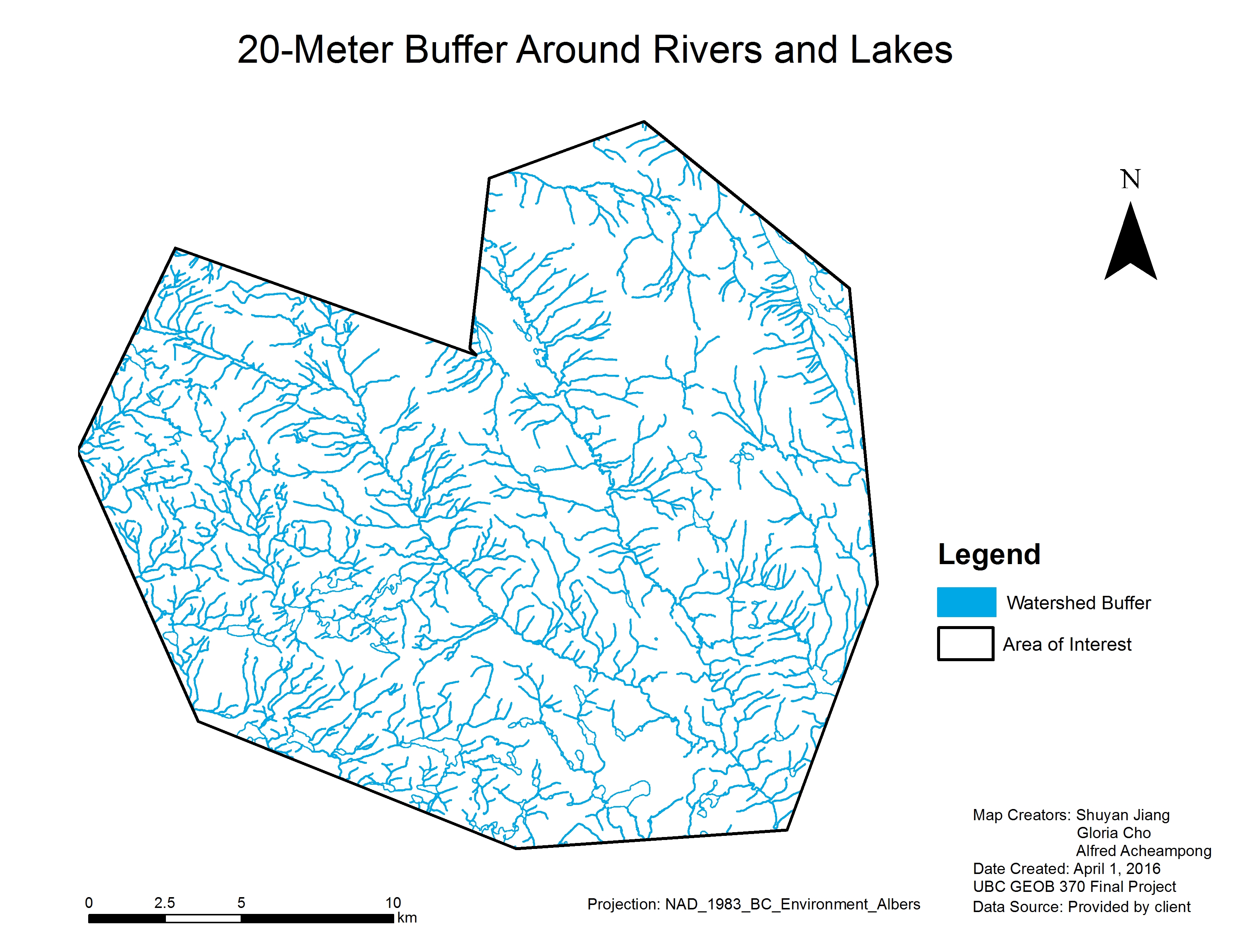
Watershed Protection: Forest plays a crucial role in purifying water and the strengthening stream banks to support high energy flow. Poor timber harvesting practices such as logging near water bodies can adversely affect the hydrology of the watershed by increasing peaks flows during storm events and raising sediment input from upland slopes. Beside, riparian habitat, which is vital to many amphibians and waterfowls. Therefore one of our major concerns was to protect streams and rivers in the harvesting area. 20 -meter Riparian buffers were made around all lakes and streams (Map 2) to minimize the harvesting impacts on watersheds.
Map 2. 20 -meter Buffer around rivers and lakes
Wildlife Habitat Protection: Forests provide unique habitats for many wildlife such as mule deer and caribou. Forest timber harvesting and other forest management activities are major causes of reduced wildlife habitat. For the purpose of protecting important wildlife habitats (e.g. mountain caribou winter range), harvesting activities would be prohibit in those areas.
Old Growth Protection: Old forests contain many unique habitat and ecosystem characteristics that are developed over a very long period which are not readily replaceable by second growth forests. These old forests form a slowly changing ecosystem that represents climatic vegetation communities. Structural diversity and habitat features found in Old Growth forests provide unique habitats required by many species which are difficult to recover upon loss.
Recreational Areas: We considered parks and hiking trails for recreation management. Parks will be excluded from our harvestable land base. A 5-meter buffer will be applied to each side of the hiking trails, mainly to maintain the visual quality and aesthetic values.
Map 3. Timber Harvestable Land Base (THLB)
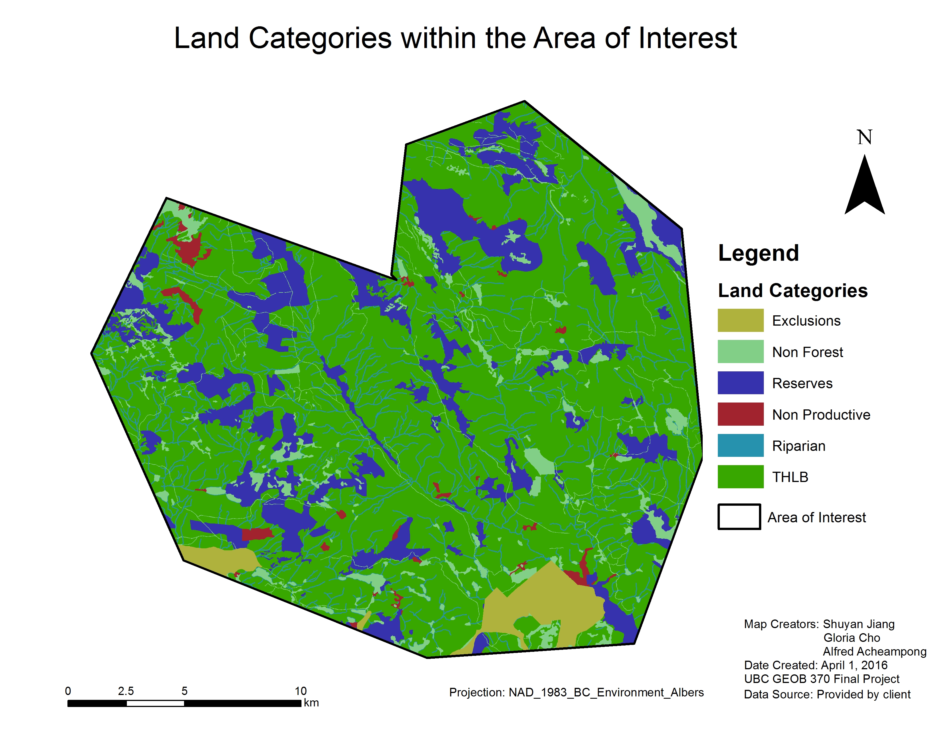
Map 3 show the Timber Harvestable Land Base (THLB, green area in the map) after excluded after all the concerned areas. I.e. Land category ‘Reserve’ represents old growth (Old Growth Management Areas according (OGMA) established under Forest and Range Practices Act (FRPA)); Land category ‘Riparian’ represents 20-meter buffer zone around lakes and rivers (due to the size limitation, you may not see this category in the map). Besides, after overlapping data layers with our AOI, NO SIGNIFICANT area for wildlife habitat and recreation was found in our management unit. the total THLB here is 29291.5 ha.
Further management (criteria application) would be based on the THLB area.