
Research goal: Identify potential connectivity corridors linking key areas of suitable habitat for Grey Wolves on Northern Vancouver Island.
Background: Vancouver Island Wolves are a subspecies of Grey Wolf that are endemic to Northern Vancouver Island. With an estimated 180-440 individuals remaining (FLNRORD, 2014), the VI wolf is considered an endangered species (UVIC). VI wolves preferentially prey on black-tailed deer and Roosevelt elk (FLNRORD, 2014); both species have healthy populations on Vancouver Island (Quayle & Brunt, 2003; Reid, 2003). Though the high availability of prey on Vancouver Island permits VI wolves to live at a higher density than their mainland cousins (up to 14 individuals per square km), wolves still require relatively large areas of habitat to accommodate the territoriality of other packs and to avoid drawing down prey populations in one place (UVIC).
Since VI wolf prey (deer and elk) require tree cover for survival, the distribution of VI wolves is restricted to forested and semi-forested areas. As a result VI wolves are particularly vulnerable to habitat fragmentation, a prevalent issue on Vancouver Island. Already extirpated by urbanization and agriculture on the Southern half of the island, VI wolves have been pushed to the more remote Northern half and West coast. Evidence suggests that clearcut logging poses the greatest threat to the survival of wolf populations in the Pacific Northwest due to the industry’s negative impact on deer and elk carrying capacity (Reid, 2003); unfortunately, logging is prevalent even in the remote areas of Vancouver Island where wolves remain, destroying and fragmenting the forests that wolves and their prey rely upon (Reid, 2003). Furthermore, as the population of VI wolves declines and habitat becomes more fragmented, genetic transfer between separate packs may decrease; the resulting inbreeding further endangers the survival of the VI wolf (UVIC). The loss of wolves from Vancouver Island could contribute to runaway populations of deer, the browsing behaviour of which could fundamentally alter the structure of ecosystems (UVIC). Furthermore, as an endemic species, the protection of the VI wolf is essential to avoid its extinction from the wild.
Ensuring that connectivity corridors between areas of suitable VI wolf habitat are protected is essential in ensuring that VI wolves are able to move freely across the landscape. Connectivity improves access to prey, while also decreasing the genetic isolation of individual packs. Ultimately this would increase the resiliency of the VI wolf to any further habitat loss and/or environmental changes. For our project, we aimed to identify key connectivity corridors linking key areas of suitable habitat for Vancouver Island Wolves.
Process and Data Inclusion/Exclusion Reasoning: Since the VI wolf lives in remote forested areas, there is no even remotely detailed distribution data available for the species. Only extremely vague general range information was available (Fig. 1). This is not a problem that is unique to our study region, rather it is a universal challenge in studies requiring wolf distribution data. The resulting standard to resolve this issue is to, in lieu of field data, create a raster that illustrates habitat suitability for the main prey species (black-tailed deer and Roosevelt elk)(Cleland, 2013; Darimont & Paquet, 2000) within a known general range (Fig. 1). In the creation of this model we considered the factors used by Raincoast Conservation Society in their study that identified suitable winter deer range along the central BC coast (Reid, 2003); we adjusted these factors to also reflect the winter habitat requirements for Roosevelt Elk (Quayle & Brunt, 2003). These factors included: elevation, slope, and forest stand age/species/volume. We chose to model the winter range of prey species because they are more limited than summer range conditions. This ultimately helped us identify corridors for the times of year that survival is more challenging for wolf packs.
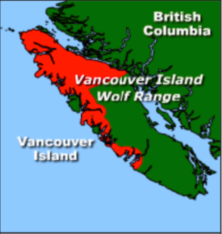
Figure 1. General range for the Vancouver Island Wolf (UVIC).
We considered the following factors in our creation of a model illustrating suitable wolf habitat:
- The prey suitability raster because wolves preferentially hunt deer and elk (they only hunt smaller prey when necessary).
- Active forest service road density- wolves prefer densities of <0.45-km/km2 (Darimont & Paquet, 2000) and are not found in areas with densities of 0.62 km/km2 or greater (Cleland, 2013). Additionally, it was assumed that areas with higher FSR density experienced more logging and therefore more habitat destruction/fragmentation.
- Main roads were buffered by 250 m and avoided completely except when absolutely necessary (based on a study of human interaction with Finnish wolves (Kaartinen, Kojola, & Colpaert, 2005).
- Municipalities were buffered by 1000 m and avoided in all cases (Kaartinen, Kojola, & Colpaert, 2005).
- Wetlands – wolves use these areas for hunting when other prey sources are unavailable (eg. hunt beavers) (UVIC).
We did not consider:
- Distance to water sources because water is extremely plentiful on Vancouver Island.
Following the creation of our wolf habitat suitability model, core areas of ideal habitat were identified, between which we identified potential corridors that could be used by the VI wolf. Please see the methods section for more details regarding this process.