
To identify the expected core habitat areas of the Vancouver Island wolf based off of our suitability raster, we used the ‘Locate Regions’ tool. We set the minimum area size to 120 square miles (310.8km2), as suggested by TUFTS University (Cleland, 2013). We set the region shape to ‘ROUND’, as areas with lower circumference to surface area ratios (more round areas) are safer and more effective core areas in conservation (Naro-Maciel et al., 2009). As the ‘Linkage Mapper’ tool works best with 10 or fewer core areas, we set the number of regions to 10. Of the 10 regions that were located, we manually removed two in the south-east (Figure 4), as the only available map of the wolf’s range (Figure 1) does not include this section of the island. We converted the remaining 8 regions to polygons – using editing tools to merge polygons, as some became disconnected after the conversion – and exported the data as a shapefile.
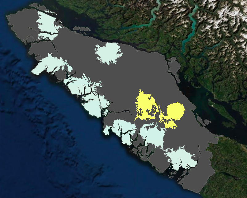
Figure 4. The ten regions located from the ‘Locate Regions’ tool. Those (8) found within the wolf’s range (see Figure 1) coloured in light blue, those discarded (2) coloured in yellow. Project area in grey.