
The main prey of the Vancouver Island wolf is the Columbian black-tailed deer, as well as Roosevelt elk. The density distribution of the species’ prey is an important factor to assess wolf habitat suitability. As no data could be found describing the prey’s density distribution within our project area, we had to create a winter habitat capability raster based on factors affecting prey distribution, which we could then use later on in the wolf suitability analysis.
According to McCrory et al. (in press), both prey types inhabit very similar ranges, and the factors found in their winter range are as follows:
- Elevation between 0-600m
- Slope less than 40 degrees
- Western-hemlock dominated forests
- Forest/stand volume between 150-850m3/h
- Forest/stand age of 120 years and older
Factors c, d, and e were found in the same Forest Vegetation Composite layer, so three new layers were created based on the selection of the above specified attributes. As these layers were vectors, they had to be converted to raster. Then, each of the five layers were reclassified with new Boolean values of 0 or 1, with 1 given to the values which consisted with the prey’s range as outlined above, and 0 given to all other ranges (including NoData values). Each layer was then trimmed to the project boundary.
A weighted overlay was conducted to create the prey winter range capability raster. Using the ‘Weighted Overlay’ tool, each factor was given an equal weight, as the literature had identified no specific preferences. This produced a raster layer with prey capability ranging from a value of 1 (least capable, red) to 6 (most capable, blue) (Figure 2).
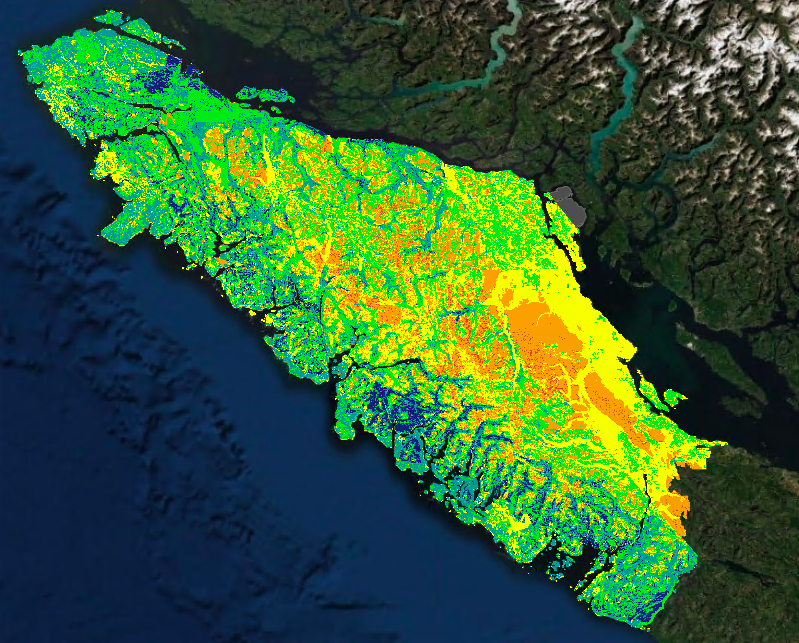
Figure 2. Prey winter habitat capability raster, with warmer colours indicating less-suitable areas and cooler colours indicating more favourable areas for Columbian black-tailed deer and Roosevelt elk.