Monthly Archives: April 2016

My Personal Statement

Instructions given by instructor: 
Think about your friends and family and potential employers as your audience for this statement. Submit the statement by putting it on the homepage of the eportfolio you’ve created for this course.
To create your Personal Statement, you may want to consider some or all of the following questions:

  • In what circumstances and under what conditions do you learn best?
  • What did you learn about yourself when working as part of a team in this course?
  • What is one thing that surprised you about GIS/what you learned in this course?
  • What have been the proudest highlights of your learning in Geography 270? What are your main disappointments?
  • If a friend asked you what you learned in Geography 270, what are 2 things you would say?
  • If someone asked you why you were studying Geography, and specifically GIS, what would you say?

Your Personal Statement could be useful to you in professional contexts in the future, such as:

  • As a way to introduce yourself at a networking event (like a GSA networking event, a professional association event you might attend, or at a work gathering for a future job)—this kind of statement can also be called an “Elevator Pitch”
  • As a summary statement at the start of your resume or in a cover letter

As part of an answer to a common interview question: “Tell me about yourself.”

Personal Statement:

Learning how to utilize a program like ArcGIS provides the user with new reaches of freedom in terms of how to study data and learn the most one can from the use of maps. The small achievements one experiences as they undergo trial-and-error with this program are why seeing the final map brings such satisfaction and the ability to represent information in a more visual way is another powerful tool in one’s belt.

Our Final Project: What I’ve learned

Individual submission re: Experience with final project

Find attached: Our final project
GEOB270 FINAL final export

  1. Summarize the project:  your team’s project proposal and goal?

The goal of our team’s project was focused on using GIS maps to display the trends in wildfire across time (the last century) in BC due to climate change factors. Our project proposal included the above as well as plans to observe a few other facets of wildfire in BC, including risk to conservation areas, and the relationship between fires and human presence and access. We also proposed to investigate the spending by government on wildfire management every year, to take an economic look at the issue.

  1. How did you organize your team (project management)?

One of group members volunteered to construct a plan of how we hoped to divvy up the workload for this project. She came back to us with a list and breakdown of each section of our report and who would do them based on everyone’s strengths and weaknesses. We then discussed as a group whether there were any duties we would rather do or not as they were currently assigned, but worked very efficiently as a group and ultimately felt that everyone had a fair share of the report and would do the best on the sections they were assigned. From here on in, we worked more as a group than someone taking the leadership role, constantly checking in and discussing which maps we were finding the most difficult or easy, and anything any member wanted to add or tweak slightly was discussed first with the group. This may have been the most effective and diplomatic group I’ve worked with this year at UBC!

  1. What are some interesting things you learned as a result of the process? For example:
    1. Some facts about the project?
    2. Some interesting GIS analysis techniques?
    3. Some facts about teamwork / project management approaches and techniques?
    4. Some issues or tips around data management on a team?
    5. Some issues around publicly available data and proprietary data?

In terms of what I learned while completing this project, I learned a lot more than I expected too regarding wildfires in BC. As I’m studying conservation, a lot of classes include basic information about wildfires—however, working with the data and seeing it represented on a map that I have control over taught me many more details about wildfire, as well as made me think of it in new ways, like how much human access to an area can so easily increase the amount of land around there at risk.

One of the analysis techniques I learned more about in this process was Joins and Clips, which one of my other group members taught me much more about. One of the challenges we had was separate sets of data that pertained to the same map, and so joining them together was an interesting process to figure out as we went along. Our team worked extremely well together through this entire process—no one hesitated to just step up and claim a part of the project they felt they could handle, and no one made choices without consulting everyone else. No one was in any way harsh or controlling, and all opinions were heard before decisions were made.
Google drive proved to be our ally in this project, which is where we kept all our data so anyone could access it any time. I also realized over the duration of this project that so much more data is publicly available than I would imagine considering the lack of transparency we see in government recently.

Lab 5: Environmental Impact Assessment

Memo to “potential client” regarding environment impact assessment:

Dear Client,

The proposed project of “Garibaldi at Squamish”, a year-round destination mountain resort, is one that is guaranteed to have many impacts on the surrounding communities, both positive and negative. The Municipality of Whistler has already submitted a letter opposing the project in the summer of 2015, and the first application for approval was denied due to lacked information on the effects on habitat and wildlife. Due to this, it has been asked that an Environmental Impact Assessment be performed so as to make sure the decision of approving the park is easier to make for those involved.

I am a natural resource planner, employed by the British Columbia Snowmobile Federation (BCSF), who has been previously opposed to the project. By examining the EIA recommendations and the case against the project made by Whistler, I will evaluate wheter the BCSF has a case to continue opposing the project.

In the Environmental Impact Assessment (EIA) above, I have outlined the land use areas the proposed project would be impacting, as well as details of wildlife impacted in these areas. To simplify the process of a full EIA, I have only studied the effects of the project on:

  • riparian habitats (effect on fish);
  • The winter range and project effect on two species of Ungulates;
  • Old growth management areas (OGMAs);
  • Red-listed ecosystems for 6 plants species:
  • Areas below 600 metres (elevation low enough that will not experience snowpack);
  • And local roads and parks

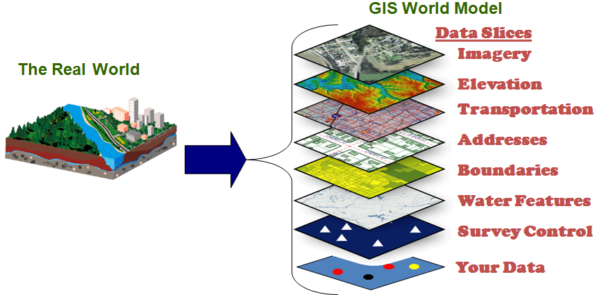
By layering this data into ArcMap, it is a very straightforward way of viewing the various areas the project will impact, where they overlap, and how much of the project impacts none of these areas. Along with this, simple calculations were performed to analyze how much of the proposed project boundary infringes on how much of each land use category, available below:

Areas below 600m: 91.38%
OGMA: 67.8%
Ungulate winter habitat: 4.41%
Red-listed plant species: 24.8%
Riparian areas: 0.2%
Project area in protected areas: 91.4%

As you can see in the map and in the calculations, the vast majority of the proposed project boundary is within protected areas. Based on this information, the BCSF’s negative view of the project seems advisable. While acknowledging that the construction of the project would supply many people in the surrounding areas with jobs, the evidence for the considerable impacts on the environment and wildlife are obvious and should not be taken lightly.

Judging by this EIA, the two greatest environmental concerns to project development for Garibaldi at Squamish are:

  1. Protected areas (plus Old growth management areas) and the project’s impact on each area
  2. Impact on red-listed plant species

In terms of mitigating these concerns, this is one of those cases where there may be strategies to minimize the impact on these areas, but no solution will mean completely avoiding the negative impacts on these areas. Public awareness throughout the project area could aid in maintaining red listed species, however the construction of the park will impact these species in the end anyway.

Protected areas and old growth forests, as with the red-listed species, will obviously be heavily impacted and cleared out due to the construction of the park. While the old growth forests are less likely to be negatively impacted by guests at the park, carbon emissions following the destruction of a carbon sink (like an old growth forest) are massive. One way to mitigate this would be for the project to commit to making up this carbon footprint, whether in carbon payments or building incredibly sustainable buildings and park recreational machines.

Overall, I would deem this project unsustainable and the trade-off between the resort income and jobs created do not make up for the negative impact on the environment.

Map:

EIA

Response to class prompt: “When working on environmental projects, you sometimes become involved in proposals that you do not ethically believe in. Do you personally think the project should be allowed to continue? Does this differ from what you wrote in your memo?”

As I wrote in the memo, I personally do not believe the proposal we got to study in this lab should go ahead. Even before performing all the exercises with the maps, simply reading that the elevation of the area wouldn’t allow for the minimum snowpack was enough to disagree with project. This information combined with the knowledge we have of the future impacts of climate change and what it means for increasing temperatures should be enough that this proposal gets denied.