i-Tree Eco

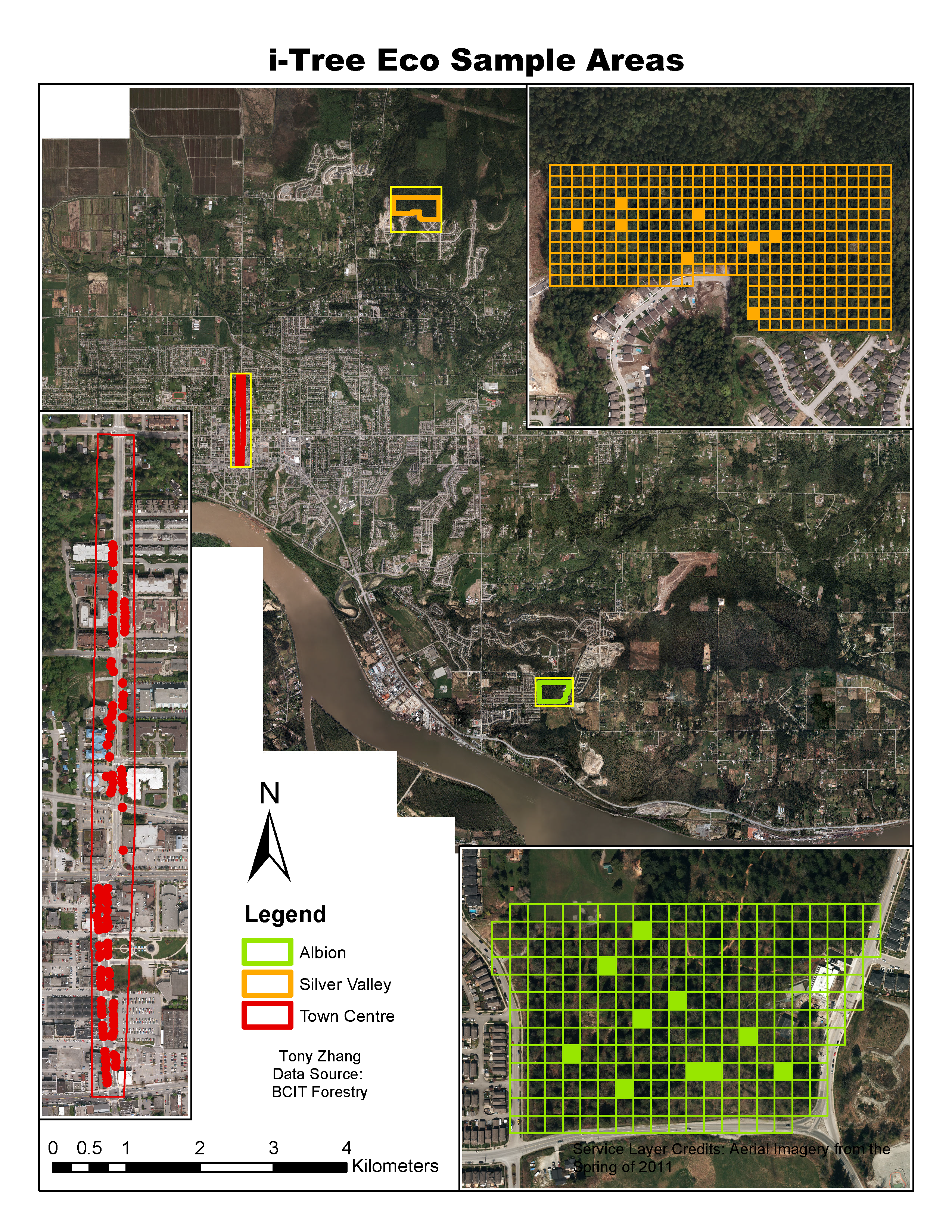
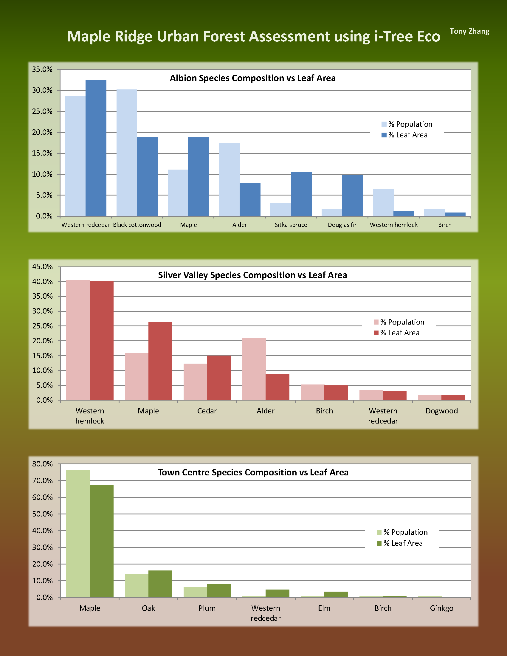
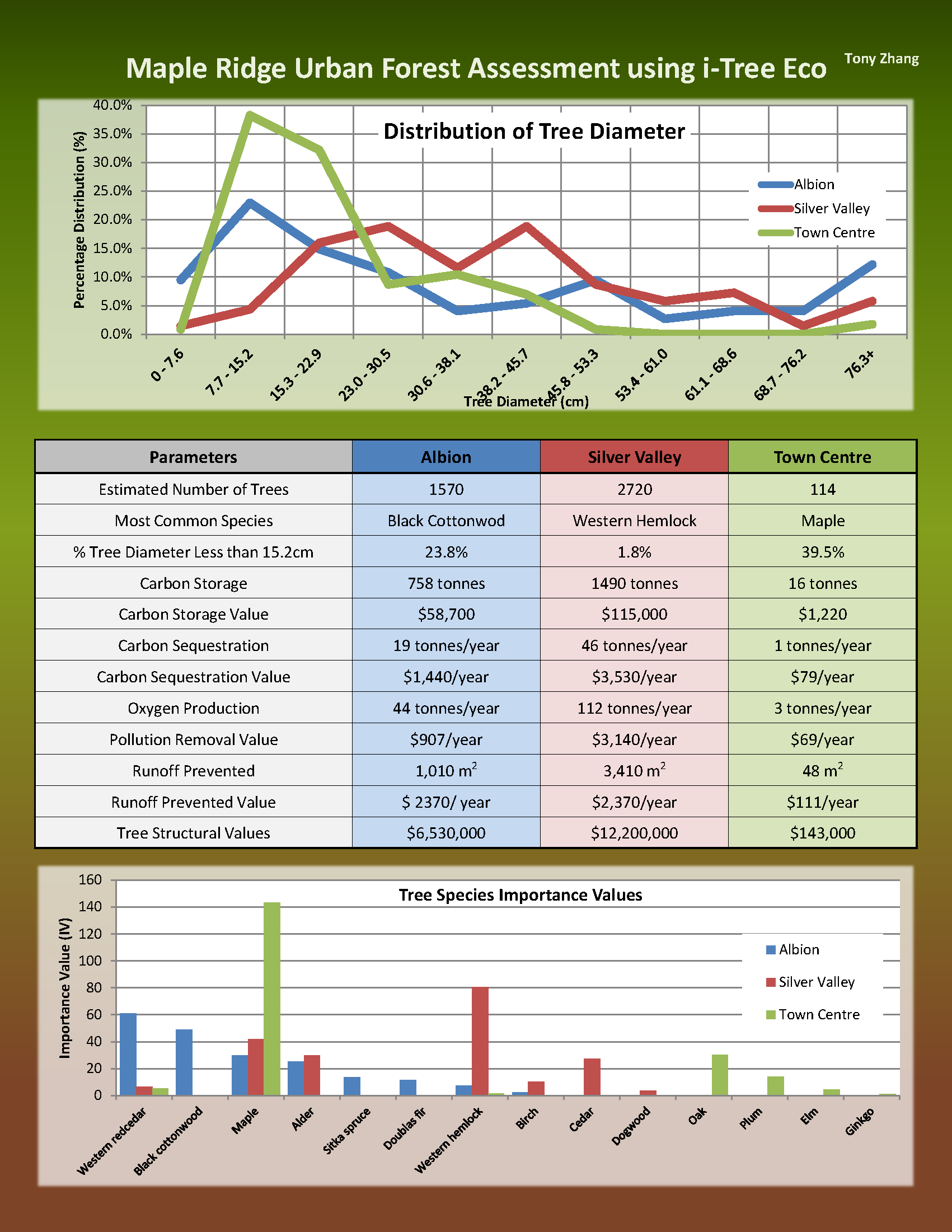
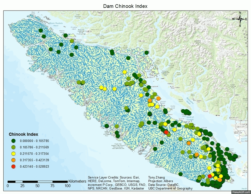
Thanks to data collected by BCIT’s Forestry students we were able to use i-Tree Eco tool to produce some interesting statistics on the environmental and economic values of trees in the city. Here’s a map of 3 study areas and a sample of the results the tool was able to produce. Click on the charts to view bigger version.

EcoStudyAreaMap posterletter2 posterletter3

ArcScene

I started BCIT’s GIS ADP program and it’s super intense and busy so far. There haven’t been many opportunities to make cool maps since most of the labs are pretty technical. We’ve been testing out ArcScene with 3D data, so here’s a scene of Nanaimo with data I found on the city’s website. It would have been cool to make the buildings pop out too but unfortunately building height data isn’t complete for the whole city.

Nanaimo 3D