This week we talked about three important but different areas where GIS is important, and they are related through five common themes: patterns, processes, places, people, and perspectives. The first area is landscape ecology, a sub-branch of ecology. Ecology in general is the effects of biotic and abiotic factors on organisms, and landscape ecology focuses more on specifically how the landscape as a factor affects those organisms. Another area is health geography. Health geography is very wide branching, and includes topics like disease ecology, health care delivery, and the relation between environmental and health studies. The third area we discussed is crime analysis. By analysing existing data we can find patterns that help with crime prevention and mitigation. The story about how lead in gasoline was related to crime was interesting, because it showed the impossibility of knowing the complete truth, but analysing data and using statistics can help explain or predict patterns with close enough results despite only having theories for guidance.
We also started working on our first lab which was to help us learn the basics of Fragstats program. Using ArcGIS, we created land use raster files for Saskatoon in 1966 and 1976, and exported it as TIFF files that Fragstats can use. In Fragstats we calculated several class-scale (for each land use area) metrics and a few landscape-scale (whole map) metrics. Determining “edge” depth for each patch was also important for many metrics because it creates different habitats compared to inner areas which cause ecological implications. The resulting metrics can then be exported into other programs like Excel for making comparisons or creating tables and graphs. Below is a sample map for the raster stage of the data in ArcGIS.
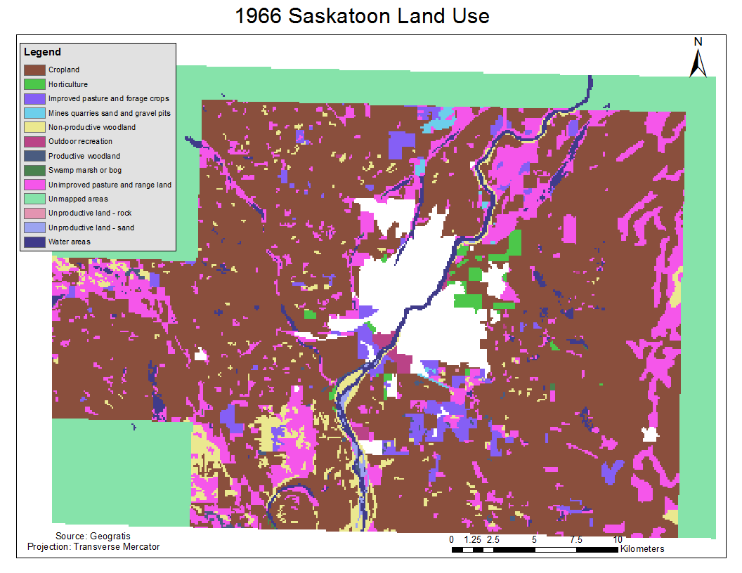
Raster map of 1966 Saskatoon Land Use