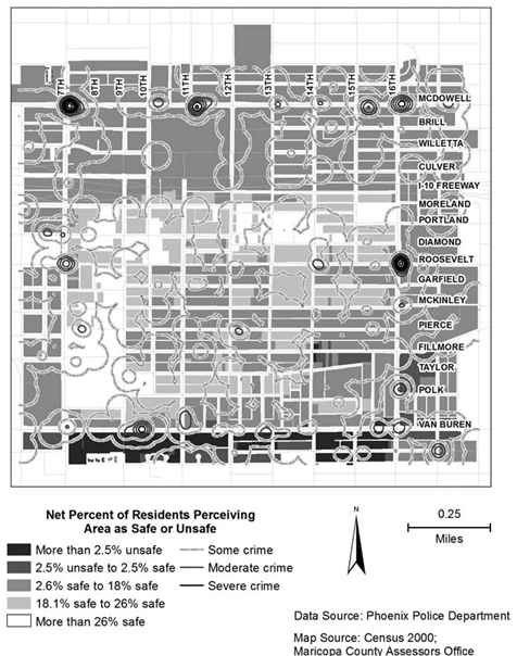
This week we had our third and last journal article presentation, focused on crime analysis. The article I chose was called Comparing Police and Residents’ Perceptions of Crime in a Phoenix Neighbourhood Using Mental Maps in GIS, (link here). The objective of this article was to use mental maps created through resident and police interviews to see how perceptions differ between police and residents, and also to compare their perceptions to actual crime. The mental maps created through interview for both police and residents were digitized and aggregated into ArcGIS for analysis. The researchers found that police and residents had very different perceptions of crime, with residents emphasizing areas of safety while police emphasizing areas of danger. Also, perceptions of neither groups showed good correlation to actual crime. The researchers believed this is because residents tend to feel safer in their own neighbourhoods regardless of actual crime, while police are heavily influenced by historical events, and even if an area no longer have frequent crimes police will still feel danger in that area. Overall this article did a good job improving upon previous studies of a similar nature, but I felt that the surveying methods were too different between residents and police for comparison, and the presentation of maps could have been better.
One other article I liked was the on the relations between parks and housing values. The researchers found that parks can lower the housing price of surrounding areas. I thought this was surprising because I always thought of parks as a point of interest like schools or shopping centres which home buys often look for. But it turns out parks can also be hotspots for crime which in turn makes a neighbourhood less desirable.
Maps could have been better