Protected & Restricted Areas Map (Binary Constraints), Background:
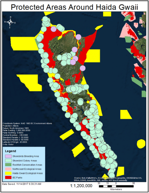
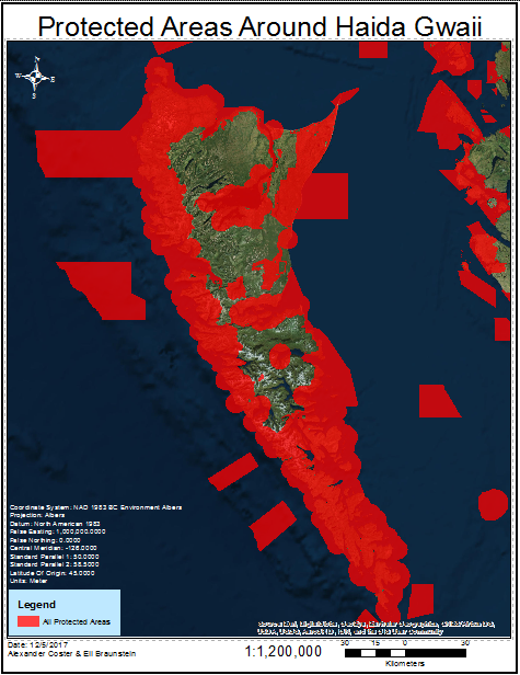
As part of our commitment to preserving the ecological integrity of the Haida Gwaii environment, we developed a map to integrate protected areas, areas of biological significance, and shorebird nesting and colony sites. These areas will be included in the Multi Criteria Analysis, and separated as areas which cannot support any development or construction of infrastructure.
There are a number of protected areas which have been included for our analysis to restrict development:
- Provincial Parks & Conservatories (BC Parks)
- Rockfish Conservation Areas (Department of Fisheries & Oceans)
- Ecologically, Biologically & Culturally Significant Protected Areas (Department of Fisheries & Oceans, Marine Plan Partnership for the North Pacific Coast)
- Breeding Shorebirds & Nesting Shorebird Colonies (BC Marine Conservation Analysis)
Loss of habitat remains one of the leading threats to shorebird populations, so colonies and nesting grounds must be given special consideration (US Fish and Wildlife Service, 2006). Their feeding and mating schedules on Graham Island should not be disturbed. Noise, dust, pollution and increased human activity from nearby development will stress bird populations. Wind turbines have been cited as a major threat to bird populations as well, but this is not agreed upon. Recent studies conducted on 109 post-construction sites at 71 facilities across the United States found that about 2.8 birds perish annually per wind-powered megawatt, meaning about 200,000 birds die a year due to wind farms in the US (AWEA, 2017).
Wave energy converters have also been documented as potentially disturbing to wildlife. Noise pollution, construction, maintenance and operation of these devices can be potentially harmful to the ecological systems on Haida Gwaii. Construction and operation of solar farms on Haida Gwaii will also need to avoid these protected areas. Thus, these constraints will be applied across the three conducted MCEs.
Protected Areas Map (Constraints), Methodology:
Provincial Parks and Conservatories, Rockfish Conservation Areas, and Ecological, Biological, & Cultural Significant Areas were downloaded as vector shapefiles. They were projected to NAD BC Environment Albers.
These areas were obtained from BCMCA as vector polygon shapefiles. They have not been modified for our analysis. This includes 52 protected administrative zones, 10 biologically significant areas, and 13 rockfish conservation areas.
Shorebird nesting and colony sites were downloaded as vector points, projected to BC Environment Albers, and buffered by 5km to reduce stress on bird populations. The 5km buffer has been suggested by the BCMCA in their Seabirds Expert Workshop Report regarding development restrictions (2006).
All the protected area polygons were Merged to produce one shapefile to be used in our subsequent MCE as constraints, or areas which we will be excluded from our results.


