WInd Generation
The Multi Criteria Evaluation for wind farm location had several determining inputs:
- Mean annual wind speeds
- Bathymetric elevation (for off-shore installations)
- North Grid transmission lines
- Advised Against Development areas
- Protected Areas
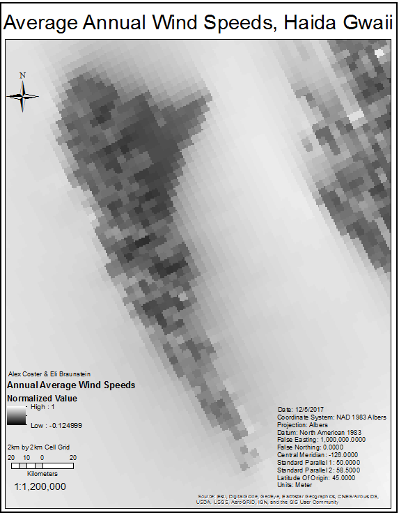
We acquired a Wind Energy Potential map from BCMCA which contains a 4km² cell grid of information on wind power generation for 30m elevation. One of the attributes is average annual wind speed (m/s), which we use in our analysis. Average annual wind speed is classified into five categories, in m/s:
- <6.0
- 6.0 – 6.5
- 6.5 – 7.5
- 7.5 – 8.5
- 8.5 – 10.0
While anything below 6.0 m/s is unusable, we are generally only interested in areas suitable for the Vestas V90 and Siemens 2.3-93 turbines, our proxy devices (8.5 – 10.0 m/s and 7.5 – 8.5 m/s respectively) (DNV Global Energy Concepts In., 2009). Our analysis of mean annual wind speeds lead us to the conclusion that onshore sites are insufficient in wind speed to be viable locations, therefore offshore locations will be the focus for wind power generation.
The Average Annual Wind Speed map underwent normalization:
| Average Annual Wind Speed (m/s) | Normalization Value |
| 8.5 – 10.0 | 1 |
| 7.5 – 8.5 | .8 |
| 6.5 – 7.5 | .6 |
| 6.0 – 7.5 | .4 |
| < 6.0 | 0 |
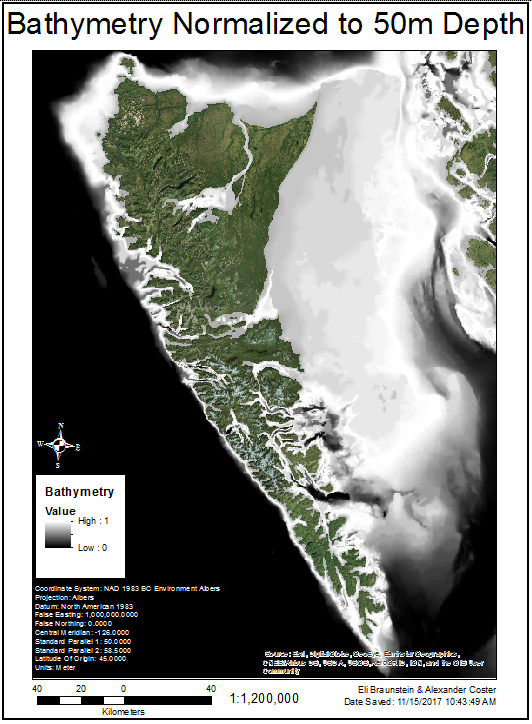
A Bathymetry map was obtained from BC Marine Conservation Analysis, and was converted to a raster and normalized to a midpoint of 50m, which is close to the economic constraint for most commercial offshore wind turbines (European Wind Energy Association, 2013). Although ‘deep offshore’ platforms are in use, they are not considered for this analysis due to their greater financial costs.
The Euclidean Distance from Transmission Lines and Advised Against rasters were included as part of the MCE as well.
Now that our criteria have been normalized, we need to weight them. We used the Analytical Hierarchical Approach (AHP) on 123ahp.com
| Wind MCE Factor | AHP Score / Weight |
| Advised Against Areas | 0.4725 |
| Wave Power | 0.3505 |
| Bathymetric Depth | 0.1153 |
| Distance From Transmission Lines | 0.0618 |
The Advised Against Areas were our most significant factor in the AHP weighting process to address the fact that previous projects had been cancelled due to public opinion. Average Wind Speed is given next priority, as we are searching for the most productive areas. Bathymetry and Distance to Transmission Lines are more or less economic constraints, so their importance is downplayed.
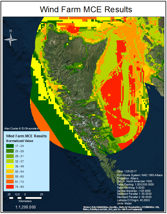
We used these parameters in the Weighted Sum tool, and this produces a rough map of areas of varying suitability for a wind farm.
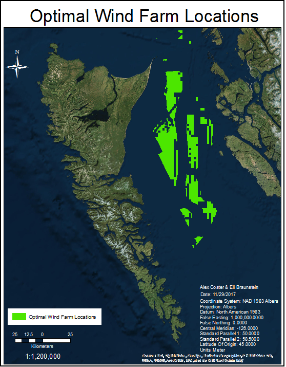
Next, we use the Times tool to multiply the values by 100, convert the float raster to integer, then convert the integer raster back to a vector polygon layer. We selected the polygons with the highest MCE ratings (greater than 74), created a new layer, and used the erase tool to overlay the Protected Areas polygon. Finally, we clip our MCE polygon with a modified wind speed polygon which is comprised only of areas 7.5 m/s or greater, the lowest wind speed threshold for our proxy offshore turbines. We are left with a final product: approximately 1930km², the vast majority of it to the east of Graham Island in Hecate Strait.


