Advised Against Development Areas Map (‘Soft Constraints’), Background:
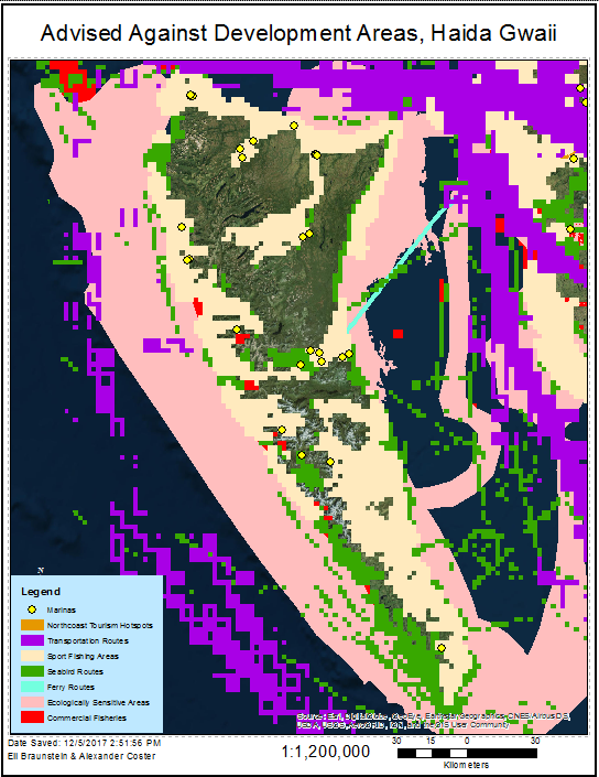
The Haida Gwaii archipelago is used extensively for fishing activities, transportation, and tourism activities. There are large swaths of coastal shelf that have been designated as biologically significant and sensitive areas by the Department of Fisheries and Oceans as well.
These commercial and ecological zones of interest have been included in our analysis to further guide, but not restrict outright, possible development:
- Commercial Fishing Areas (BC Marine Conservation Analysis)
- Sport Fishing Areas (BC Marine Conservation Analysis)
- Transport Shipping Routes (BC Marine Conservation Analysis)
- Tanker Exclusion Zone (BC Marine Conservation Analysis)
- Tourism Hubs & Marinas (BC Marine Conservation Analysis)
- Ferry Routes (BC Marine Conservation Analysis)
- Marinas & Coastal Facilities (BC Marine Conservation Analysis)
- Ecologically Sensitive Areas (BC Marine Conservation Analysis)
Advised Against Development Areas Map, Methodology:
The layers for each of the factors listed above were downloaded as polygon, line and point shapefiles and projected to NAD BC Environment Albers prior to operations.
Commercial Fishing Areas, Sport Fishing Areas and Transport Shipping Routes use much of the ocean area, though their use is sparse and low in value. They have been modified so that only the significantly used areas will be separated from our analysis. Commercial Fishing Areas consists of a grid of 4km² planning units that contain 8 or more fishing features that inform each unit. Sport Fishing Areas consists of 4km² planning units containing one or more fishing features. Transport Shipping Routes has been modified by selecting 4km² planning unit grid cells with 5 or greater shipping features. Ferry Routes and the Tanker Exclusion Zone, both line features, have been buffered by 1km to allow sufficient room for safe passage of ferries and tankers. Marinas have been buffered by .5km to allow sufficient room for ships to dock. These adjustments will account for the desire to limit disturbance to existing commercial activities. Ecologically Sensitive Areas were not spatially modified.
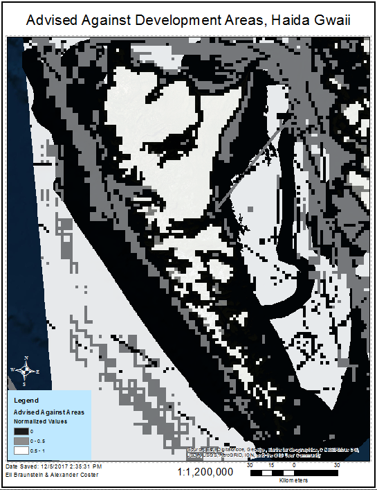
Advised Against Development areas were organized into a normalization index through the Select by Attributes and Editing functions. Like the constraints map, these factors will be applied to the three MCEs.
| Area Type | Normalization Score |
| Ecologically Sensitive Areas | 0 |
| Seabird Routes | 0 |
| Transport Routes (tanker, ferry) | .5 |
| Sport Fishing | .5 |
| Commercial Fishing | .5 |
| Tourism | .5 |
| Marinas | .5 |
| Unused Area | 1 |
This will strongly dissuade development on biologically/ecologically sensitive areas, while only strongly considered project sites will be considered in commercially active areas. The vector file was then converted to a raster, using the Normalization score as the cell value. This raster, along with the Protected Areas shapefile, will be used in the final stages of the MCE analysis for each proposed project type.
Transmission Lines Factor Map:
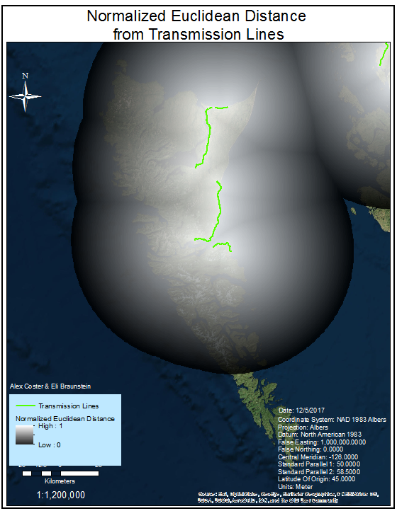
Transmission line shapefiles were obtained from ABACUS in vector format. We converted the vector files into a raster, and performed a Euclidian Distance function to create values for cells depending on their distance from power lines. The Euclidean Distance raster was normalized using Raster Calculator:
((Max Value – Actual Value) / Max Value)
This gave smaller distances from transmission lines a higher value for the MCE analysis.


