Background
This summer, extreme heat took the lives of nearly 600 British Columbians, making it the deadliest weather event in Canadian history. (Aslam, 2021). We are already experiencing the impacts of climate change. With temperatures projected to both increase in variability and rise overall, extreme heat events are no longer a “1 in 1000 year” anomaly, but a frequent occurrence to which we must adapt accordingly. Presently, Metro Vancouver lacks a centralized plan to address heat vulnerability, as well as a singular, easy-to-access map of all public cooling centers.
British Columbia Deaths During the Heat Wave
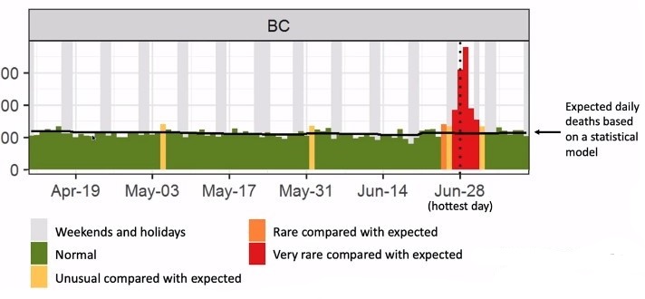
Image from Aslam (2021).
Study Objectives
- Locate populations that are most at risk of heat-related illness/death in Metro Vancouver.
- Locate regions where the risk of heat exposure is the highest
- Create a complete map of cooling centres in Metro Vancouver.
- Highlight where more adaptation is needed (at-risk areas lacking access to cooling centres).
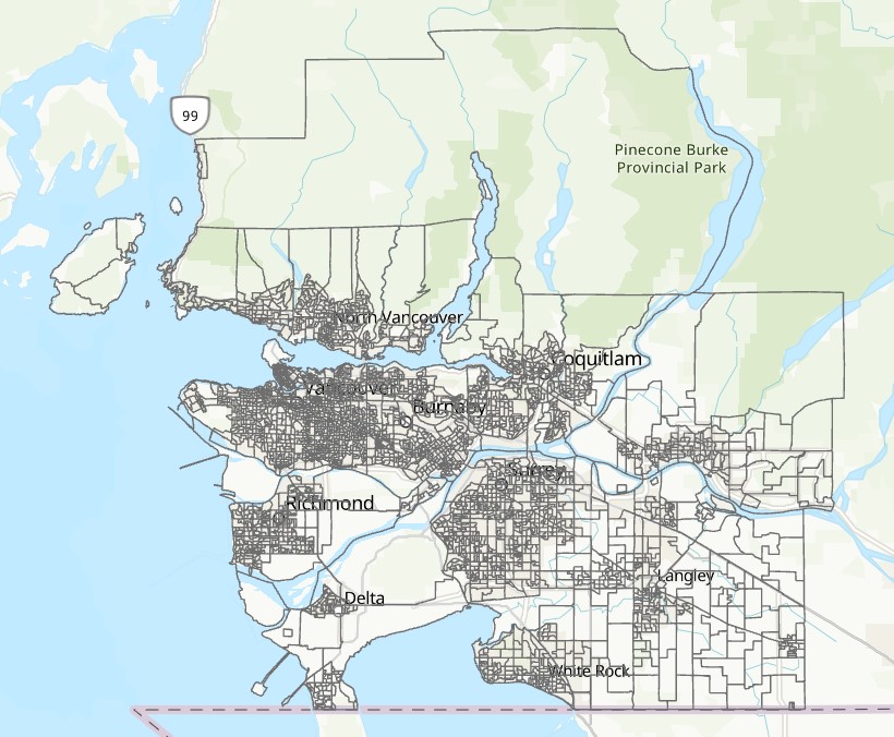
Study Area
The study area, Metro Vancouver, includes Anmore, Belcarra, Bowen Island, Burnaby, Coquitlam, Delta, Electoral Area A, City of Langley, Township of Langley, Lions Bay, Maple Ridge, New Westminster, City of North Vancouver, District of North Vancouver, Pitt Meadows, Port Coquitlam, Port Moody, Richmond, Surrey, Tsawwassen First Nations, West Vancouver, and White Rock. We analyzed the area of Metro Vancouver by census dissemination areas, as shown below: