I was first exposed to LiDAR data through the MGEM program in the course Advanced Earth Observation and Image Processing. In this course we completed several labs where we visualized and analyzed LiDAR data using the FUSION Program, as well as creating scripts for processing LiDAR data using RStudio. We worked with sample airborne LiDAR data taken from one of UBC’s research forests, which came in the form of multiple-return LAS datasets. Using this data, we created a Digital Elevation Model (DEM), a Digital Surface Model (DSM), a Canopy Height Model (CHM), and modeled individual tree crowns. We also calculated a variety of forest metrics and created models to predict above-ground biomass and dominant tree height using other lidar-derived metrics.
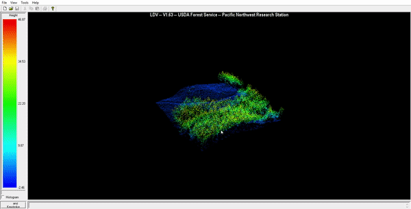
I recorded this gif using FUSION to show a visualization of a small subset of the LiDAR return data, and then show the derived DEM and DSM overlaid over the point cloud.