For my final research project in the MGEM program, I chose to examine how greening and browning occurred in Canadian boreal forests. My study area consisted of the Athabasca Plains ecoregion, which is located in northern Alberta and Saskatchewan. Greening (increased vegetation productivity) and browning (decreased productivity) are commonly assessed using the Normalized Difference Vegetation Index or NDVI. I acquired preprocessed Landsat data from members of the UBC Integrated Remote Sensing Studio, who created national composite images with spectral values from the best available pixel taken from the growing season in each year from 1984 to present. Using this data, I derived NDVI each yearly dataset using the following formula: (NIR – Red) / (NIR + Red). I created the following gif using 20 NDVI images for each year 1984 – 2003 in ArcMap, where darker green represents a higher NDVI value.
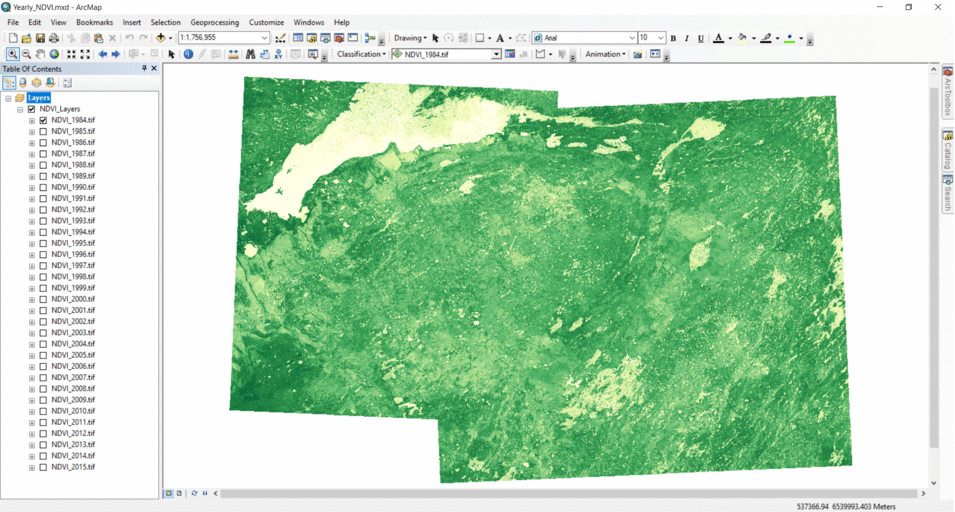
NDVI is clearly variable throughout the region from year to year. This may be due to year-to-year weather patterns like drought/rainfall, longterm processes like climate change, and the impacts of disturbance. The large, well defined patches of decreased NDVI that appear suddenly in the image show areas that experienced wildfires or other disturbances. I masked out these disturbed areas for my later analysis.