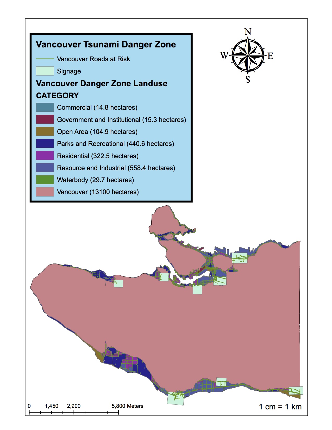
In our third lab about constructing a map that informs the danger zones of a possible tsunami in Vancouver. In my findings I determined that 11.35% of Vancouver’s total area is under danger as show in this map of Vancouver’s tsunami danger zone.
With the data for the lab here is how I was able to calculate that total area in danger percentage:
First I looked at the total area of Vancouver by opening an attribute table for the Vancouvermask layer and looking at the Shape_Area value. Then I added a new field to the table and changed the field calculator to get the area from m^2 to km^2 to simplify the numbers. I summarized the different landuse types that might be affected by a tsunami by categories and looked at each land use’s total area, also after converting it into km^2 from m^2.
Lastly I used the statistics tool in the attributes table to determine the total area of the land that may be affected by a tsunami and divided that by the area of Vancouver found in the previous question.
With the new map I had constructed I was able to identify the following health and education facilities in risk of being devastated by a tsunami.
| Health Facilities in the Danger Zone | Education Facilities in the Danger Zone |
| False Creek Residence | Emily Carr Institute of Art and Design |
| Villa | Henry Hudson Elementary |
| Cathay Care Home | False Creek Elementary |
| Broadway Pentecostal Lodge | St Anthony of Padua |
| Yaletown House Society | Ecole Rose Des Vents |
To get this list I went and used the Select by Location tool to find the health and education facilities in Vancouver that were found in the tsunami danger zone. From there I exported the selected facilities data into new layers called Education_Danger and Health_Danger. I found the specific entries by looking at the attribute table.