Geob 270 – Final Project
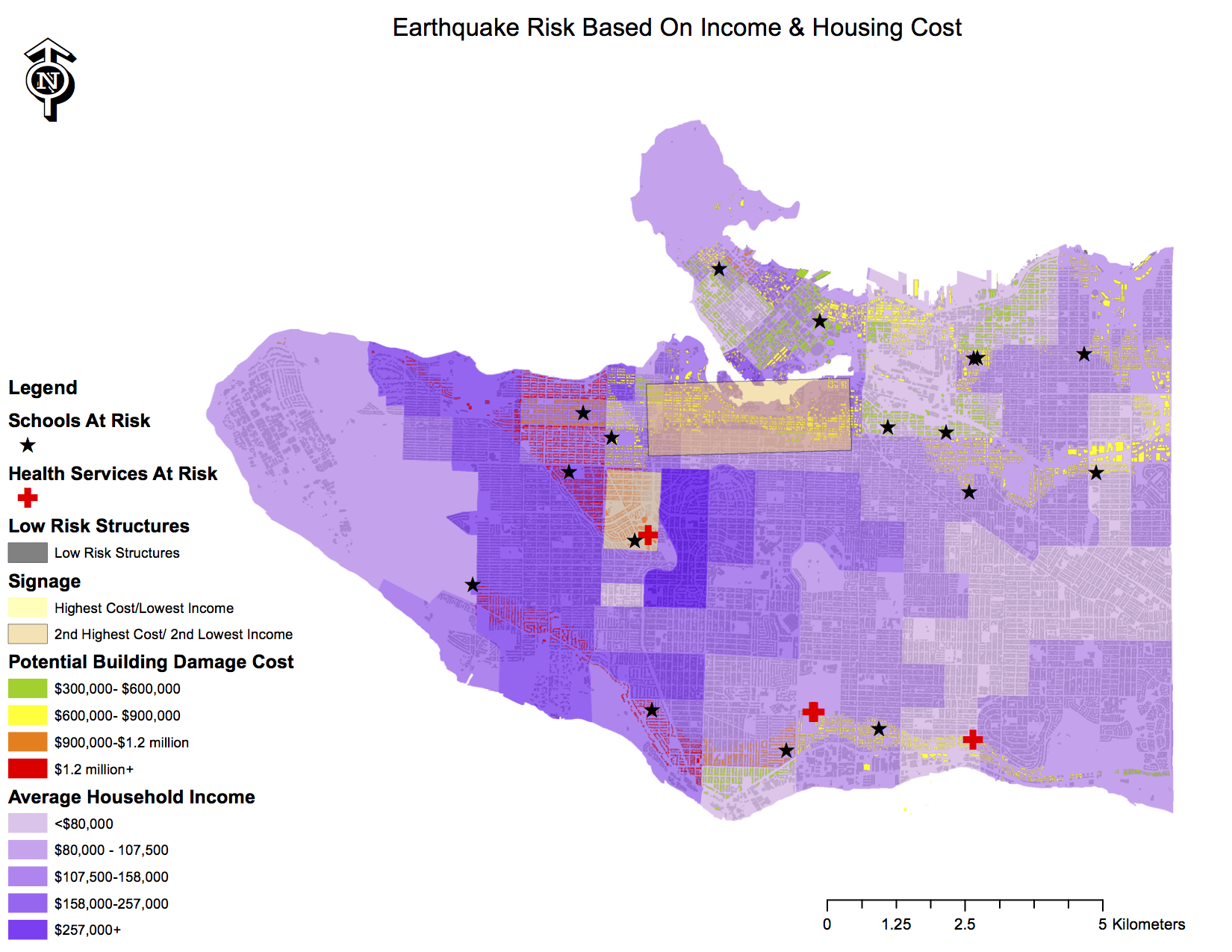
For our final project, my group members and I considered many possibilities for topics, but we were determined to conduct an analysis of Vancouver that would prove useful to its residents. After some discussion between bicycle lanes in Vancouver and possible uses for the city’s newly purchased tracts of land, we agreed to collect data and prepare an analysis of the areas of Vancouver that were most at risk of damage from a large earthquake. Many residents of Vancouver are familiar with the fact that scientists have predicted that a large “megathrust” earthquake will occur within the next 50 years. Our project assessed the areas most at risk from damage from a disastrous earthquake event, and also included socio-economic considerations.
Initially, we all split up to scour the Internet to collect all the pertinent data that we could find. Then, we gathered at one computer and worked together to construct the maps that we required. This allowed for a pool of knowledge regarding the ArcGIS software group.We then proceeded to divide the report by sections. I constructed the flow chart, drafted the Further Research and Recommendations portion, and helped to bring all components of the report together into one cohesive document.
This project reminded me of the importance of keeping a singular, organized, and comprehensive work station.In our second meeting, the group attempted to open the work that had been completed the week before but we were unable to do so because some files were missing or the file directories were not consistent. There were some days when I was unable to be physically present to contribute to the construction of the maps. I learned through my absence that, despite the innumerous advances to technology in recent years, communication is still most efficient when face-to-face contact is established. Working remotely greatly hindered my work speed, and caused some confusion as to what my tasks were.