Storm Surge: Vancouver Case Study
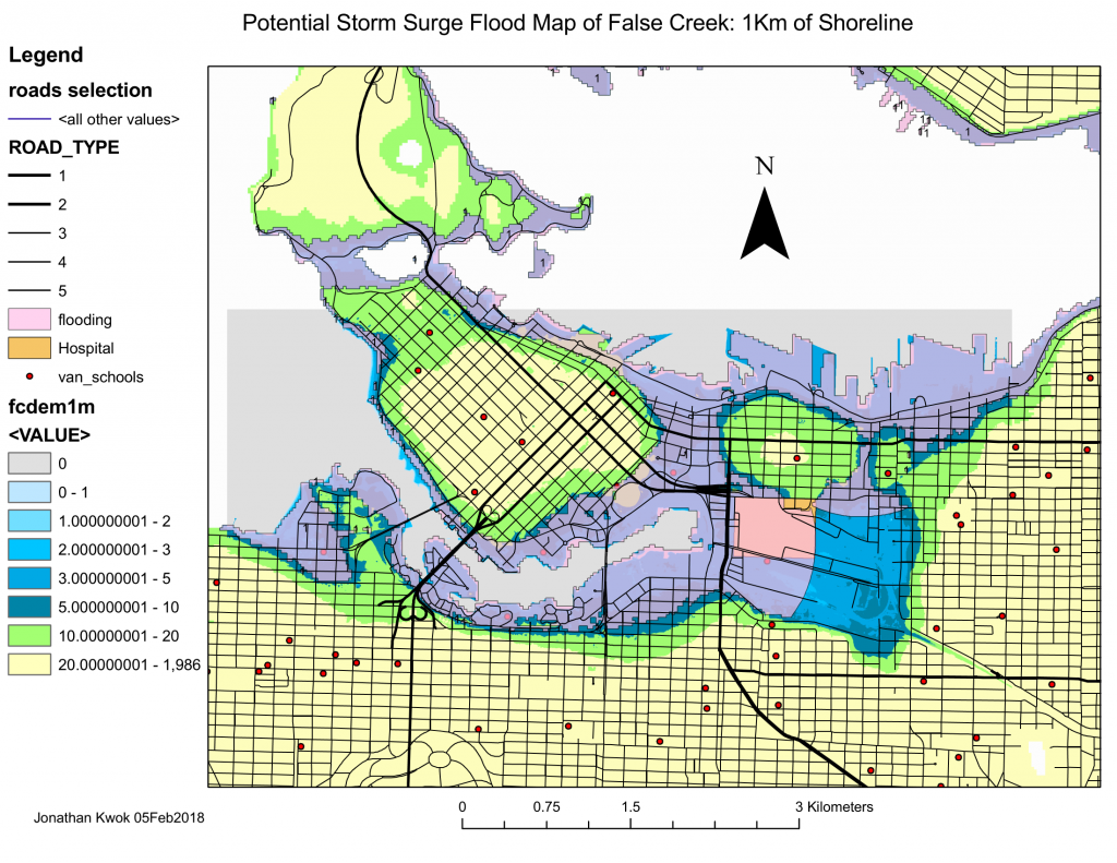
The Greater Vancouver area is developed on a delta which is susceptible to tide changes, specially if there is a sudden change in sea level. Luckily Vancouver Island’s presence helps decrease the effects of tsunamis from seismic activity, but the area is still at risk of a storm surge. With large amounts of datasets, I have learned to mine through the data and to represent them based on scenarios. Below are a few maps of the Greater Vancouver area made in ArcMaps using the ArcGIS software.
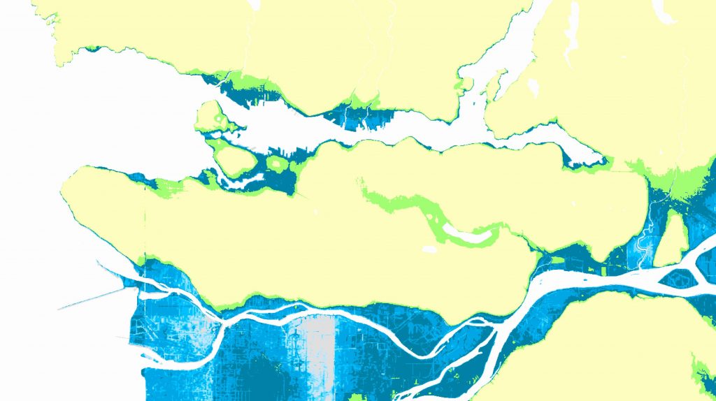
Vancouver Template used for the maps. Layer used represents areas susceptible and intensity for flooding.
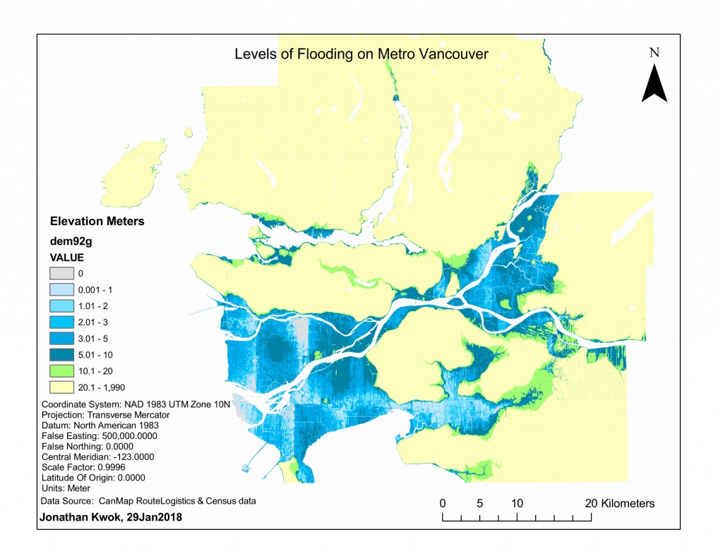
map2
 map 3
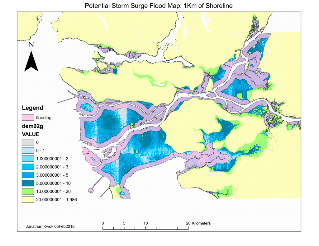
map 3
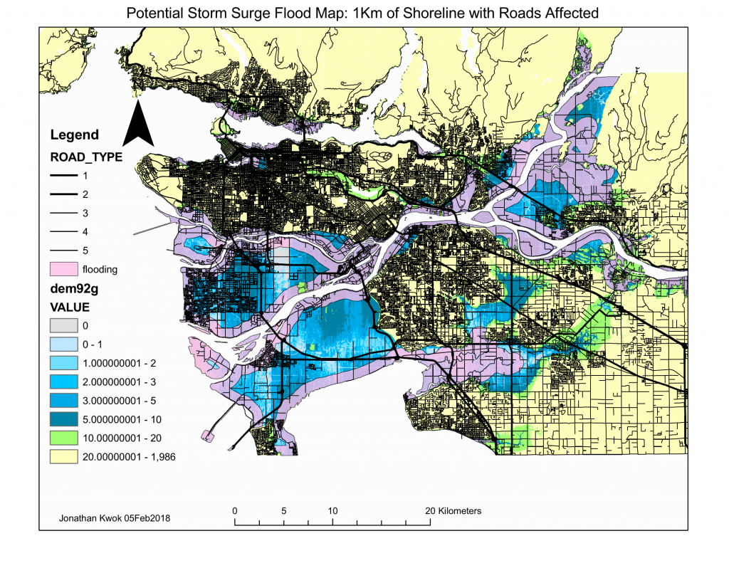
Map4
Map5
xx
z
| ROAD_TYPE | Name | Description |
| 1 | Expressway | Expressways and 400 series highways, e.g. Highway 401 |
| 2 | Primary Highway | Primary Highway, e.g. Highway 7, Highway 11 |
| 3 | Secondary Highway | Secondary Highways |
| 4 | Major Road | Major road or Arterial road, e.g. Bayview Ave |
| 5 | Local Road | Subdivision road in a city or gravel road in a rural area |
| 6 | Trail | Trails |
| 10 | Main | Main Railway and Transit Lines (includes segments of rail that are shared with transit) |
| 11 | Sidetrack | Sidetrack of Main Railway Route |
| 12 | Abandoned | Abandoned sections of Main Railway Route |
| 13 | Transit | Transit lines that are not shared with Railway lines |
| 20 | Ferry Route | Approximate travel route of Ferry |
| 21 | Ferry Ramp | Ferry Ramp |
| 22 | Ice Road | Approximate travel route of Ice Road |
| 23 | Ice Ramp | Ice Ramp |
| 24 | Ferry Route/Ice Road | Approximate travel route of Ferry/Ice Road |
| 25 | Ferry/Ice Ramp | Ferry/Ice Ramp |
![]()