BY ISAAC LOWENTHAL WALSH
I joined the Climate and Cryosphere team in May 2022, as a recipient of UBC’s Work Learn International Undergraduate Research Award, to support data collection for Holly Chubb’s doctoral thesis. Over the course of the summer, we have worked in the lab and at two field sites in the Coast Mountains to plan, gather, analyze, and present data exploring the relationships between climate change, cryosphere degradation, and high mountain mass movement events.
Both field sites are located on Líl’wat First Nation territory. Qw’elqw’elústen (Mt. Meager) translates to “cooked face place,” or “really hot face” in Ucwalmícwts, the language of the Líl’wat First Nation. Qw’elqw’elústen is the only currently active Canadian volcano formed during the Quaternary period, sitting roughly 160 km north of Vancouver and 65 km northwest of Pemberton. Quaternary volcanoes such as Qw’elqw’elústen in the South Coast Mountains of British Columbia are often composed of weak rock, which is eroded easily, and often display patterns of rock fall near glacial trimlines (Friele et al., 2008). The August 2010 landslide/debris flow mass movement event at Qw’elqw’elústen was one of the largest in Canadian recorded history (Allstadt, 2013), producing a seismic signature with a magnitude equivalent to M = 2.6 and a flow path measuring a total length of 12.7 km (Guthrie et al., 2012).
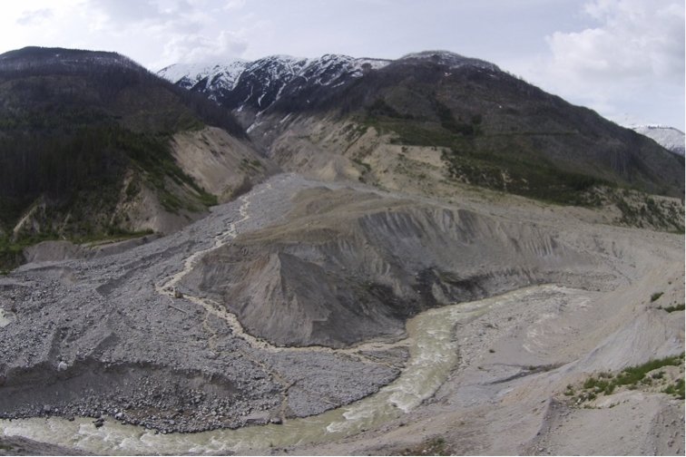
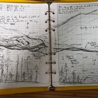
Qw’elqw’elústen field work took place from May 31st to June 3rd, June 9th to the 13th, and on August 18th. We were able to access the runout zones of the 2010 Qw’elqw’elústen Landslide via the Meager Creek Hotsprings FSR, to the west of Líl̓watátkwa7 (Lillooet River), and the Lillooet River FSR, to the east of the river. During our first site visit, we investigated the southwest deposit lobe, taking systematic sediment samples and recording precise survey points using a GNSS receiver system, discussed in further detail below. We enjoyed a consistent weather window of partial sun and mild temperatures. On the second visit, Michele Koppes joined us for the first two days, during which we explored the easternmost deposits, using the same methods, in intermittent showers. On the final two days of our second trip the skies cleared, and we surveyed the eastern debris floodplain in mostly sunny, ~15° C weather.
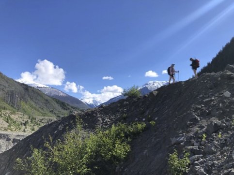
N’skenú7 (Joffre Peak) is located roughly 25 km east of Pemberton, bordering Joffre Lakes Park to the west and the Nlháxten/Cerise Creek Consevancy to the east. The landslide events of May 13 and 16, 2019, lie almost exclusively within the Nlháxten/Cerise Creek Consevancy, a culturally important area to the Líl’wat First Nation. The Líl’wat First Nation shares joint management and supervision of the Conservancy with BC Parks (Geohazard Report, 2019). Similar to Qw’elqw’elústen, N’skenú7 was subject to glaciation during the Quaternary period, and has experienced significant glacial retreat since 1980. A moraine on the now-failed north slope of N’skenú7 marks the maximum Holocene extent of the glacier that used to lie there. The thinning and recession of this glacier eroded and steepened the north slope, and the patchy remnants of this glacier were swept away in the 2019 landslides (Friele, 2020). It is hypothesized that the mass movement events of May 2019 were directly preconditioned by melting permafrost, in conjunction with rapid snowmelt. This resulted in higher groundwater levels and increased porewater pressure within the rock, which would have weakened the structural integrity of the entire face.
Although significantly smaller in size, the slide at N’skenú7 is more impressive to me, since the boulders are consistently larger, requiring focused scrambling and route planning to traverse, and the entire flow path can be seen in full as you approach the middle. We collected data over the course of three trips, from July 13th to 16th, July 21st to the 22nd, and on August 17th. The site is accessed via the Keith’s hut summer route trail, and we stayed overnight at Keith’s hut, perched on the west ridge of N’skenú7. The first days of the first trip were very hot and cloudless, but the weather turned rainier on the third day. Concerned about the risk associated with crossing the highly unstable deposit while it was wet, we extended our stay an extra night. On the second trip, it was mostly sunny and still, favorable drone-flying weather.

N’skenú7 headscarp. The two failures are exposed, slightly below and to the viewer’s right of the peak. The terminal moraine of the now-extinct Joffre glacier smiles near the base of the mountain.
Methods
Whilst in the field, we used an EMLID GNSS receiver system to take survey points of significant features with centimeter-level accuracy of their position and elevation. Features that we recorded with the EMLID included the extents of the flow paths, heights and locations of hummocks, and locations of woody dams and large woody debris. The EMLID was also useful in characterizing the general topography of the area. By taking survey points in locations representative of each deposit area, we were able to gather data on the undulating terrain we encountered in all areas of the flow path.
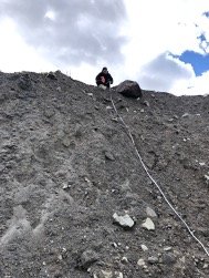
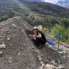
Sediment samples, 40 from Qw’elqw’elústen and 11 from N’skenú7, were dug from significant and characteristic locations in each flow path, using a trowel, to a depth of roughly 15 cm. These samples will be sieved in the coming months to determine their grain-size distribution; the grain-size distribution will be analyzed to understand the rheological dynamics of the debris flow in greater detail. We also took sediment logs in areas where the deposit profile was exposed, noting the degree of mixing and sorting within the deposit.

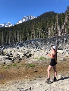
On the second and third visits to each site, we flew the new Mavic 3 cinematography UAS (Unmanned Aircraft System). At Qw’elqw’elústen, we photographed the eastern debris floodplain and the easternmost deposits from the event (east of Líl̓watátkwa7). Flying over N’skenú7, we captured nearly all of the deposit and photographed of the headscarp from afar. These flights captured 3cm-resolution imagery instrumental in the creation of an accurate orthophoto of the N’skenú7 flow path. Orthophoto analysis helps to visualize deposit features—hummocks, fluvial channels, woody dams, etc.—from an overhead angle, on a broader scale.
PERSONAL REFLECTION
The field season was not without challenge. At Qw’elqw’elústen, we had multiple grizzly and black bear sightings, and we came back to the campsite one evening to a fresh claw mark in our bear canister. What we anticipated as a relatively simple river crossing to access the plug of the slide turned out to be a ~30m wide impassible torrent of rapids. We felt the presence of a very real danger crossing the flow path at N’skenú7. The eastern buttress hung overhead, cracks propagating into the rock along the fault where the other two buttresses had already failed. Nevertheless, the season was greatly successful. Beyond completing our research objectives and collecting the data we hoped to collect, it was incredible to drink in the beauty of the South Coast Mountains and marvel at the power and scale of these two enormous mass movement events. I feel incredibly blessed to have received the opportunity to work on this project, and while my time in the lab may be coming to a close, I look forward to seeing how the study comes together in the coming year.
