The MCE model shows the presence of highly susceptible landslide zones within human dominated regions in the West Vancouver- Sunshine Coast- Sea to Sky federal electoral district. This is of particular interest as recreational activities, urban development, and infrastructure are increasing in these regions. Forest clearing and land development can decrease slope stability while also putting more of the population into these at risk areas.
Map 2 examines areas of existing human infrastructure that are within potential landslide zones. However, it should be noted from Map 1 that a large risk of landslide occurrence still exists outside of these zones. Flows from these high risk areas still have potential to reach areas populated by humans and cause costly destruction to infrastructure and possible loss of life. Further analysis using in depth calculation and models may help in predicting where landslide flow will travel, and its extent.
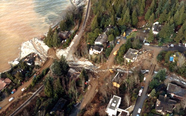
Debris flow at Lions Bay. Source: http://ibis.geog.ubc.ca/courses/geob370/students/class05/joconnel/intro.htm
This mountainous region of BC receives high rainfall, and is located on active tectonic fault lines. By taking this into account, in addition to vegetation type and bedrock geology, landslide susceptibility was mapped. This evaluation suggests that there are in fact at risk regions within human dominated areas of the West Vancouver- Sunshine Coast- Sea to Sky region. The following analysis aims to educate current and prospective residents, and recreational visitors to this region of BC. In addition, this analysis may be beneficial for employing preventative and restructuring measures when looking at existing infrastructure and communities.

