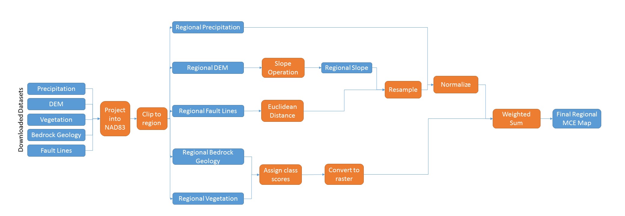
In order to conduct a landslide susceptibility risk assessment, applicable parameters were inputted into a multi-criteria evaluation (MCE) model based on a review of academic landslide literature. Based on the rating that each of the following parameters provided, a ranking of landslide susceptibility for each layer was determined. The parameters in question consisted of:
- Slope;
- Precipitation;
- Proximity to fault lines;
- Vegetation cover; and
- Bedrock geology
Following manipulation of these layers (Figure 1), each layer was normalized and then weighted prior to being inputted into the MCE model.

Figure 1: Flow chart of methods and manipulations applied to each applicable data layer used when developing the MCE model
Using the finalized regional MCE map, an additional map focused to human dominated regions was created to assess risk to infrastructure and urban communities. These regions were then compared to determine which high human traffic regions represented the largest threat to human safety and infrastructure was created.
