Soil Drainage
| Soil Drainage | Old Value | ReclassifiedValue |
| Non-applicable | 1 | 8 |
| Imperfect | 2 | 3 |
| Moderately Well | 3 | 4 |
| Poor | 4 | 2 |
| Rapid | 5 | 6 |
| Very Poor | 6 | 1 |
| Well | 7 | 5 |
| Other | 8 | 7 |
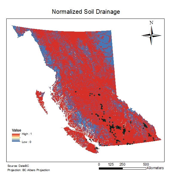 Soil drainage was manually reclassified from very poor drainage(1) to rapid drainage(6). Current plants were found in Soil Moisture Regime classes (SMR) between 1(xeric) to 5(Sub-hydric). Soil drainage properties in those classes ranged from rapid – moderately well to imperfect. Leafy Spurge can thrive in a variety of soil types but has been found to be the most aggressive in dry soils due to the lack of competition. Therefore the fuzzy midpoint of 5.5 was given to reflect the SMR value of 3 (sub-mesic), which was the average SMR of the current plant locations.
Land Use
| LAND USE | VALUE | LAND USE | VALUE |
| Agriculture | 1 | Recently Logged | 1 |
| Alpine | 5 | Recreation Activities | 3 |
| Barren Surfaces | 5 | Residential Agriculture Mixtures | 2 |
| Estuaries | 4 | Salt Water | 6 |
| Fresh Water | 4 | Selectively Logged | 2 |
| Glaciers and Snow | 5 | Shrubs | 2 |
| Mining | 5 | Sub alpine Avalanche Chutes | 4 |
| Old Forest | 5 | Urban | 3 |
| Outside B.C. | 6 | Wetlands | 5 |
| Range Lands | 1 | Young Forest | 1 |
| Recently Burned | 4 |
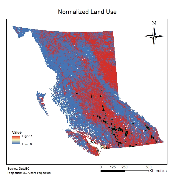 Land Use classes were ranked from 1-6, 1 being the most preferred and 6 being the least preferred areas for plant growth. Through our literature findings, it was found that Leafy Spurge prefers open areas such as rangelands and grasslands. It was also found to be a ruderal species, preferring disturbed lands. Agriculture was given a value of 1 because this plant is commonly found along the edges of agricultural areas and can spread due to farm equipment. Land classes ranked from 4-5 included areas with less open space (such as Old Forests) or areas with inadequate soil for plant growth (such as Barren Surfaces and Alpine). Outside of BC and Salt Water were given a value of 6 and removed because these two classes were not within our area of interest.
Current Plant Locations, Rivers, Roads
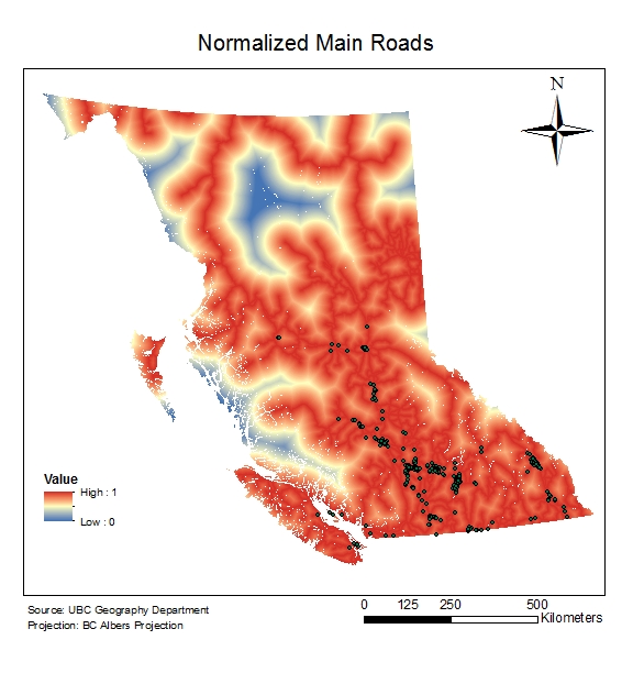
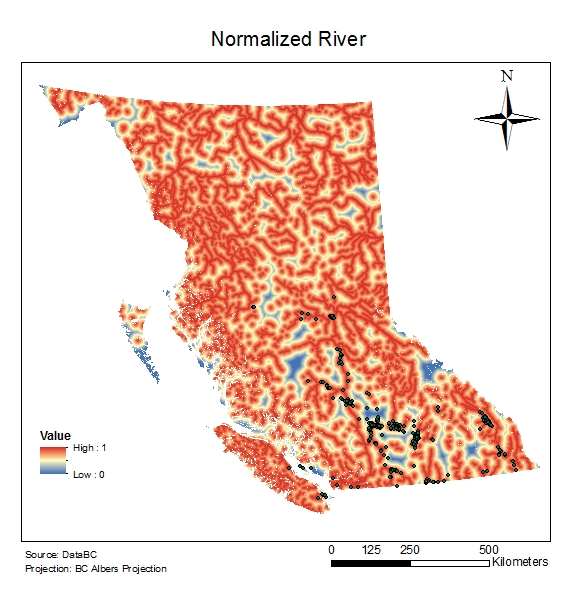 Current Plant locations, Rivers, and Roads were all normalized linearly, with distances closest to the features given a higher value (value near 1). A Euclidean distance surface was created for each feature. Minimum values for plant and roads were given a value of 0, and this was the furthest distance based on our Euclidean Distance Surface. The rivers layer used a customized minimum of 60,000. This was based on the histogram of the rivers layer. While the actual range was 0-153,850 m, a majority of values (99.87%) fell between 0-60,000 m. This step was to prevent any outliers from skewing our normalization.
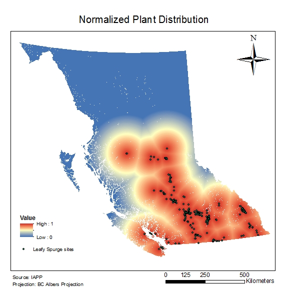
Elevation & Aspect
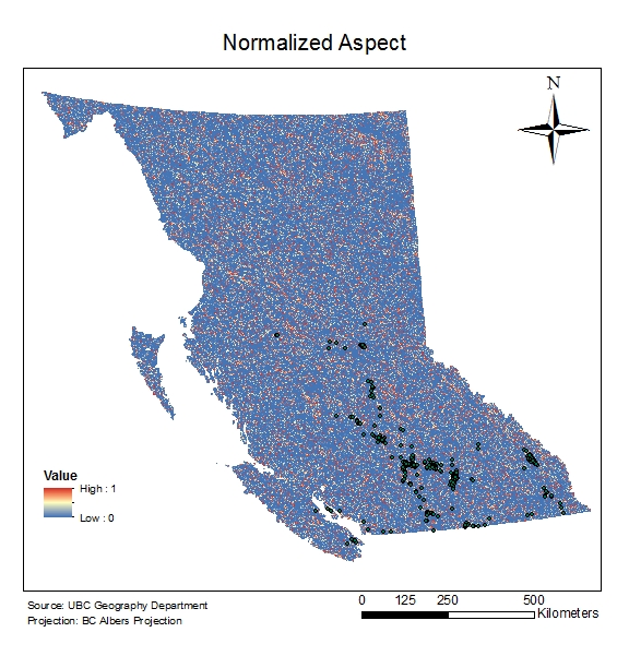
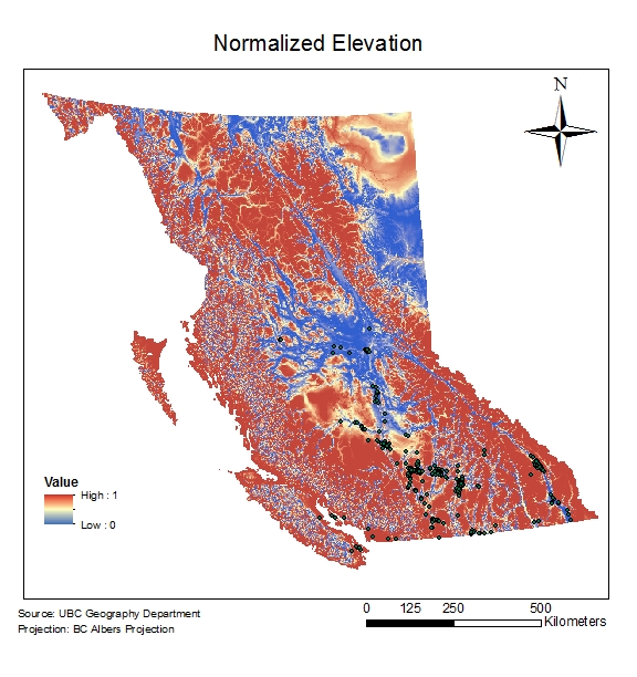
Elevation and Aspect were normalized using a Fuzzy Gaussian. Midpoints for Elevation and Aspect were based on average values of pre-existing plant distributions in BC.