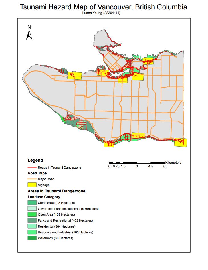
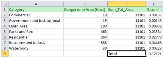
5. 12% of Vancouver’s total area is in danger. I totaled up the categorical areas in the “Vancouver_landuse” layer to find the sum of the total area and used the values from the “Dangerzone” area to find the totals of each category of landuse that would be affected. I found the percentage of affected area for each category and for the total area.
6. 2 separate layers were created by using the intersect tool. The danger layer was intersected with the “Vancouver_health” and the “Vancouver_education” layers separately. The facilities that are affected.
| Category | Name |
| Health Facility | False Creek Residence |
| Health Facility | Broadway Pentecostal Lodge |
| Health Facility | Yaletown House Society |
| Health Facility | Villa Cathay Care Home |
| Education Facility | St. Anthony of Padua |
| Education Facility | Ecole Rose des Vents |
| Education Facility | False Creek Elementary |
| Education Facility | Ely Carr Institute of Are & Design |
| Education Facility | Henry Hudson Elementary |
Accomplishment Statement: The intersect tool was used in this lab to highlight specific data that is relevant to the mapping area. In this exercise, the intersect tool was used extensively to highlight the types of roads, schools and health facilities that will be affected in the tsunami zone in Vancouver.