EXECUTIVE SUMMARY
Pohon Group is a private land development company based in Indonesia. The apartment superblock, TreeParkCity (TPC), is situated in the city of Tangerang.Pohon Group is a private development company that focuses on mixed-used sustainable housing. Their current project TPC is an apartment block just west of Jakarta in an area called Tangerang. Their goal is to promote the apartment and show off the area’s amenities along with the proposed Mass Rapid Transport station that is going to be built close by.The building promotes sustainable and affordable living while using innovative design techniques.
The deliverables for the project include: a transit map, amenities map, infographic, and poster (see below for visuals). The transit map shows the proposed MRT route from Jakarta to Tangerang, but it should be noted that this is a proposed route and not a concrete plan. The amenity map displays the various amenities in the surrounding 5km radius of TreeParkCity. The infographic works to educate the public about the MRT line and its benefits to the area. Finally, the poster provides a more detailed summary of the project conclusions.
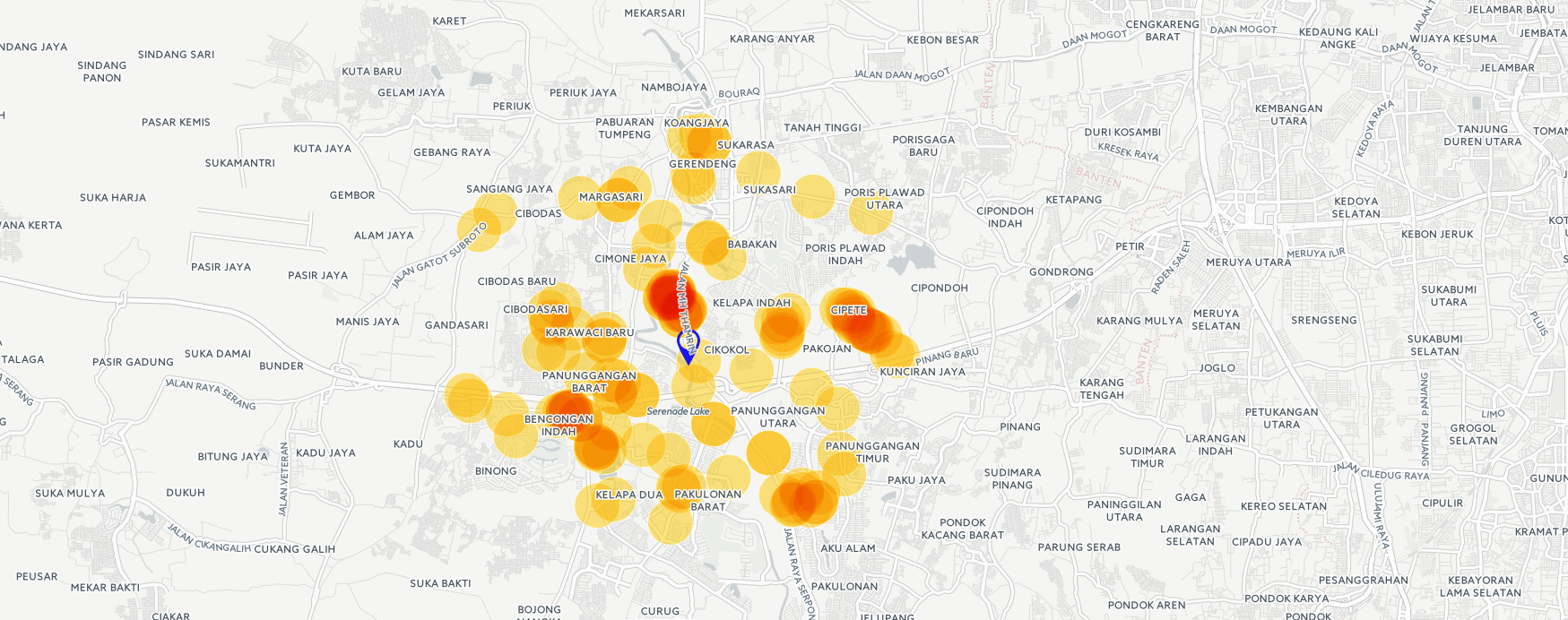
The study was focused within a 5km radius in considering the themes of mobility and accessibility. We decided that a 5km radius is within a distance whereby individuals can easily access the amenities by foot, cycling, or public transportation. Due to the extensive amount of information in the amenities map, we opted for an interactive map as our form of representation. With the interactive map, users have the ability to toggle layers and click individual point data for more information. This maximizes the amount of data communicated, but still presents a simple and clean visualization.
To argue that TPC is abundant in amenities within walking distance data analysis was applied for the maps embedded on the posters. For the amenities map, using the features available on Carto, we illustrated the concentration of amenities around TreePark City to demonstrate the availability and proximity of amenities. For the transit map, adding in lines through Illustrator and Photoshop, we attempted to communicate the significance of the location of TreePark City for its proximity to transit lines.
In terms of visual design, following the guidelines on visualization as laid out by Edward Tufte, throughout our visuals there was a focus on simplicity. Clutter was decreased in hopes to eliminate any potential elements that may distract the user from the main objective of the visualizations.
The biggest limitation was the lack of an existing database of information. However this in turn became an objective of the project in which we were to establish an electronic database using open source tools to provide them with the data, and to increase the accessibility and usability of the data. This allows the company to easily make future edits to the data and equips them with preliminary resources for them to continue to make georeferenced visuals and representations.
Finally, as the company is situated overseas, we faced the obvious barrier of not being able to meet in person. However this was easily overcome through E-mail and messaging applications.
Access my Individual Write-Up here
PROJECT DELIVERABLES
1.Transit Map
2.Amenities Map
3.Infographic
4. Poster
5.Interactive Map (and QR Code)

(6. Additional: Food Density Map)
(7. Additional: TreePark City Amenities Dataset- csv.file)