Accomplishment Statements:
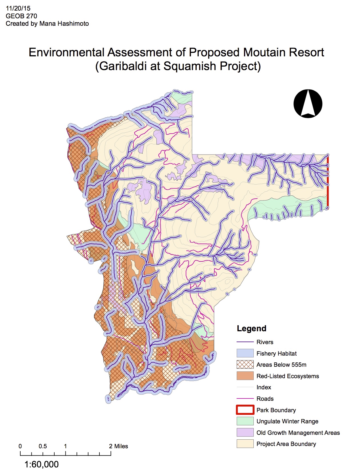
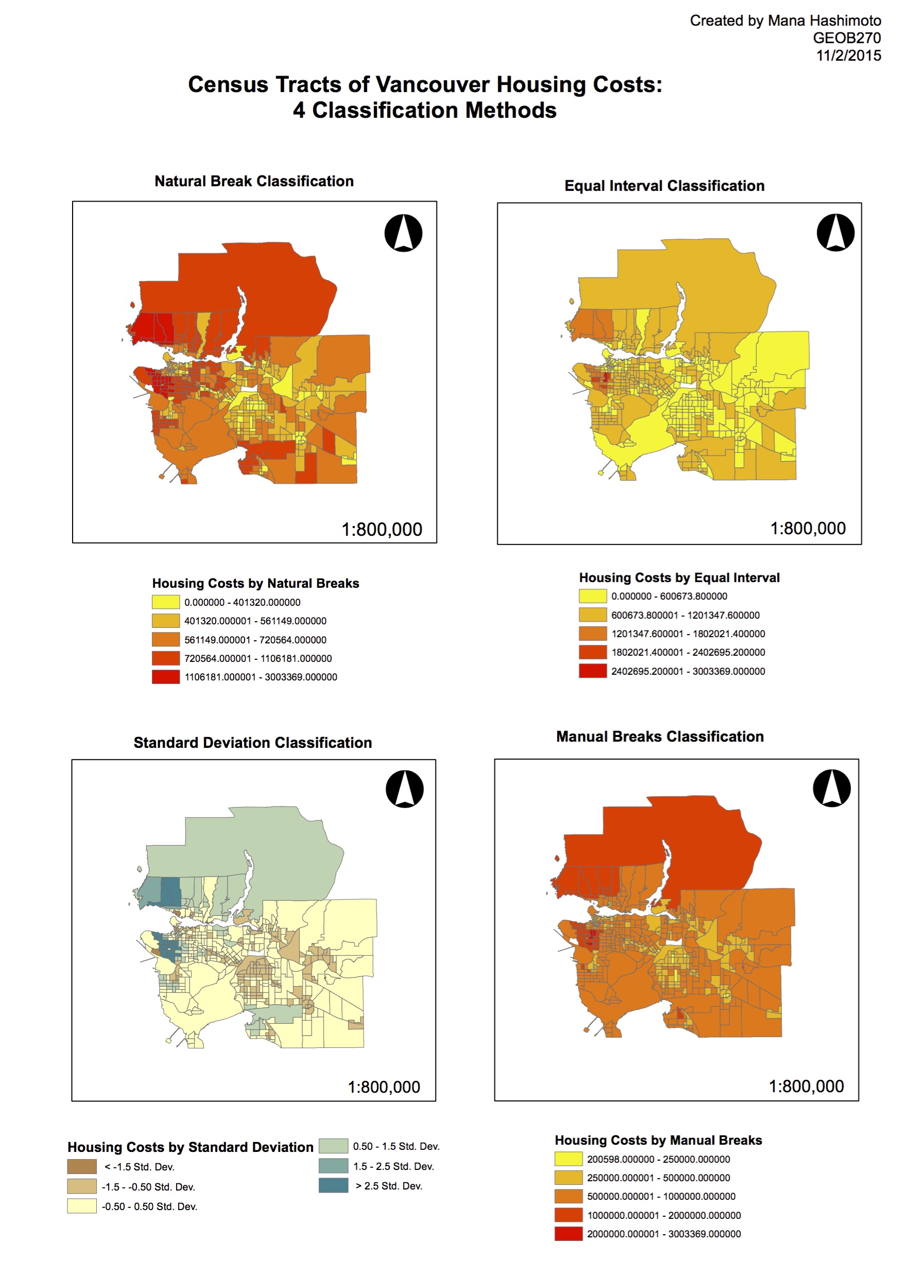
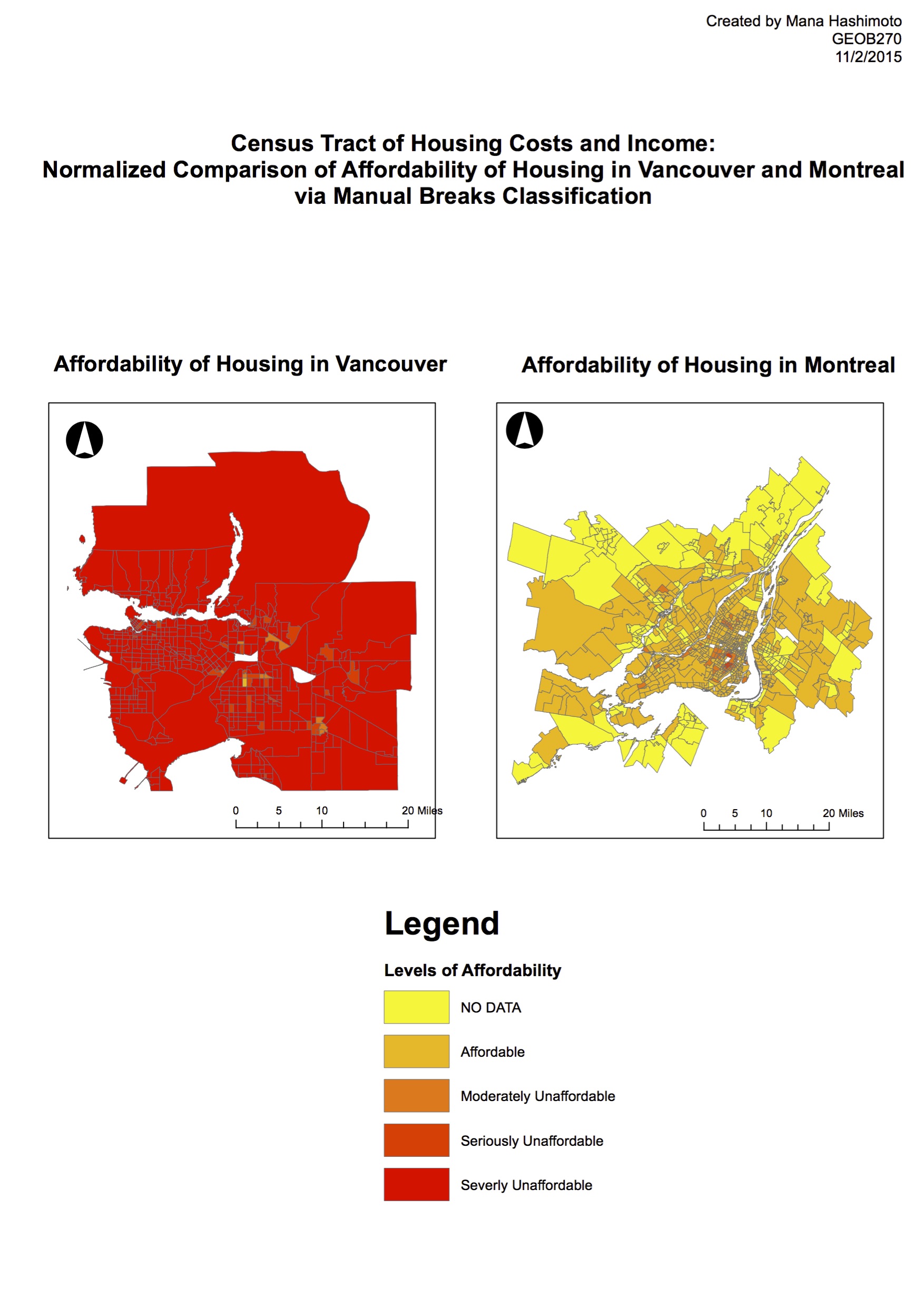
In investigating the Affordability of Housing in Vancouver and Montreal (Lab 4), and conducting an Environmental Impact Assessment of the proposed Garibaldi Lake Ski Resort in Squamish(Lab 5), I learned many new techniques using the ArcGIS software.
Lab 4: Affordability of Housing
- Gained knowledge of where and how to find appropriate data.
- Demonstrated understanding of quantitative classification methods and their impact on understanding information.
- Generated a map demonstrating clear understanding of the ethics of data representation.
Lab5: Environmental Impact Assessment
- Demonstrated resourceful capacity by independently locating appropriate data.
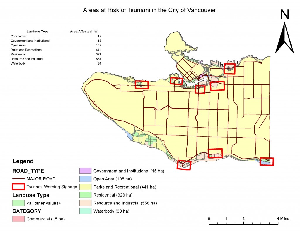
- Productively utilized various geoprocessing tools in ArcGIS to effectively present data.
- Critically evaluated the proposal of the ski resort effectively using the knowledge and information gathered from the analysis.
Individual Professional Development Reflection
As a 3rd year Human Geography student this GEOB270 course has allowed myself to gain greater knowledge on the processes and significance of creating maps and visual representations. I have picked up practical skills in how to best utilize the GIS software available from the university, but also knowledge that is applicable to open sourced geoprocessing systems as well. I have also gained awareness in the critical implications of the use of image and data representations, and the issues of ethics surround the issue of representation. This course has also allowed me to realize the strength of teamwork, that allows to generate contributions that have can have significant influence. Through the team project I also realized the requirement of individual work ethics as well, in order to maximize the limited time with the team.


