472 – Creating Interactive Maps with Carto
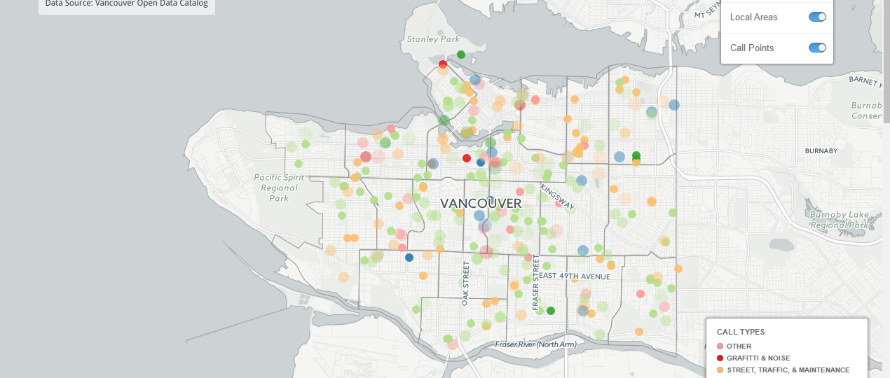
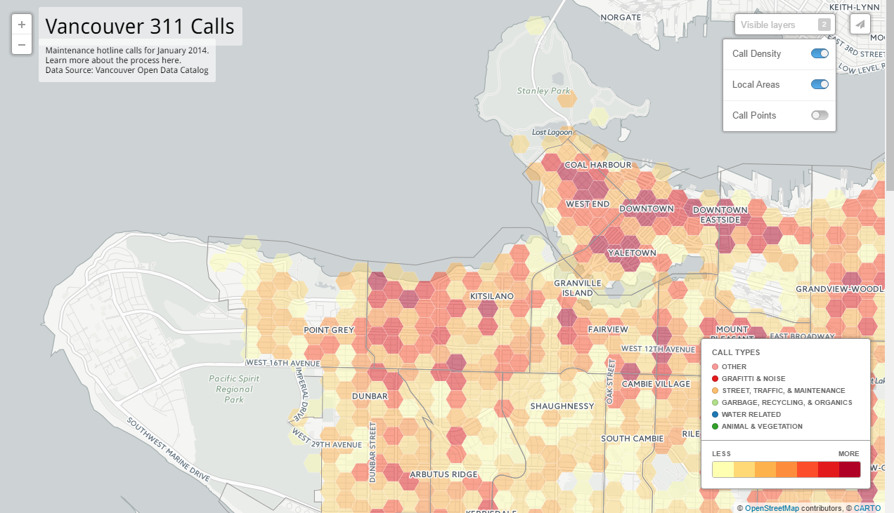
Carto (formerly known as Carto DB) is an online platform for mapping data. As with many online services, it is free to use to create maps but free accounts have limits, to create maps with large data sets or certain features, you will have to pay for a subscription. The platform is very easy to use and fairly intuitive. To practice using the platform we created new interactive maps to visualise the Vancouver 311 calls data, but this time had to limit the dataset to just a single month of data due to the data limits of a free account. As the platform is designed to streamline map production, you can simply add a data set and then adjust the options for how to represent that data on the map with various menus; for example choosing between display types such as: simple, category, density etc. Then you can adjust options for the presentation of the overall map such as choosing which layers should be controllable by the user, adding legends, zoom options etc. This is a much simpler and more accessible user interface than for example trying to map this data in R. By simply choosing a display type for each layer in the map display wizard, complex map display options are already added, such as when adding a density layer, the hexagon grid will automatically scale and reclassify itself with the zoom chosen by the user.
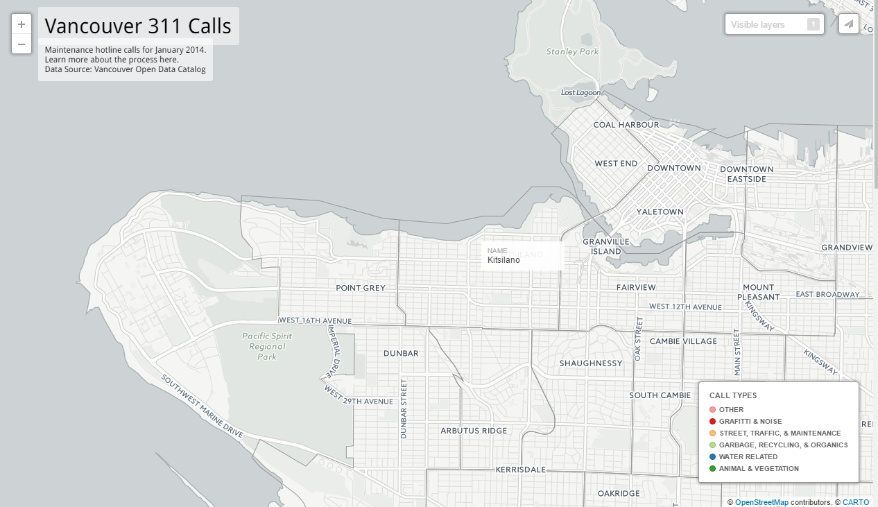
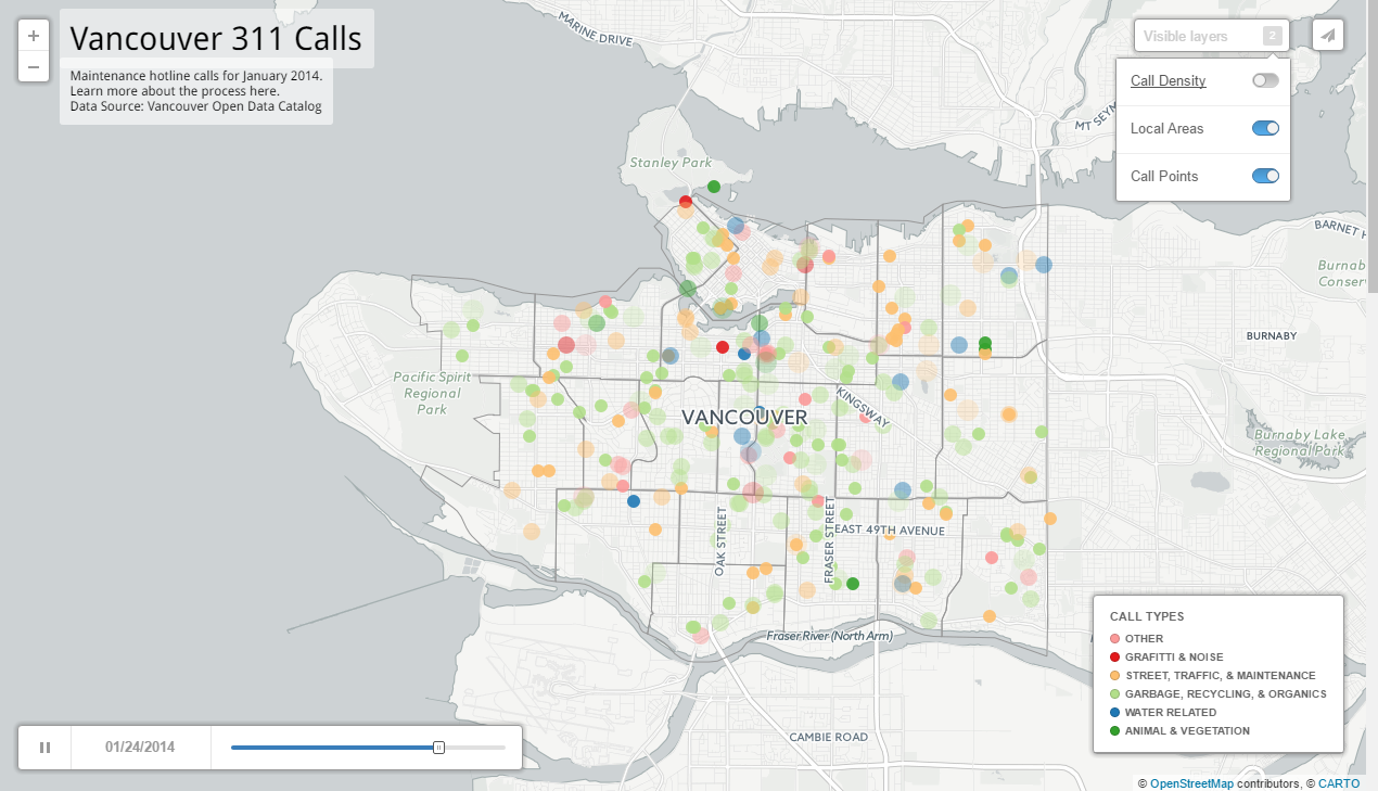
For my version of this map I added three layers:
- A simple layer showing the areas of the city using a shapefile from the city of Vancouver that presents the area name when the mouse is hovered over a polygon.
- The call data plotted as a density layer which visualises the call density on the map using a shaded hexagon grid.

- The call data presented as a “Torque Cat” type which makes the individual call points (coloured by category) pop up on the map as a bar indicating time is scrolled through.

Carto also hosts the maps you create and allows you to embed them on other sites or simply share the link to the map itself – like this:
https://matt-wagstaff.carto.com/viz/20916b1c-a60b-11e6-8692-0ef7f98ade21/public_map